Skip to Content

Regenerative Agriculture

Increase farm profits while promoting environmental stewardship

A heat map of farmland overlaid with a photo of a person in an apron tending an orange tree sapling in a sunlit orchard

Balance profitability and sustainability

Regenerative agricultural practices can protect the environment, improve soil fertility, and optimize long-term profitably to create greater food security. Increasingly, precision farmers use geoenabled smart devices and cloud computing to understand how no-till, cover crops, rotational grazing, and other sustainable practices contribute to better soil health, biodiversity, and CO2 sequestration.

Achieve spatial insights with an analytical approach

Mapping and location enablement

Incorporate the power of location intelligence into regenerative farm management practices to gain new spatial insights, improve critical decision-making, and create more balanced outcomes.

A photo of a casually dressed person crouching in a sunlit chicken coop hand-feeding chickens and roosters from a bucket

Field operations

Use integrated mobile field apps to collect detailed information at the source. Streamline field communications and create workflow efficiencies.

A photo of a casually dressed person crouching in a sunlit field of green crops, using a mobile phone to photograph a crop

Real-time visualization and analytics

Collect and analyze precise information in near real time. Use performance dashboards to model dynamic processes, improve response times, eliminate waste, and reduce costs.

A photo of a casually dressed person kneeling in a large barn beside one of many cows, using a tablet to record data

Imagery and remote sensing

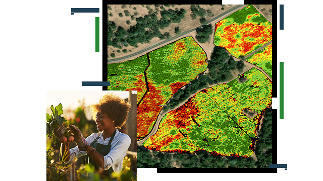
In a precision sustainable agricultural practice, staff can use imagery and GIS to detect change through the analysis of multitemporal datasets.

A graphic of a computer monitor displaying a map dashboard with a map of green farmland, a graph, and vegetation statistics

Spatial analysis and data science

Explore a wide array of data types with powerful analytical tools to uncover new patterns and trends that can lead to greater holistic understanding.

A graphic of a computer monitor displaying a map dashboard displaying charts and concentration maps of green farmland

BLOG

The technology behind an agricultural revolution

Sensor feeds with crop health and weather data combined with location intelligence help staff achieve sustainable agricultural outcomes.

Go to the blog

Products for regenerative agriculture

Previous
Next

Contact sales

Contact us

Outside the United States

Connect with the Esri agriculture team