For Emergency Snow Removal, Surveys and Dashboards Prove Key
After a record-setting snowstorm hit Oswego County, New York, county staff used GIS to coordinate and prioritize requests for help.
After a record-setting snowstorm hit Oswego County, New York, county staff used GIS to coordinate and prioritize requests for help.
After collecting data on streets, public spaces, and people’s cycling habits, Ostrava is strategically updating its cycling infrastructure.
Johns Creek, Georgia, deployed Konveio’s Plan Hub—an AI-powered, geospatially enabled framework built on ArcGIS Experience Builder.
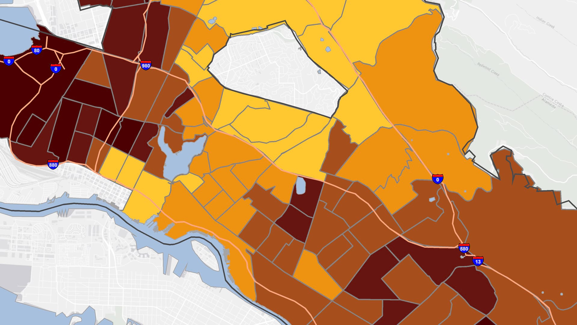
The app, built with ArcGIS Experience Builder and ArcGIS Survey123, shows whether housing projects can access simpler environmental reviews.
The Open Space Institute used ArcGIS Experience Builder, ArcGIS Instant Apps, and ArcGIS Survey123 to modernize its outreach efforts.
ArcGIS Experience Builder and ArcGIS Instant Apps have several new features to help users build robust web apps with minimal effort.
The Move Tucson app allows the public to explore how the city’s transportation plan will change community mobility.
A GIS-powered America’s Commerce Corps program called Community Connection helps consumers and communities engage with local businesses.
Somerset County in New Jersey has created a GIS-based website that provides details on affordable housing options and more.
Two Esri partners collaborated to bring museum visitors closer to dinosaur history at a Colorado museum.
To help people find and view a university’s outdoor art, a team used ArcGIS Experience Builder to create a custom app with strong visuals.
A dynamic and interactive web app now educates visitors on critical issues and best practices.