An extension to ArcGIS Online, ArcGIS Image for ArcGIS Online makes imagery more accessible and more easily managed while eliminating the need for an organization to maintain infrastructure for imagery. Uploaded imagery and the results of analysis are saved as image services so that they can be shared and used in ArcGIS throughout an organization.
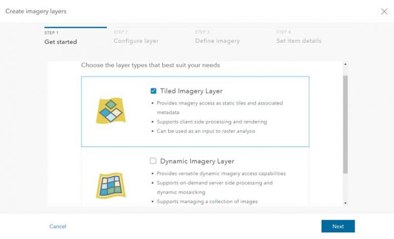
Imagery uploaded to ArcGIS Image for ArcGIS Online can be saved as a tiled imagery layer or as a dynamic imagery layer. Layers of either type can be used as input for raster analysis. Both layer types retain pixel information, pixel values for any location, and image metadata.
Static tiled imagery layers are more efficient for viewing and support client-side processing and rendering. Dynamic imagery layers support on-demand server-side processing, dynamic mosaicking, and image collection management. By returning only what is needed to display the current extent, dynamic imagery layers can deliver good performance over low-bandwidth networks.
Layers of either type can be built from a variety of raster formats sourced from many providers. ArcGIS Image for ArcGIS Online can handle overlapping, temporal, and multiresolution imagery. Different enhancements and renderings can be set for layers.
Opening Up the Use of Imagery
ArcGIS Image for ArcGIS Online liberates imagery that organizations may have locked away in hard drives or stored in disparate locations. Making imagery readily accessible increases its value by making it usable to many more people in an organization. Imagery—hosted, managed, and streamed from ArcGIS Image for ArcGIS Online as tiled and dynamic imagery layers—are ready for immediate visualization and analysis.
Eliminating the infrastructure—both staff and hardware—needed to manage imagery and replacing it with a secure, scalable, and performant cloud environment managed by Esri lets staff focus on finding solutions instead of maintaining processes.
Making Imagery More Available
Because it frees organizations from acquiring and maintaining the infrastructure needed to process imagery, ArcGIS Image for ArcGIS Online makes the power of imagery in GIS workflows available to many more organizations and many more people in those organizations.
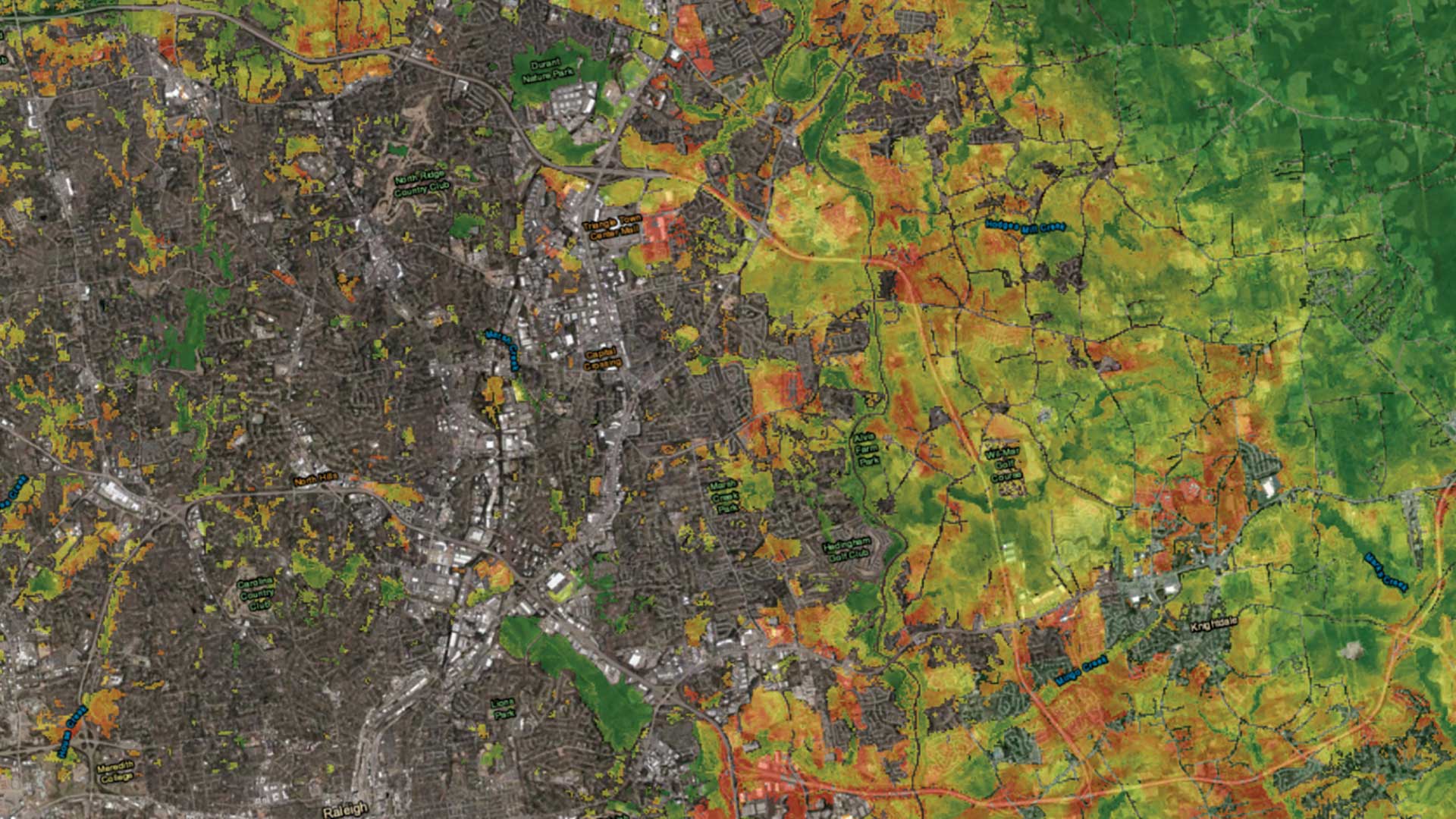
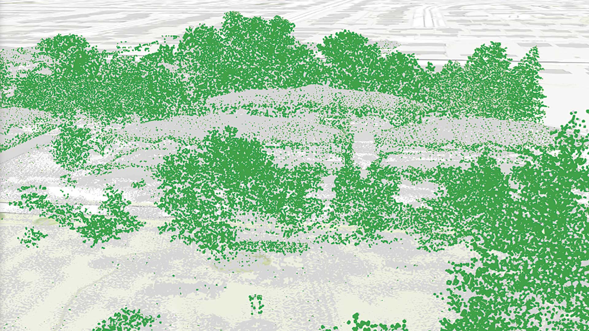
Object detection is just one of the raster analysis tools that comes with ArcGIS Image for ArcGIS Online. Using this tool, feature extraction from imagery hosted using ArcGIS Image for ArcGIS Online can take advantage of deep learning capabilities to automate the process and seamlessly use the library of deep learning models already available from ArcGIS Living Atlas of the World. This capability makes change detection analysis of the built and natural environments accessible to governments as well as private and nongovernmental organizations.
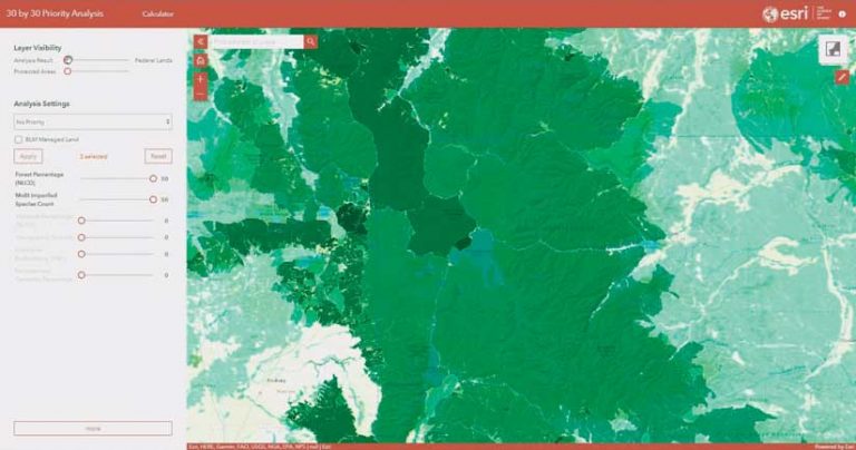
Access to current imagery provides critical information during disasters and emergencies. Imagery can be applied to asset and infrastructure inventory as well as to monitoring and evaluating the condition of vegetation, whether cropland or natural landscapes. Analyzing imagery can identify optimal paths and connections between areas, whether they are road networks or wildlife corridors. Imagery contributes to analysis workflows that forecast available water supply, evaluate the environmental impacts of planned projects, and design roads and storm drains.
These are just a few ways imagery can contribute to achieving an organization’s goals when both tools and imagery are accessible. ArcGIS Image for ArcGIS Online can be scaled for specific types of users in an organization. The level of complexity for users can range from providing an intuitive web experience viewing and managing imagery to producing a processing workflow using the Raster Function Editor in ArcGIS Online to chain one or more raster functions together. Custom raster functions can also be created using the ArcGIS API for Python.
Part of a Robust Strategy for Managing and Using Imagery
ArcGIS Image for ArcGIS Online joins ArcGIS Image Analyst for ArcGIS Pro, ArcGIS Image Server for ArcGIS Enterprise, and ArcGIS Image Dedicated. These products provide tools and services for comprehensive imagery data management, visualization, and analysis of imagery on the desktop, in ArcGIS Online, in an enterprise, or, with ArcGIS Image Dedicated.
ArcGIS Image Dedicated brings processing, analytics, and streaming capabilities directly to existing imagery collections that an organization already has stored in Amazon Web Services (AWS) or Microsoft Azure cloud, making these collections easier to manage and use. ArcGIS Image Dedicated is a SaaS offering managed by Esri.
ArcGIS Image for ArcGIS Online is available as an extension for the Creator or GIS Professional user type for an existing ArcGIS Online organizational account. User types allow organizations to control the type and extent of privileges assigned to members through roles. Once a license has been purchased, ArcGIS Image for ArcGIS Online can be managed from the Licenses section of the Organization tab. Purchase this license online.