Go Wayback with World Imagery Archives
Learn how to use the Wayback app or the ArcGIS Living Atlas of the World to access imagery archives in ArcGIS Online.
Learn how to use the Wayback app or the ArcGIS Living Atlas of the World to access imagery archives in ArcGIS Online.
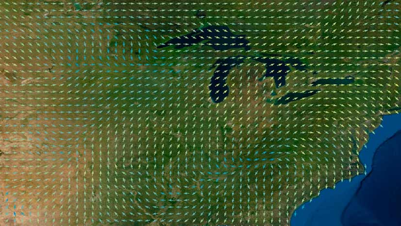
Learn the ArcGIS capabilities and workflows that give you the ability to visualize wind and ocean current data.
Esri cartographic designer Andy Skinner teaches you how to use sketch layers to enhance features in your ArcGIS Online maps.
Esri technology evangelist Bern Szukalski lays out a few simple steps to highlight specific content on your ArcGIS Online groups page.
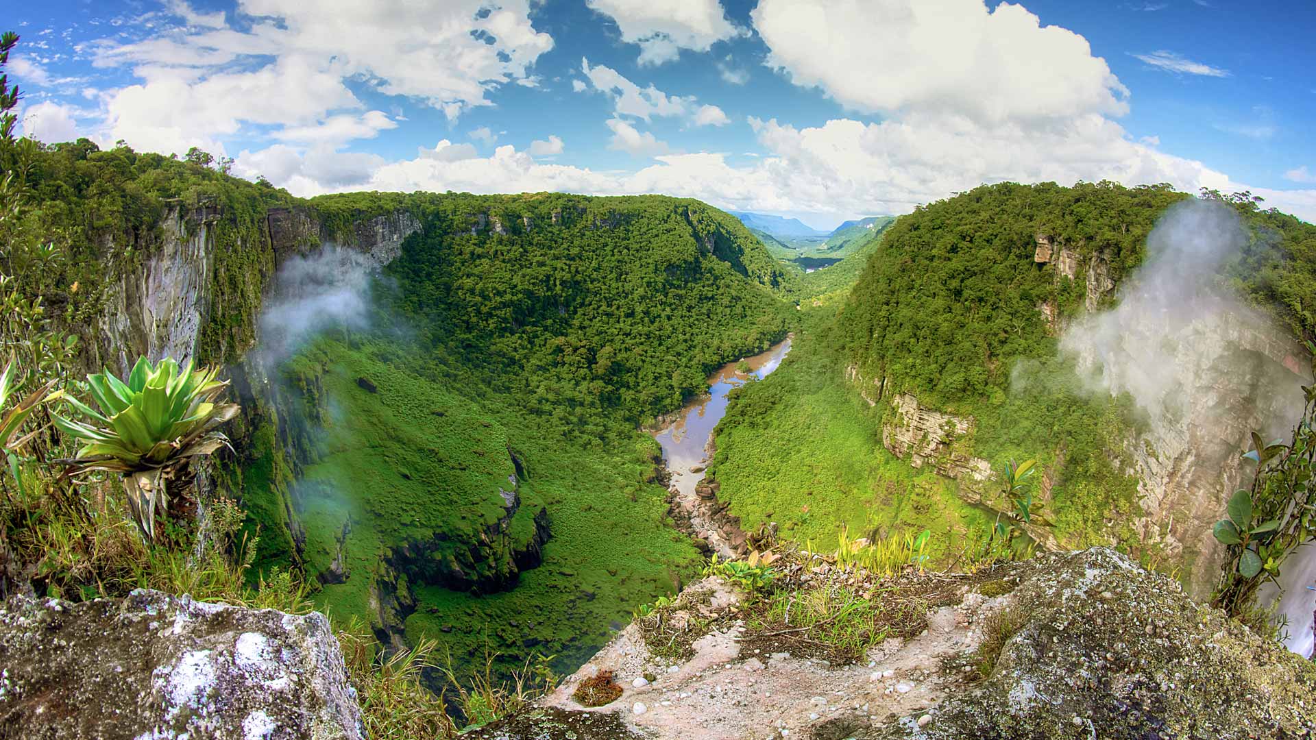
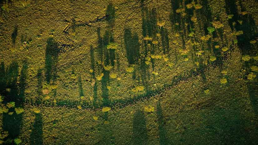
The Guyana Forestry Commission's mission is to prevent deforestation, which protects the rainforests. GIS technology helps achieve this goal.
In the Configuring an ArcGIS Online Organization web course, you will learn to navigate and manage settings for your ArcGIS Online organization.
ArcGIS Online has a new home page, so it's time to reconfigure it using the home page editor. Lynnae Terpstra from Esri shows you how.
Upgrade to the new ArcGIS basemap layer service if you are using an open-source client API such as Esri Leaflet to build mapping apps.
The African People & Wildlife organization uses ArcGIS software to analyze and visualize data on human-wildlife conflicts in Tanzania.
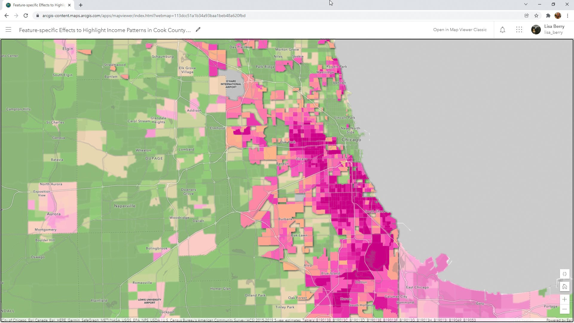
Learn to how to use a Map Viewer capability called feature-specific effects to emphasize a particular part of your map data.
Learn how to make your ArcGIS Online home page more discoverable to the public.
Key West, Florida, contributed its address point data to the ArcGIS World Geocoding Service, making the information more accurate for everyone.