A Little Hope Goes a Long Way
Mission Blue, founded by oceanographer Sylvia Earle, uses ArcGIS StoryMaps to showcase Hope Spots, marine areas in need of protection.
Mission Blue, founded by oceanographer Sylvia Earle, uses ArcGIS StoryMaps to showcase Hope Spots, marine areas in need of protection.
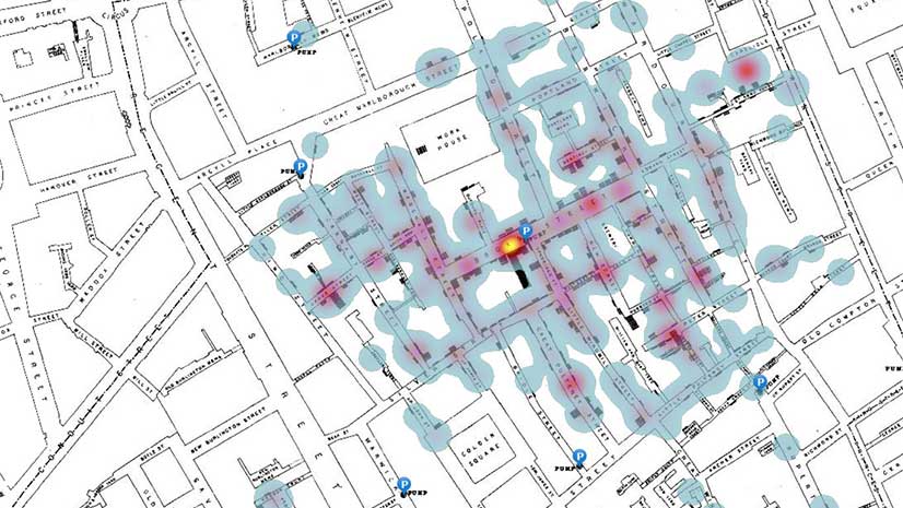
In this ArcGIS Learn lesson, you will remap Dr. John Snow's cholera outbreak data from 1854 in ArcGIS Online.
Learn to add charts to pop-ups in ArcGIS Online by following these step-by-step instructions from Esri technology evangelist Bern Szukalski.
Esri technology evangelist Bern Szukalski shows you how to create a user profile in ArcGIS Online that's polished and professional.
The City of Seattle created a Web GIS app that maps eateries offering takeout, curbside, and delivery services during the COVID-19 pandemic.
Create maps that represent individuals, houses, or anything else you can count, with the dot density mapping style in the Map Viewer beta.
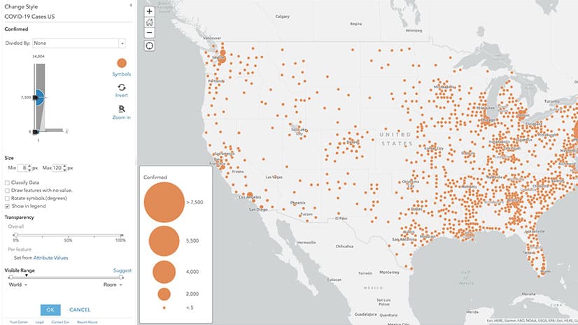
Jim Herries, principal product engineer for cartography at Esri, shares cartographic tips for improving your organization’s COVID-19 case maps.
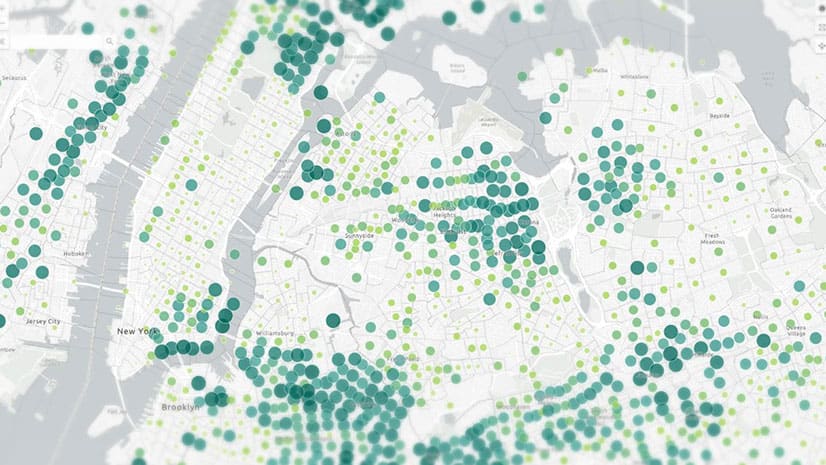
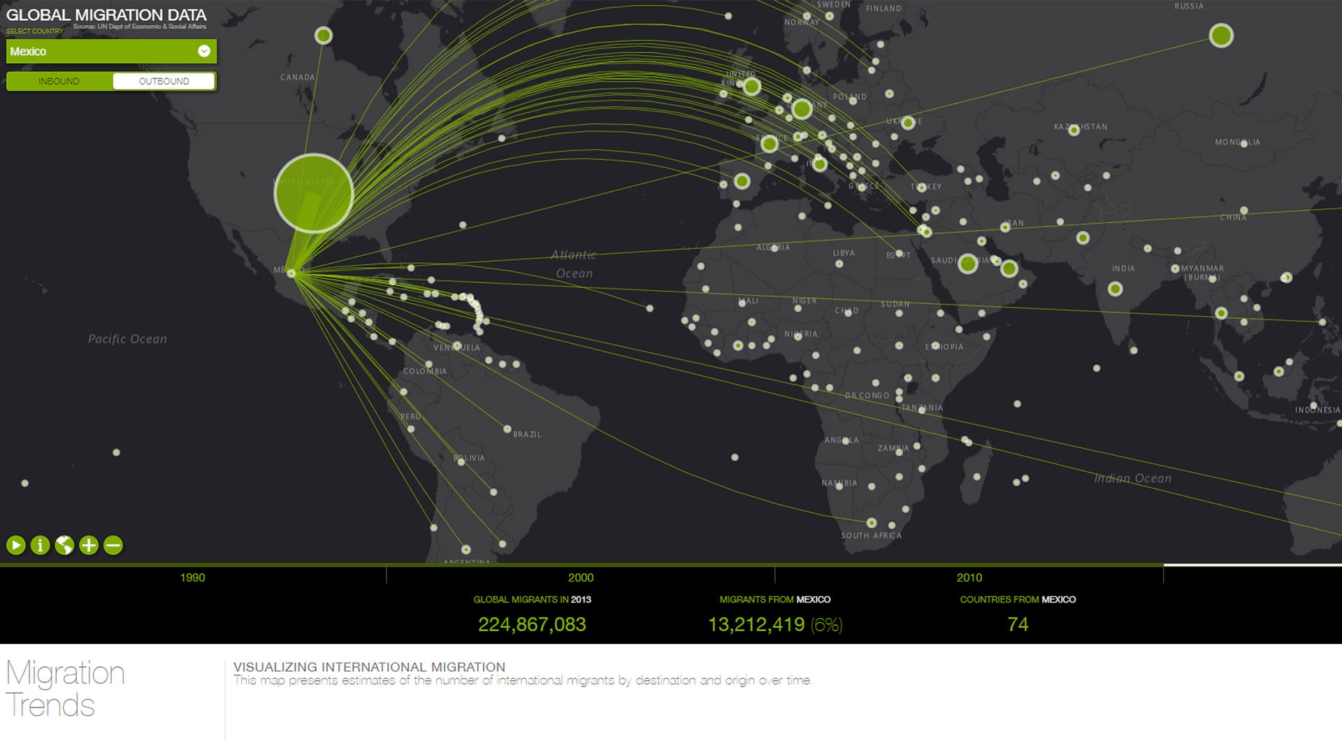
Esri cartographer John Nelson shows you how to apply graduated sizes and colors to symbols in your ArcGIS Online maps.
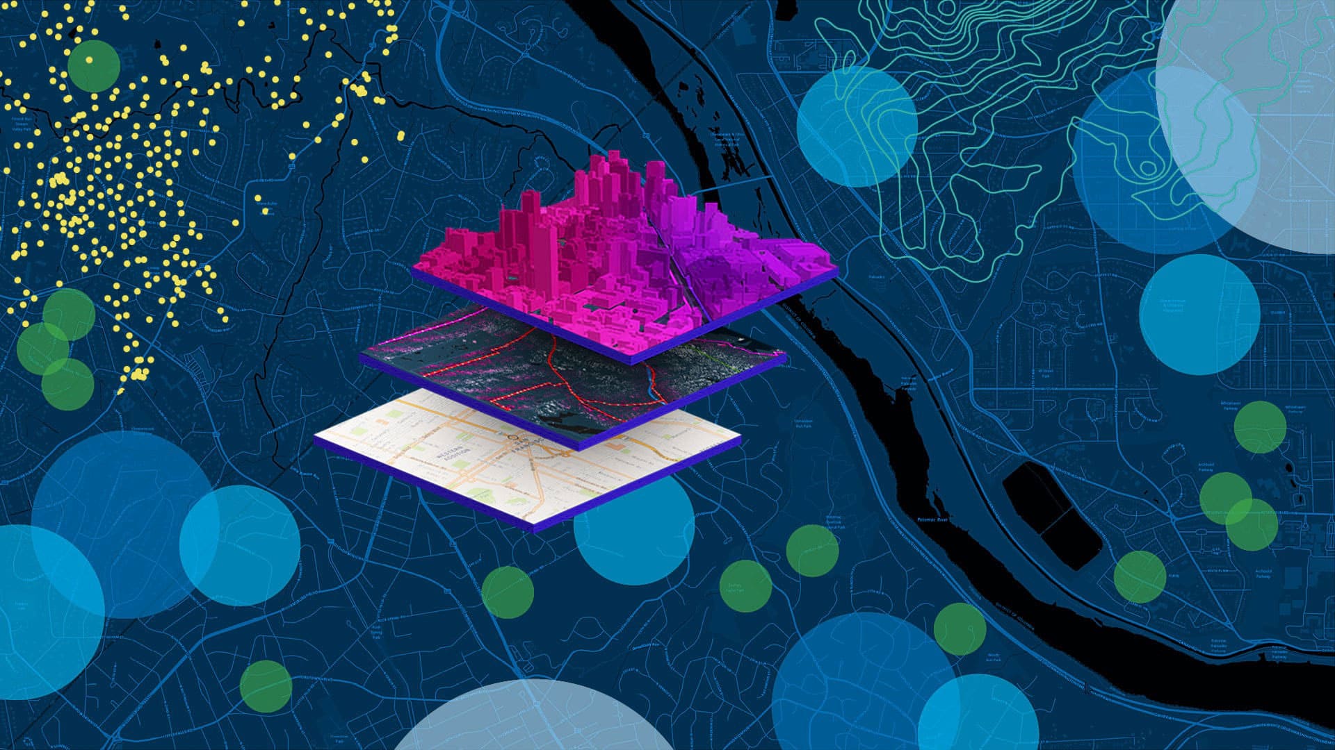
Get a two-minute overview of Scene Viewer in ArcGIS Online, which gives you the ability to visualize and analyze 2D and 3D information.
Esri technology evangelist Bern Szukalski shows you how to build your first web experience with ArcGIS Experience Builder.
When you create a new map using ArcGIS Online, you can choose which basemap you want from the basemap gallery.
ArcGIS Online and ArcGIS Living Atlas of the World provide cloud-based tools and content that make it easy to analyze spatial demographic data.