National Missing Children Database Now Accessible Through Community-Focused Map
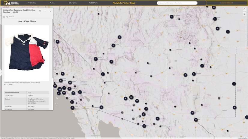
A site that delivers vital data about missing kids in the US lets the public view a map and see the faces of children who have disappeared.
A site that delivers vital data about missing kids in the US lets the public view a map and see the faces of children who have disappeared.
Read a collection of expert-written chapters, case studies, and user stories that show how mapmakers are being inclusive with their designs.
Join this free course to learn how GIS and imagery work together to enhance workflows from visualization to analysis.
From basemaps to feature layers, explore the new ways this data will enhance existing content and add new content offerings in ArcGIS.
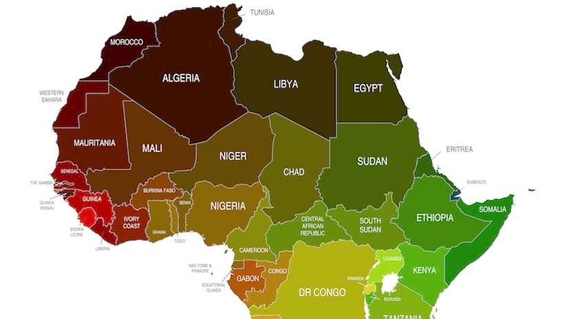
This joint effort is part of a five-year endeavor to produce the most comprehensive basemap of Africa to date.
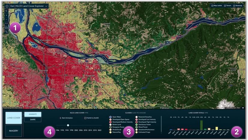
Access land cover mapping data in the form of a ready-to-use imagery layer and a web mapping application, the NLCD Land Cover Explorer.
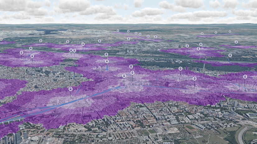
Law enforcement utilizes real-time data, a mobile-optimized dashboard, and pre-planning tools for enhanced situational awareness.
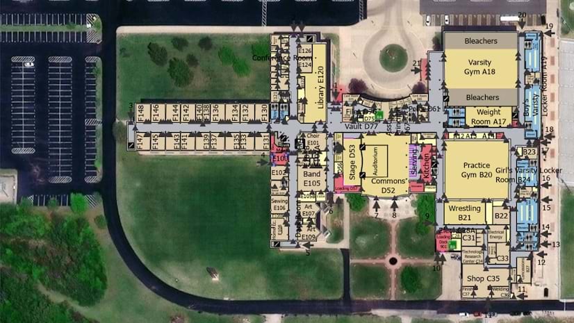
An indoor mapping system was developed for a high school in Fulton County, Illinois, to integrate with emergency response technology.
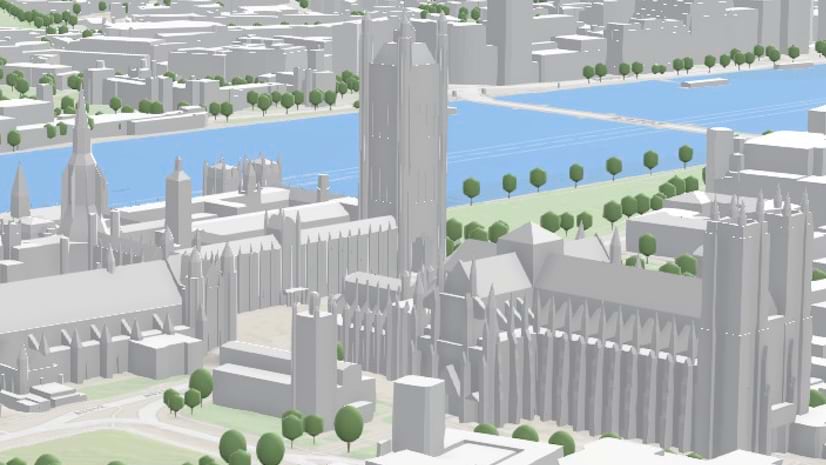
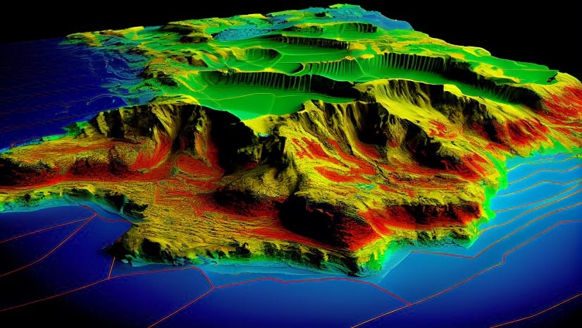
Discover how to use Scene Viewer Analysis tools to enhance 3D data.
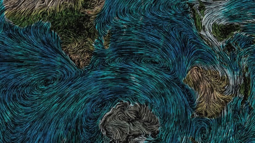
Learn how to use compositing to tint flowing wind patterns by underlying terrain colors with ArcGIS Online Map Viewer.
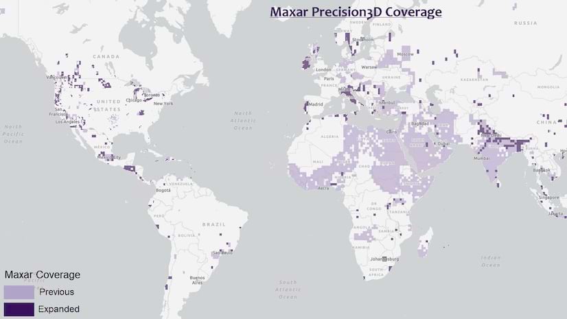
Esri continues its integration of Maxar’s Precision3D data in elevation layers.
Find out how to break into the evolving field of remote sensing and succeed in a career that’s shaping the future.