Elevate Your Maps
Esri's Rajinder Nagi gives you a tour of the tool collection available in the ArcGIS Living Atlas of the World.
Esri's Rajinder Nagi gives you a tour of the tool collection available in the ArcGIS Living Atlas of the World.
Organizations can use ArcGIS Enterprise Sites to create a tailored web GIS experience with their ArcGIS Enterprise portal.
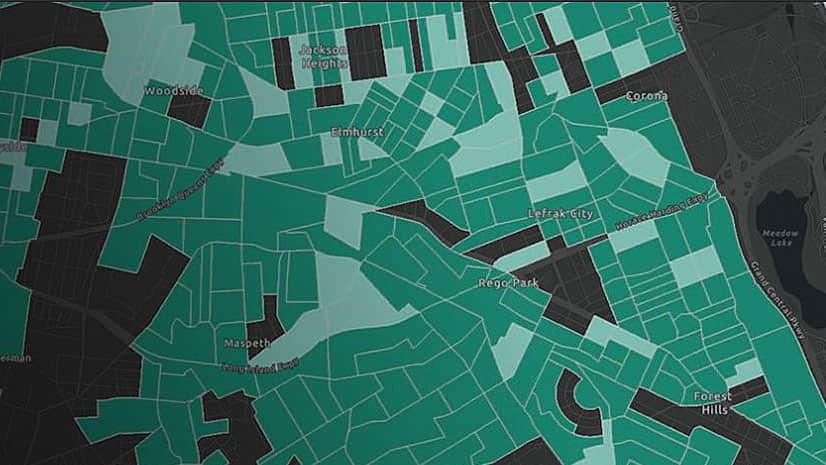
You can create market opportunity maps using demographic data available in ArcGIS Living Atlas of the World and ArcGIS Online capabilities.
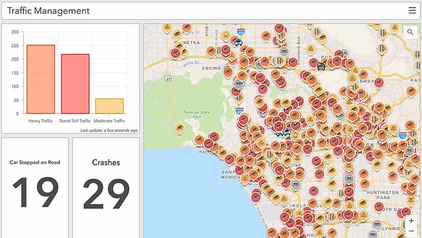
Traffic information from Waze is now available as a data layer in ArcGIS Marketplace.
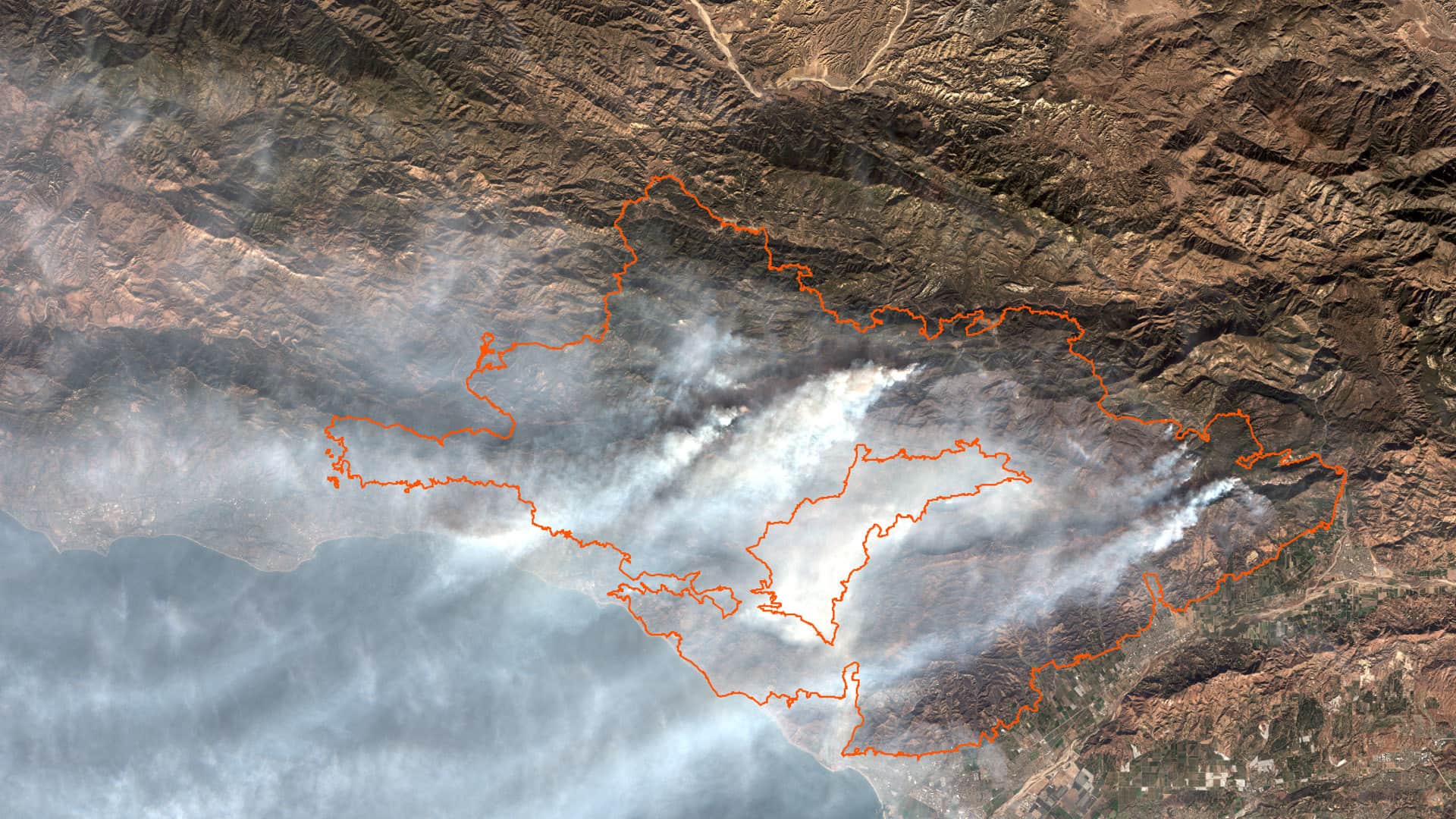
Study several aspects of the Thomas Fire by using ArcGIS Online analysis tools and data from ArcGIS Living Atlas of the World.
Esri cartographic product engineers Jennifer Bell and Diana Lavery demonstrate the smart mapping capabilities in ArcGIS Online.
Tune in to Introduction to Official Statistics, the first in a series of webinars about how to use GIS in conducting the 2020 census.
Spike, a laser measurement device from ikeGPS, boosts field productivity and data capture capabilities when used with Survey123 for ArcGIS.
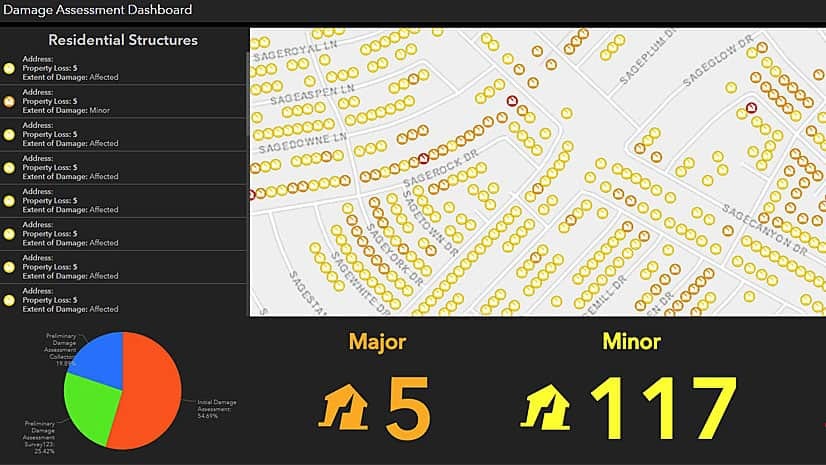
Work with ArcGIS apps and ArcGIS Pro software to create, collect, and share hurricane damage assessment information in this Learn ArcGIS lesson.
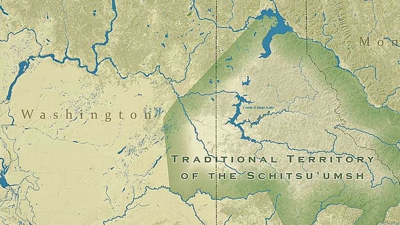
The Samish Indian tribe, the Native Village of Georgetown, and the Coeur d'Alene tribe of Indians were recent Tribal Story Map Challenge winners.
Celebrate GIS Day this November by hosting or attending a program that showcases GIS technology.