Touch Down on Mars
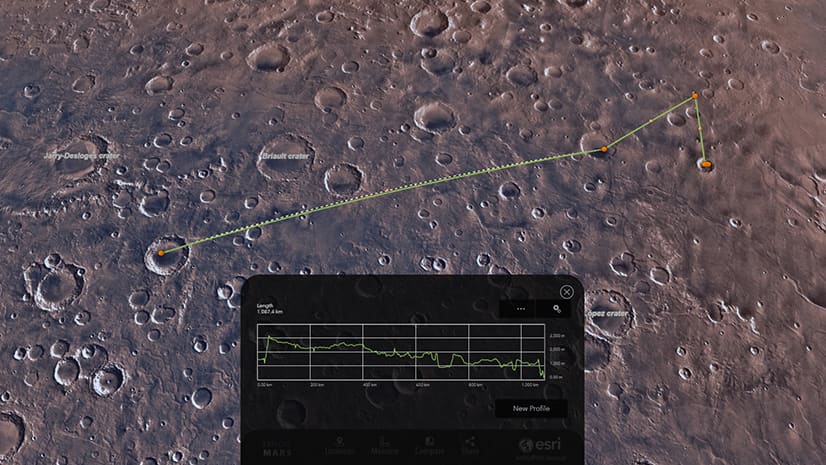
Explore the craters, canyons, and mountains on Mars using a custom 3D web app created with ArcGIS JavaScript API.
Explore the craters, canyons, and mountains on Mars using a custom 3D web app created with ArcGIS JavaScript API.
The City of Sacramento integrated ArcGIS with Salesforce in its 311 system, giving users the ability to track the progress of incident reports.
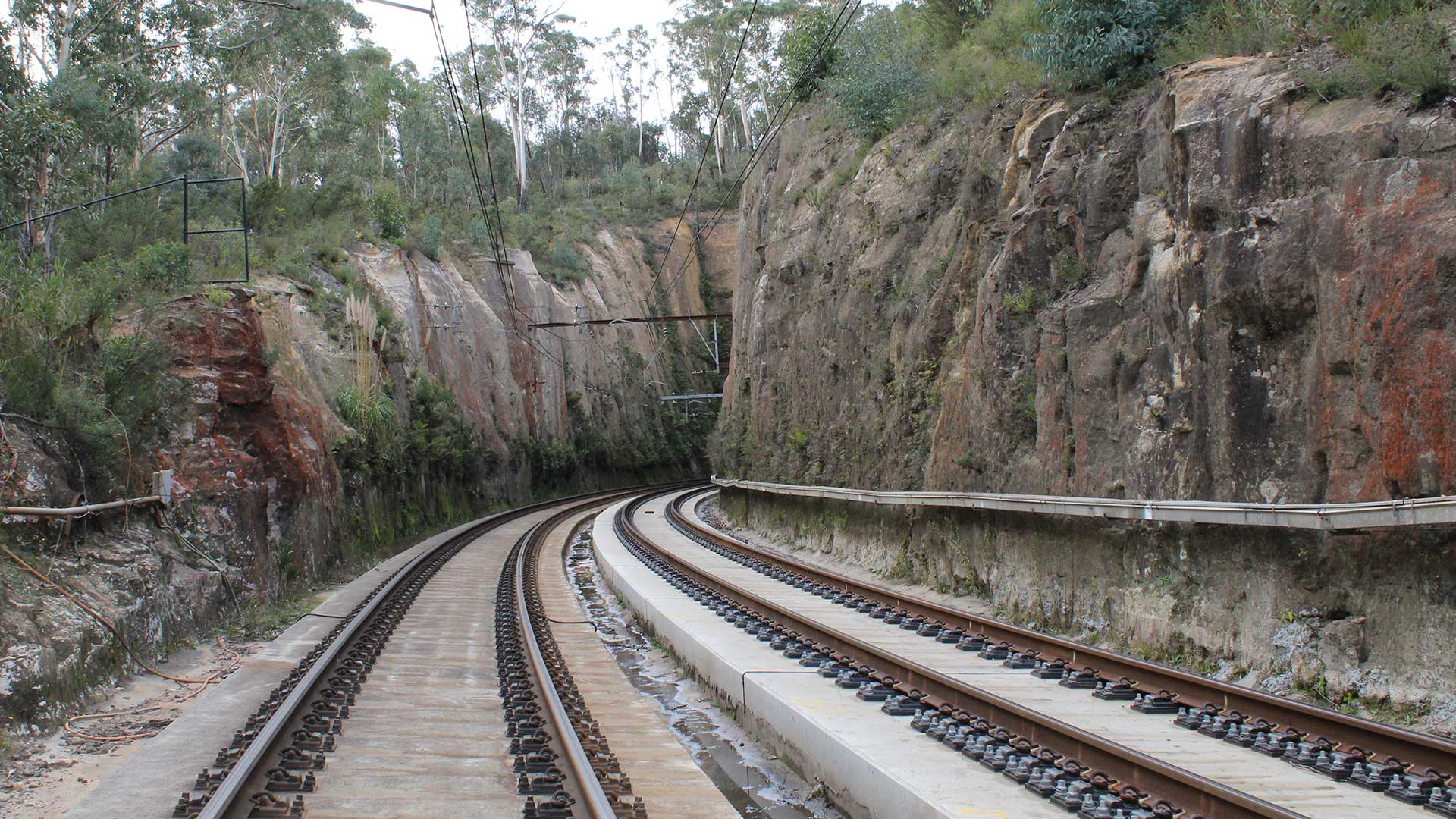
The global professional services company GHD uses ArcGIS Survey123 from Esri to collect data on rockfall hazards along a railway in Australia.
ArcGIS API for JavaScript recently began to support high-quality, scalable vector symbols in 2D MapView instances. See what you can do with them.
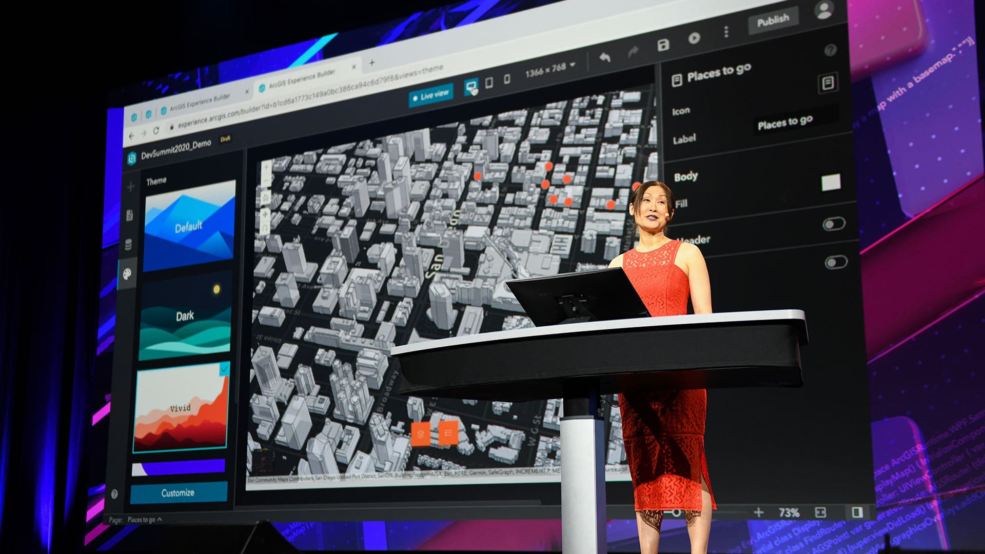
The Esri Developer Summit focused on new capabilities in ArcGIS including those in 3D mapping, natural language processing, and data science.
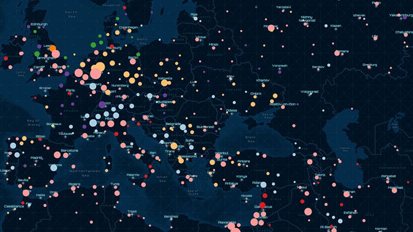
Point clustering is now available in beta in ArcGIS API for JavaScript. See how clustering works when mapping earthquakes.
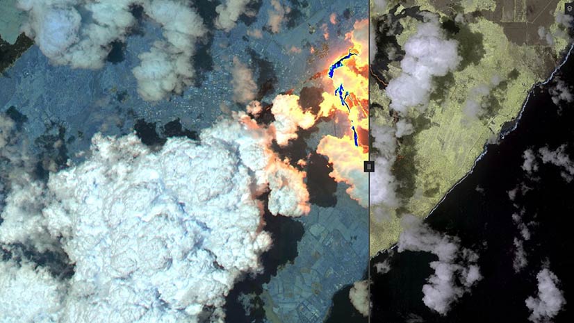
Compare map layers or view what’s underneath a layer using the new Swipe widget available in the new release of ArcGIS API for JavaScript.
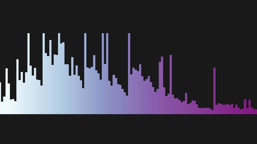
Kristian Ekenes from Esri walks through how to use ArcGIS API for JavaScript to create histograms as legends.
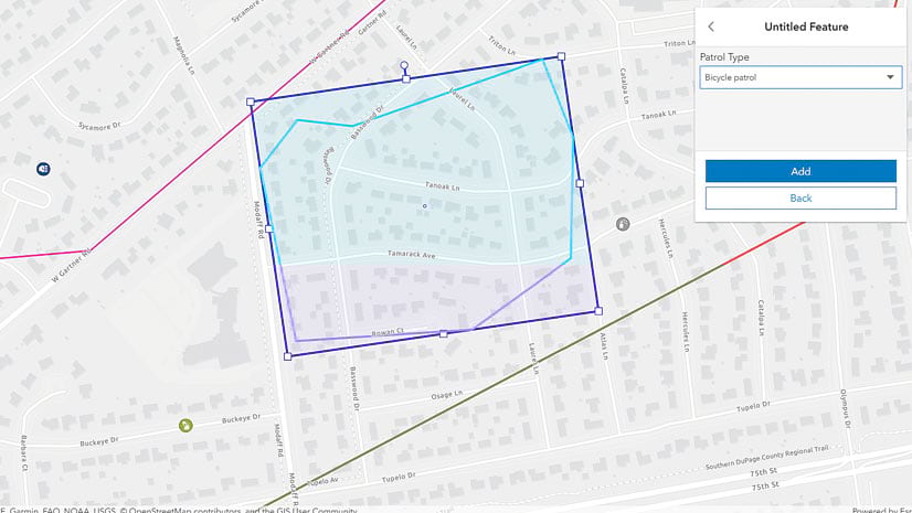
ArcGIS API for JavaScript now comes with an Editor widget that gives users of the app you developed the ability to create and edit features.
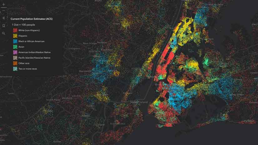
The DotDensityRenderer, new in ArcGIS API for JavaScript, gives you the ability to create striking dot density visualizations.
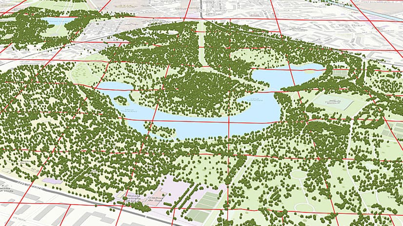
Changes to ArcGIS API for JavaScript means that you can now use 2D data to create a 3D view of your cities.