What’s New in Imagery in ArcGIS Online
New enhancements streamline the analysis of hyperspectral imagery and simplify how users can extract meaning from complex imagery datasets.
New enhancements streamline the analysis of hyperspectral imagery and simplify how users can extract meaning from complex imagery datasets.
This tool allows you to identify and select specific images within an imagery layer and create a new one based on that selection.
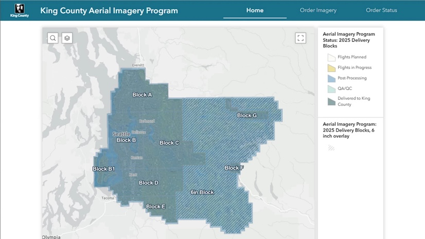
The interactive app increases awareness of the county’s imagery acquisitions and makes the data accessible in a single platform.
Join this free course to learn how GIS and imagery work together to enhance workflows from visualization to analysis.
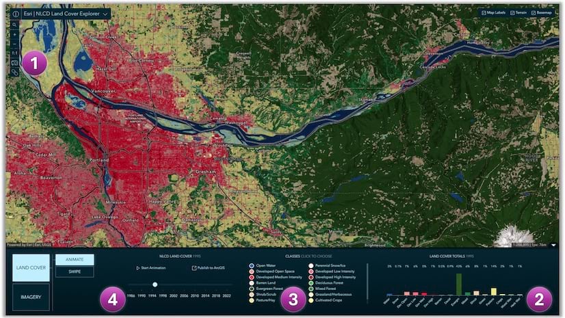
Access land cover mapping data in the form of a ready-to-use imagery layer and a web mapping application, the NLCD Land Cover Explorer.
Learn how to use compositing to tint flowing wind patterns by underlying terrain colors with ArcGIS Online Map Viewer.
Templates have arrived in ArcGIS StoryMaps. Find out how you can use them in your storytelling workflow.
Group on Earth Observations (GEO), Esri, and many other organizations and nations work together to reduce disaster risks worldwide.
Orbital Insight's GO tool uses satellite imagery, artificial intelligence, geolocation data and ArcGIS Online basemaps to understand events.
What are the advantages of sharing imagery and raster data within ArcGIS using map tile cache, tiled imagery, and dynamic imagery?
ArcGIS Data Appliance 7.2 includes Vector Basemaps plus preloaded imagery, basemaps, and reference layers, all behind your firewall.
Archaeologists Thomas Garrison and Marcello Canuto describe how technologies such as lidar has shed light on once-hidden Mayan civilizations.