GIS Education Localizes Global Goals
With GIS, SDSU's Metabolism of Cities Living Lab brings the UN's Sustainable Development Goals to communities in San Diego and around the world.
June 2024

With GIS, SDSU's Metabolism of Cities Living Lab brings the UN's Sustainable Development Goals to communities in San Diego and around the world.
Google Drive offers a way to store, share, and manage files. Here's how to use those files in ArcGIS Online.
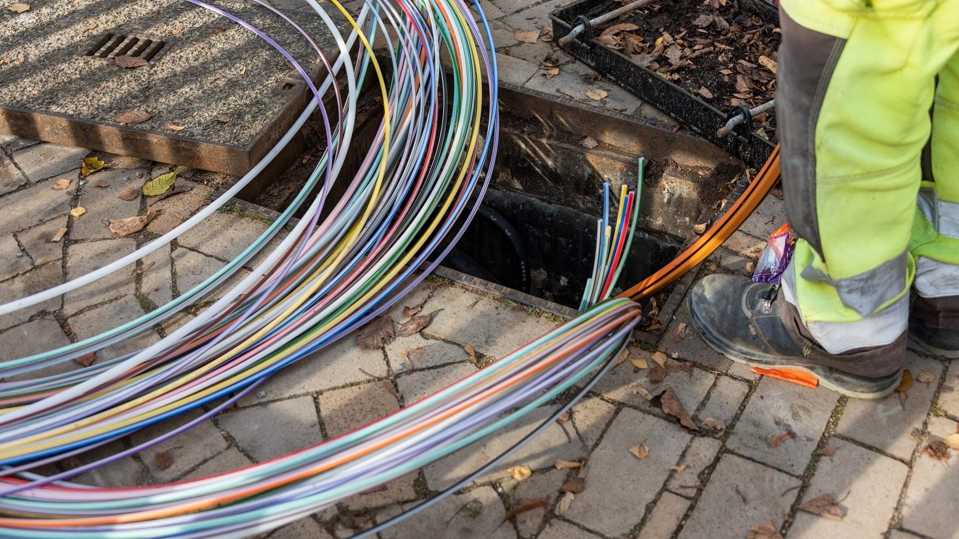
Explore how Turkcell is using GIS and machine learning to optimize fiber optic expansion across Türkiye.
Scot McQueen from World Forest ID explains how technology is enabling new ways to ensure forest health and meet market demand.
Learn how ROK Technologies uses Esri training and certifications to keep staff’s technical skills on the cutting edge.
It's not too late to register for the 2024 Esri User Conference, taking place July 15-19 in San Diego.
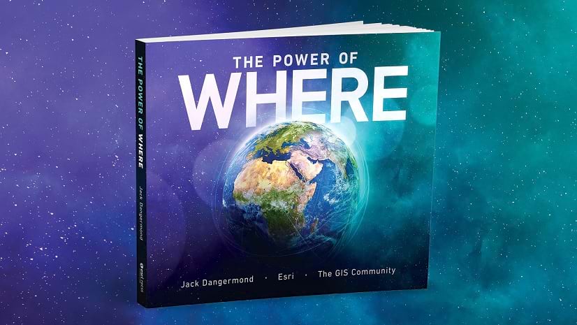
Check out The Power of Where, a new title from Esri Press to be released at Esri UC 2024.
Join this new MOOC to build skills to design and share apps that feature dynamic GIS capabilities and content.
In these videos, learn to choose the right colors for the right features in your maps.
Learn about the options available for configuring your web maps and scenes in ArcGIS StoryMaps to make them effective and impactful.
Groups are a great way to organize content, and creating galleries or apps using groups is a great way to present that content.
A USC student with a geodesign major and sociology minor gives insights into using GIS in geodesign projects and advice to other students.
The geographic approach allows you to visualize environmental factors impacting a community's health. GIS tools operationalize this approach.
D’Artagnan Scorza from LA County explains how location technology is being used to address social injustice.
This no-cost training seminar explores how GeoAI has evolved and will demonstrate real-world use cases.
In this video, discover intuitive ways to visualize and navigate Map Viewer, empowering you to unlock the full potential of your spatial data.
By default, web maps in ArcGIS Online Map Viewer display in the Mercator map projection. But what if you want to use a different projection?