
April 6, 2021 |
Dr. Dawn Wright |
April 23, 2021
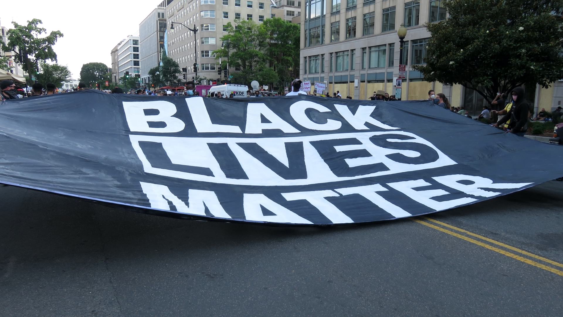
Commitments this week by 40 world leaders and more than 300 businesses to address climate change, with ambitious goals for emission reductions, make me excited about our ability to achieve meaningful change in my lifetime. In the wake of the coronavirus pandemic, our collective vulnerability helps us realize we are in this together. The pandemic disruption has provided a pause for reflection, and leaders are wise to use this time to focus on the causes of increasing climate calamities and biodiversity decline. We can, and must, take global action.
I’m heartened most by the “Build Back Better” message of the Biden administration as well as all global leaders around the world with similar sentiments, because it turns the moment into one of opportunity and level-setting to ensure that everyone benefits. The geographic information system (GIS) technology we build at Esri provides a new level of contextual awareness that gained global attention during the COVID-19 crisis. The Johns Hopkins COVID-19 dashboard was built with GIS technology. Thousands of other organizations around the world have used GIS from Esri to analyze health and safety information, understand the needs of communities, and take a data-driven approach to the pandemic’s many challenges.
My life’s work has focused on building decision support systems rooted in geography to combine disparate data and help people see the whole of a problem. Laura Dangermond and I started Esri with the enduring belief that a geographic approach can improve the natural world, our built environments, and the lives of people. I feel thankful that millions of GIS users around the world provide proof of this premise.
Humans continue to reshape the natural world and introduce new technologies made to improve our lives. We extract materials and burn them for energy, often to the detriment of our planet. While we have dramatically propelled our standard of living, fueled global economies, and increased human lifespans, we now see some practices as too intensive and inherently unsustainable. With species dying around us, and factors such as sea level rise forcing us to adapt, we must retool to take on the climate crisis.
Geography, the science of our world, is experiencing a renaissance because of the nature of these problems we are facing. Maps have always been the way we understand the broader context of a plan, a place, or a situation. Today, entirely new kinds of maps and data visualizations are possible given the integration of sensors and the data we all generate with our devices. Around the world, organizations are applying apps, drones, artificial intelligence (AI), machine learning, and the internet of things (IoT) to populate a real-time view of assets and people on a shared map.
Modern GIS software brings clarity to the complex climate challenges we confront by helping make sense of massive volumes and varieties of data. Datasets can be enriched, analyzed and overlayed in ways that reveal patterns, trends, and relationships that would otherwise remain hidden. GIS shows us an accurate picture of current conditions, and empowers us to model and simulate intervention strategies. We can iterate with GIS, to see what decisions to make, and when and where to make them. We have seen this in action as leaders choreographed their pandemic response guided by spatial analysis and real-time awareness from GIS.
The global commitment to dramatically cut back on carbon emissions will require new approaches, and a much more efficient use of water, food, energy, shelter, and mobility. For humanity, this is uncharted territory.
I’ve had the privilege of working alongside such global conservation leaders as E.O. Wilson, Jane Goodall, and Peter Raven. These great minds have all used GIS in their work because it helps clarify their questions and guide sustainable decisions. For years, GIS has helped organizations of all sizes tackle complex problems. Now, we have the opportunity of helping them see their work in a new light, applying the ethics of conservation for careful resource use, allocation, and protection.
From city planning to asset management, our users have relied on GIS to keep their organizations strong and resilient through many crises. As the president of the United States and other world leaders call for a clear plan and real results around the climate crisis, Esri will continue partnering with its users to help fulfill their sustainability goals. Together, we will promote a resiliency that transcends the needs of any single organization or moment in time. And, I have no doubt the collaborative nature of GIS work will foster new, important connections among and within organizations.
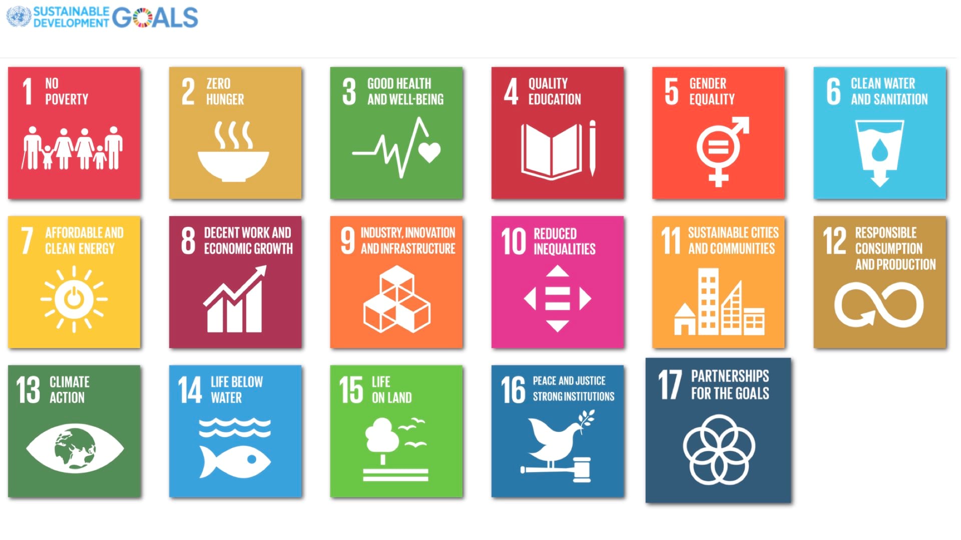
Recognizing the value of GIS at a global scale, the United Nations has organized a set of sustainable development goals (SDGs) with GIS as a foundation. Each participating country is collecting relevant data dealing with society, environment, and economy to tackle SDGs related to such challenges as water quality, forest loss, and affordable clean energy.
GIS fosters a ground truth, a common operating picture for everyone involved in solving a problem. In the context of climate change, we can use GIS to confront the consequences of centuries of shared actions. Now is a time for organizations and leaders to be bold, to face the environmental harm of our globalized economies. And that’s the good news of this week’s turn of events—it’s a genuinely promising time for government and business, not only in terms of technology, but in terms of attitude.
Use GIS to predict and prepare for climate-related risks. Explore more about climate change—causes, consequences, consensus, and actions.