displaying 396 results
Esri vector basemaps are optimized to quickly generate and update maps and apps.

ArcGIS Living Atlas of the World provides continually updated maps, apps, and data layers that can be used to make great apps.

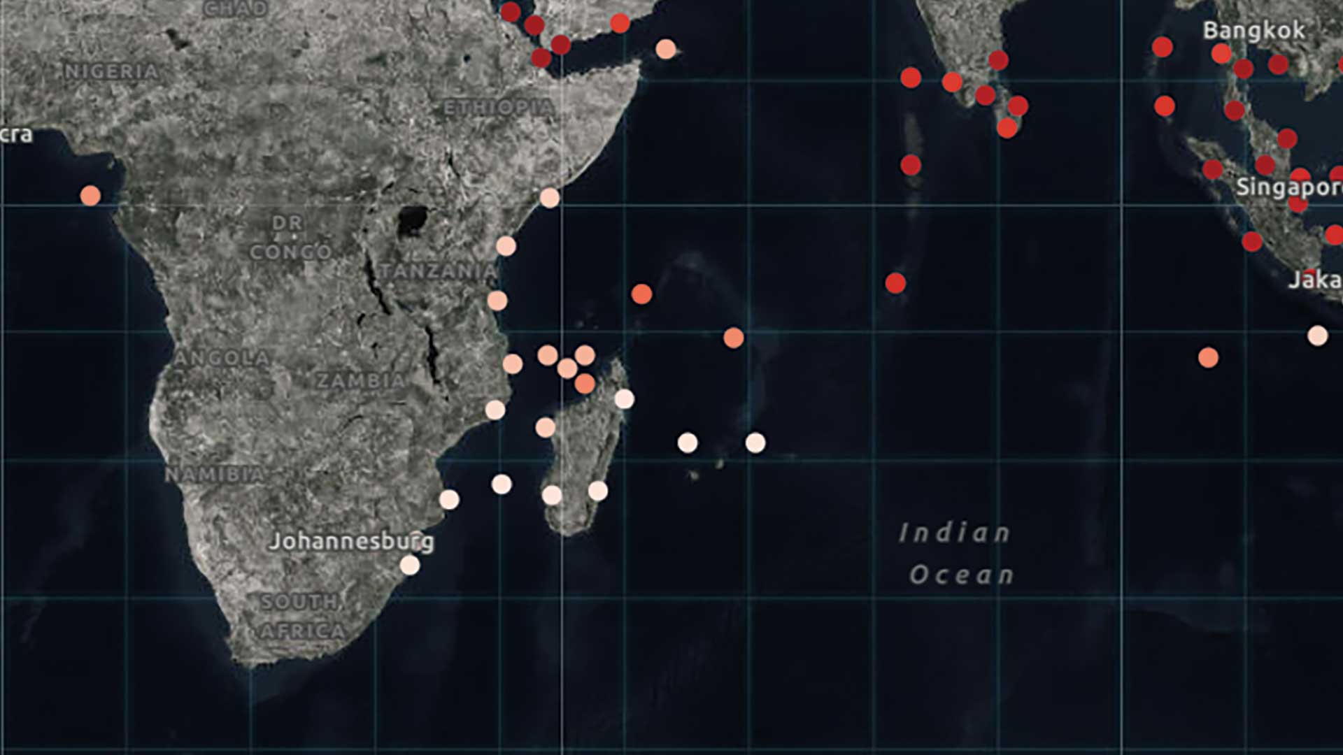
Ninety-eight percent of the internet runs on cables that stretch across the world’s seabeds.

A professor transformed a course from traditional classroom to remote interactive experience with the help of ArcGIS Notebooks.
ArcGIS Arcade lets you map the values you need or create completely new values.
Remote sensing has always rapidly incorporated advances in technology, but the pace of change has quickened recently.

US Army Corps of Engineers shares current channel information through eHydro.

Conservationist Jennifer Norris explains California's strategic success in protecting biodiversity while also sustaining the economy.
Check out the latest chapter in this series of ArcGIS StoryMaps stories on living in the age of humans.