displaying 195 results

The National Geospatial-Intelligence Agency (NGA) creates a human-machine team to deliver geospatial intelligence, a decisive advantage.

Find out how AllSource can be used in all phases of the cybersecurity cycle, from understanding a threat to analyzing and acting on it.
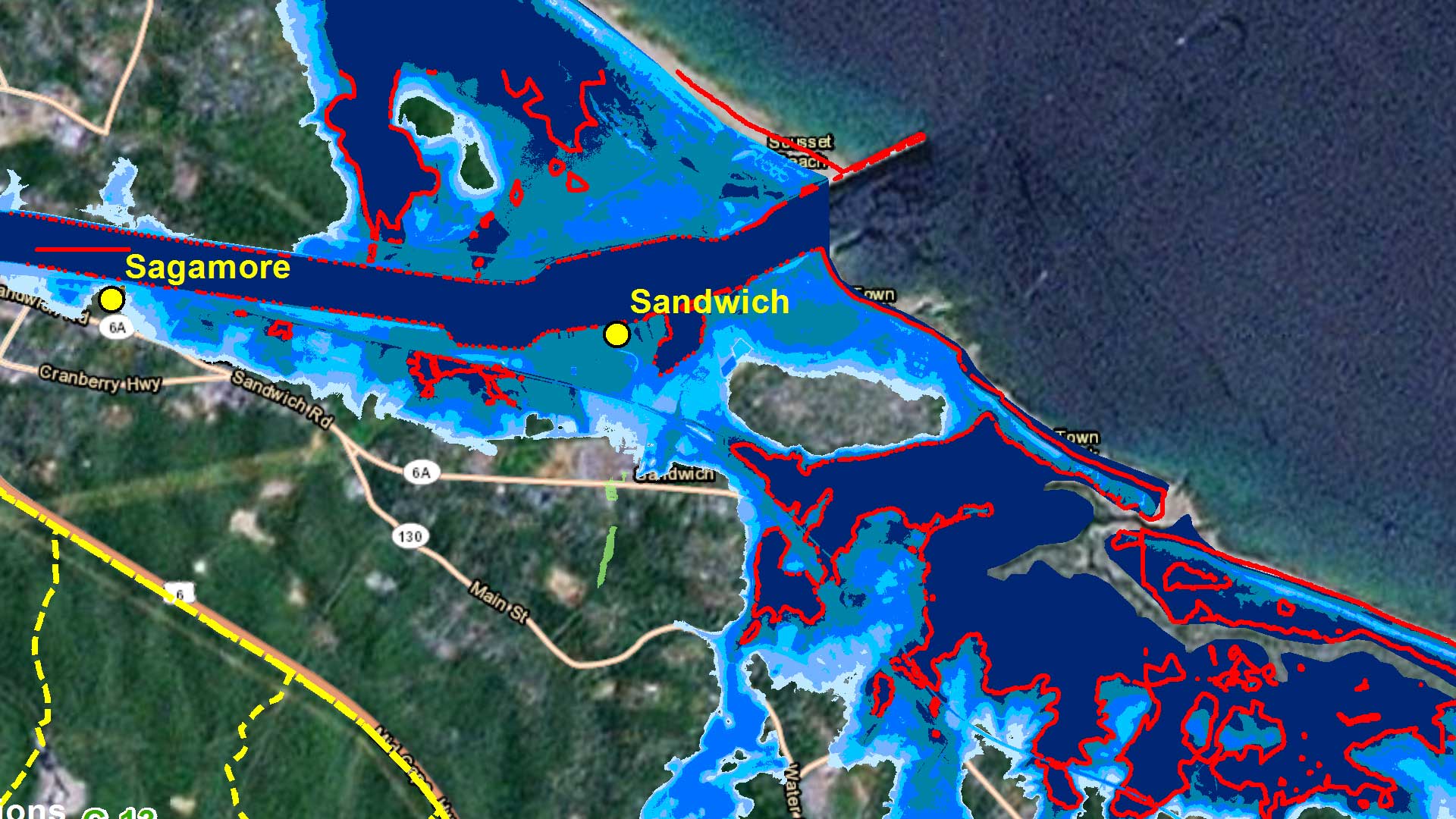
The Massachusetts Army National Guard (MA ARNG) initiated one of the defense industry's first and most comprehensive climate change vulnerability
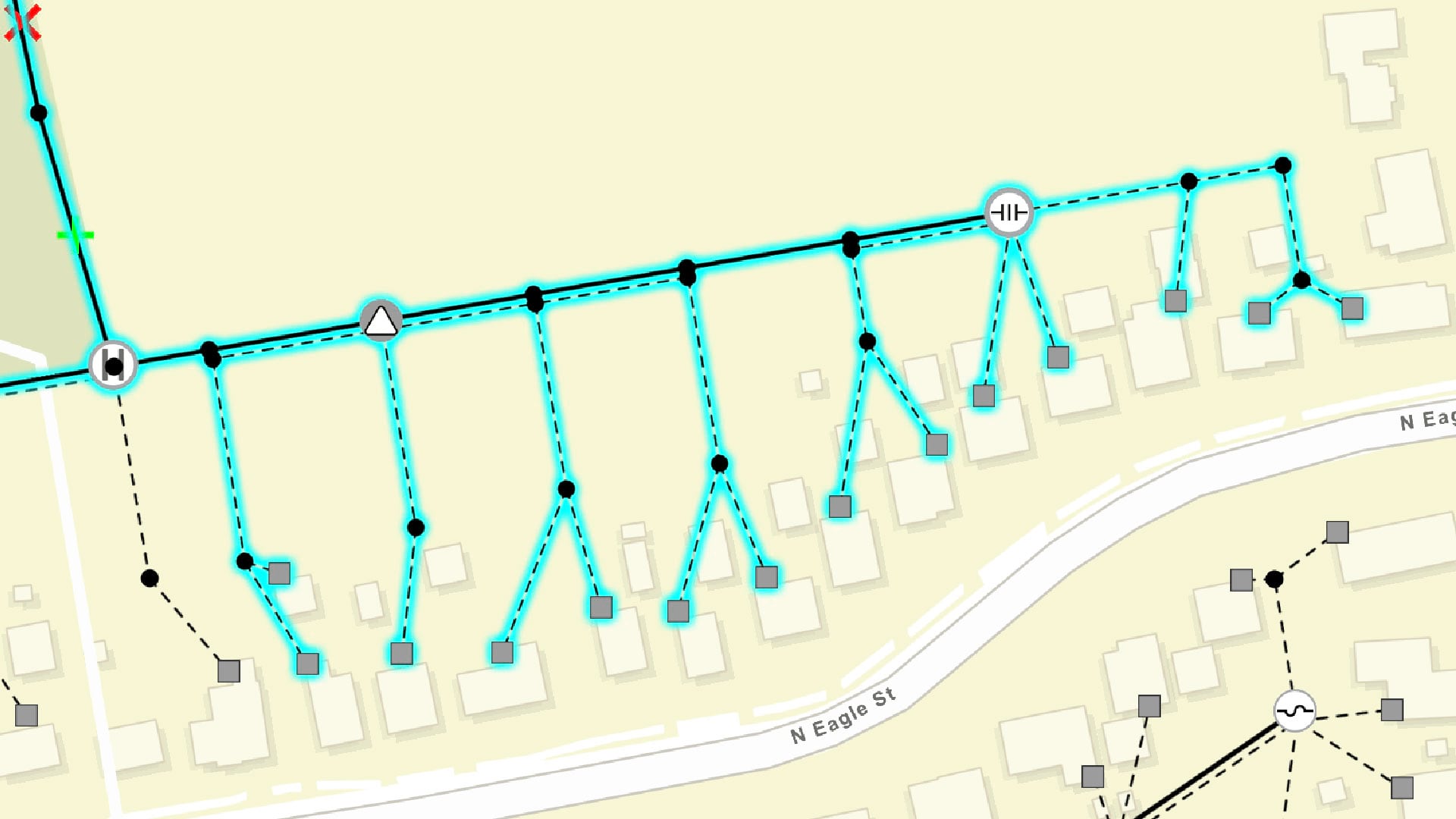
From mapping critical facilities to providing situational awareness in emergency management response to overseeing infrastructure management...

GIS is being used to help thousands who were left behind when United States forces left Afghanistan.

The USSOUTHCOM uses deep learning capabilities to monitor ship movements.
ArcGIS Runtime SDKs 100.6 is a major milestone in the capabilities it adds.
ArcGIS Video Server, a new server role in ArcGIS Enterprise, allows users to perform geospatial video analysis on the web.
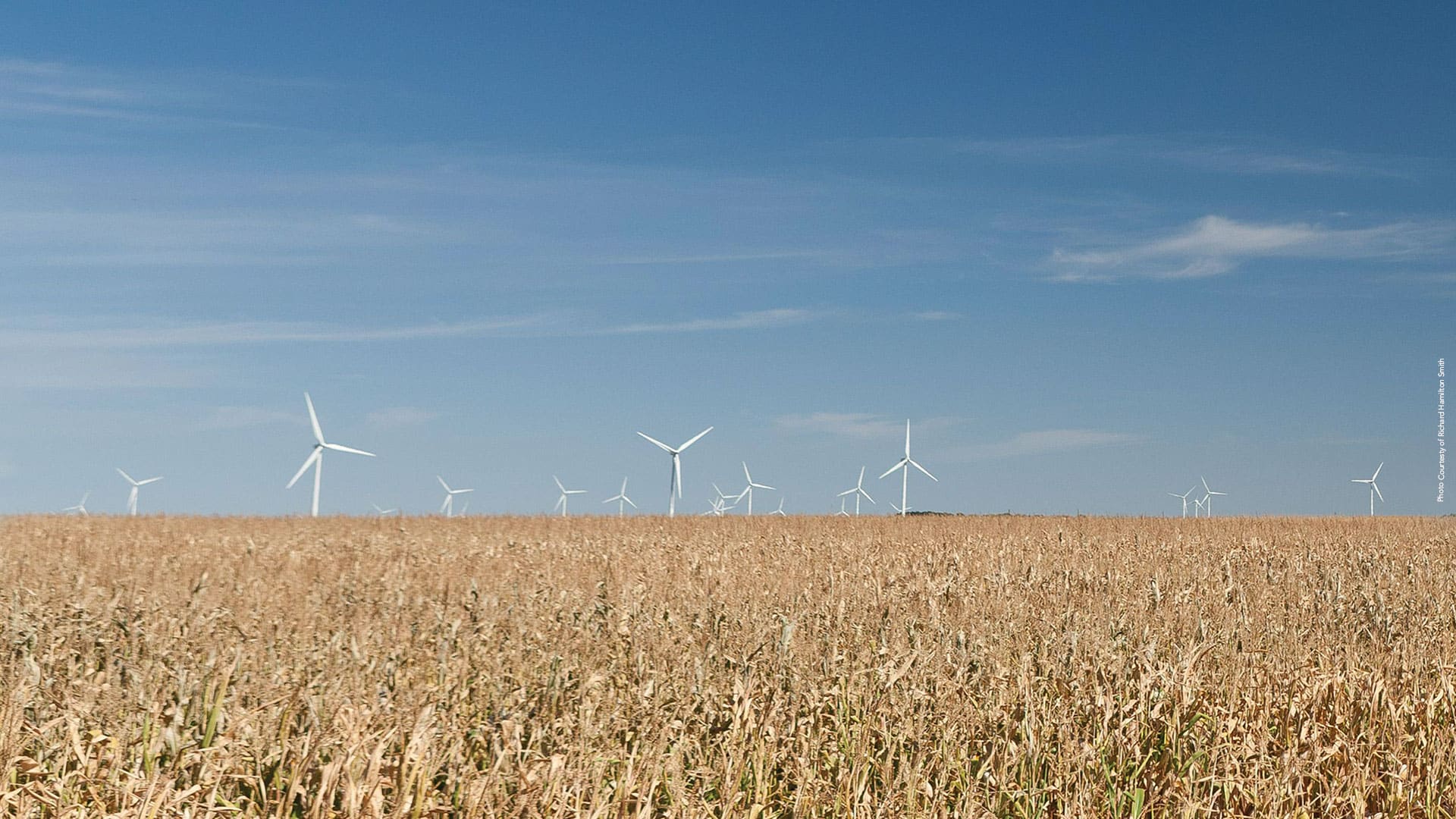
Site Wind Right, from The Nature Conservancy, focuses renewable energy development in optimal places that won’t harm wildlife habitats.
The latest release of ArcGIS technology offers powerful new features in mapping, visualization, analytics, and more.

Location-based surveys and dashboards helped citizens, local agencies, and international organizations work together.