displaying 602 results

Mary Rowe, executive director of the Canadian Urban Institute, explains how cities are repurposing empty commercial space post pandemic.

Coastal planner Leah Fulton discusses the extent of lost commercial fishing gear in the ocean pollution crisis.
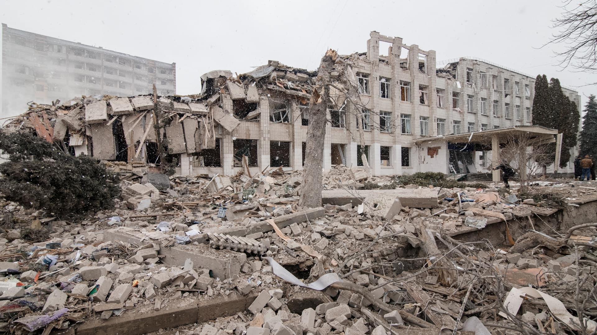
Publicly shared commercial satellite imagery and online maps—so-called open-source intelligence (OSINT)—reveal the disruption in Ukraine.
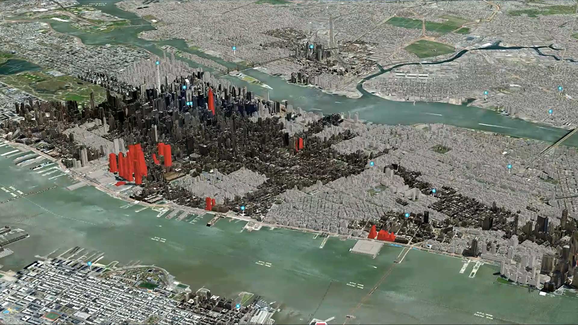
With 3D tech, location intelligence, and data-fueled insight, Cushman & Wakefield stays on the cutting edge—and helps clients see what's next.

Esri and IBM have teamed in this year’s Call for Code challenge that seeks solutions for combatting climate change.

Many consumer navigation solutions can take people from point A to point B, but businesses and organizations need more than that.
Urban Observatory at urbanobservatory.org is getting bigger and better.
Esri's new Navigator for ArcGIS app, which runs on all types of devices—from smartphones to ruggedized tablets...
If you use ArcGIS in any way, shape, or form, Scott Morehouse had a big hand in bringing your software to life.

Former director of software development Scott Morehouse is now leading small research teams focused on civic engagement and urban design.
The Catastrophe Services division of the Property & Liability Resource Bureau (PLRB), a trade association for the insurance industry located in…

More than 150 years after the first commercial oil well in the United States was drilled in Titusville, Pennsylvania, the state finds itself...