displaying 956 results

DashFLUboard allows users to monitor wild bird migrations and connect outbreaks of Highly Pathogenic Avian Influenza (HPAI) around the world.
In the new frontier of real-time GIS, Esri's ArcGIS GeoEvent Processor for Server ingests data streaming in from sources such as...

While searching for the four-year-old girl and her dog in a rural area, the massive search party relied on real-time GIS to track progress.

Investigators used real-time GIS to search a 300-acre property, coordinating the efforts of personnel from more than 20 agencies.

Mobile map-based apps gave searchers the tools to conduct a quick and comprehensive search.

The North American Grid is an interconnected network that generates and distributes electricity throughout the continental United States and...

With a single runway and little room to expand, Geneva Airport turns to real-time awareness to fuel growth.

Using a custom web map to investigate illegal water connections, Maynilad Water Services has recovered $410,000 in commercial losses.

To better track hundreds of tanker trucks that distribute fuel in Argentina, the Pan American Energy Group turned to ArcGIS technology.
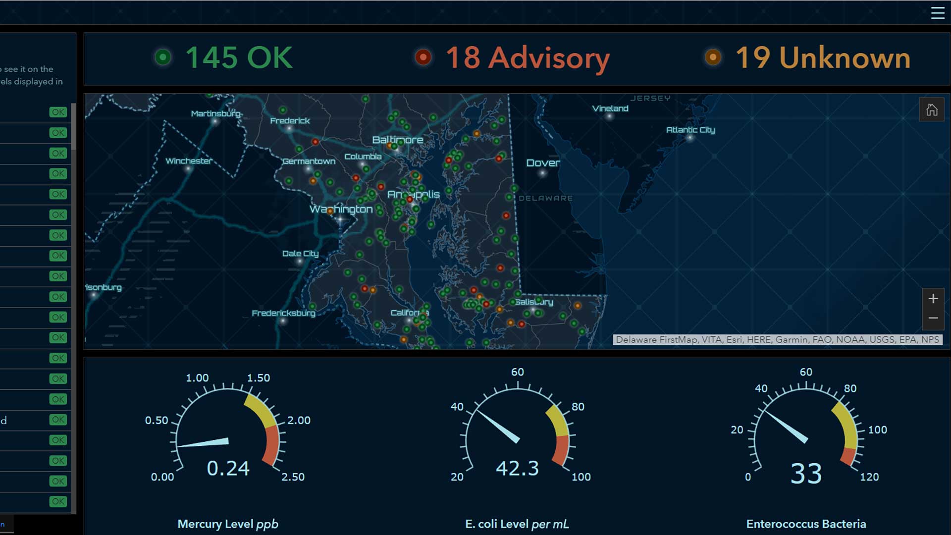
Operations Dashboard for ArcGIS provides a a comprehensive and engaging real-time view of data.

Users have more flexibility when sketching buildings, can get real-time feedback on goals, and have more tools for collaboration.