displaying 594 results

From collecting trash to modeling where winds and ocean currents take it, young people in New Zealand get inspired to take action.
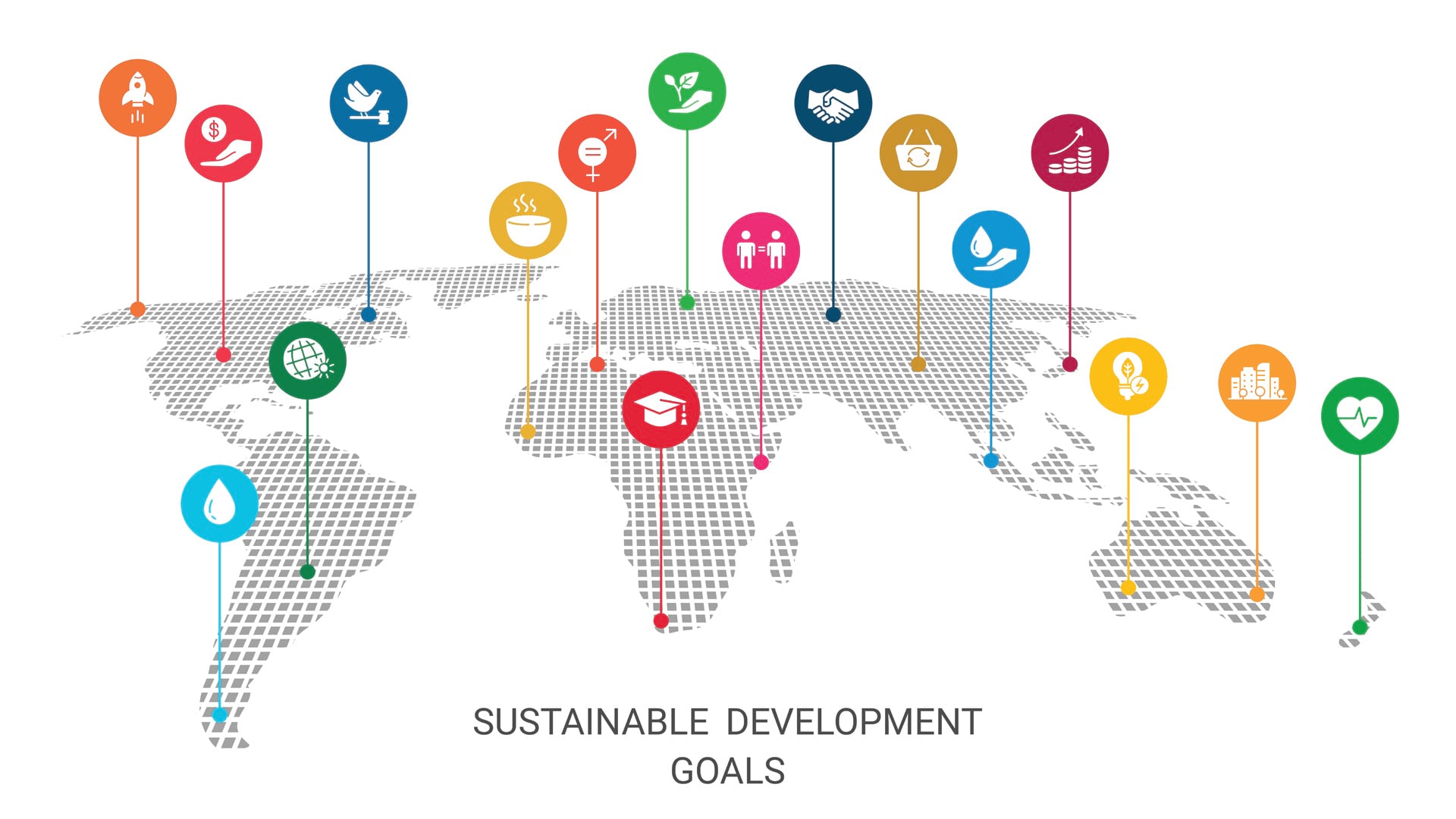
We have less than eight years to achieve the Sustainable Development Goals. Maps can help us better understand them and monitor progress.

Geography sits at the confluence of people, place, and the environment and is essential to understanding and exploring the world.

With humanity at an inflection point, we must choose to stand up and create a sustainable future.
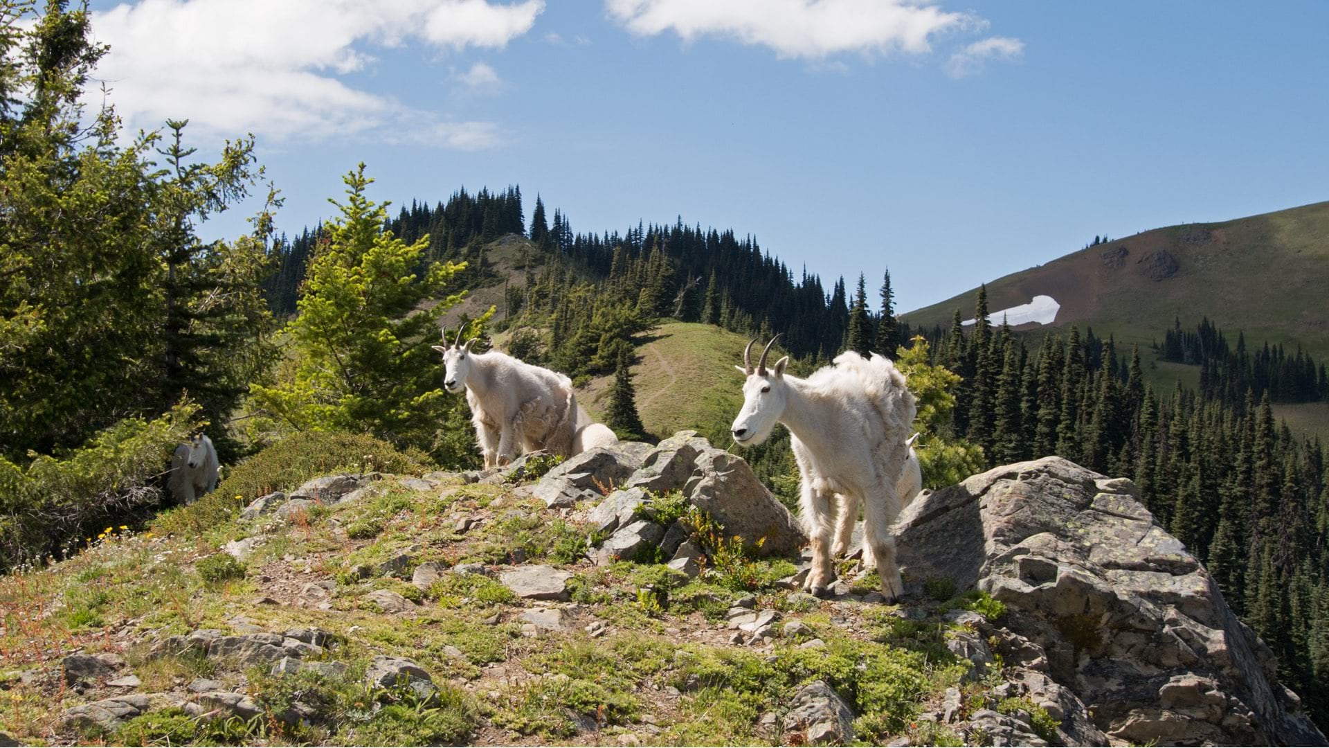
Mountain goats that were not native to Olympic National Park were captured, relocated, and monitored using location intelligence.

Jack Dangermond and National Geographic Society CEO Jill Tiefenthaler discuss technology and the power of storytelling.

Dr. Rick Spinrad from NOAA explains how technology helps sustain the global ocean economy while also safeguarding the ocean environment.
Legal scholar Dr. Kelsey Leonard explains how technology and indigenous tradition are being used to safeguard water rights.
Check out this restoration project developed for native wetland vegetation in the Swan River National Wildlife Refuge in Montana.
In this story created with ArcGIS StoryMaps, learn about the rise of seabed maps and why seafloor mapping is critical to saving our planet.
Get inspired by Sunny Fleming’s report from the National Association of Environmental Professionals Conference and Training Symposium.
In one study, geneGIS, a new ArcGIS extension, showed that humpback whales return year after year to feeding grounds introduced to them...