displaying 998 results
When an organization's reputation depends on its GIS data, errors can introduce unacceptable risk.
ArcGIS solutions provide maps, applications, templates, and widgets that support critical COVID-19 response.

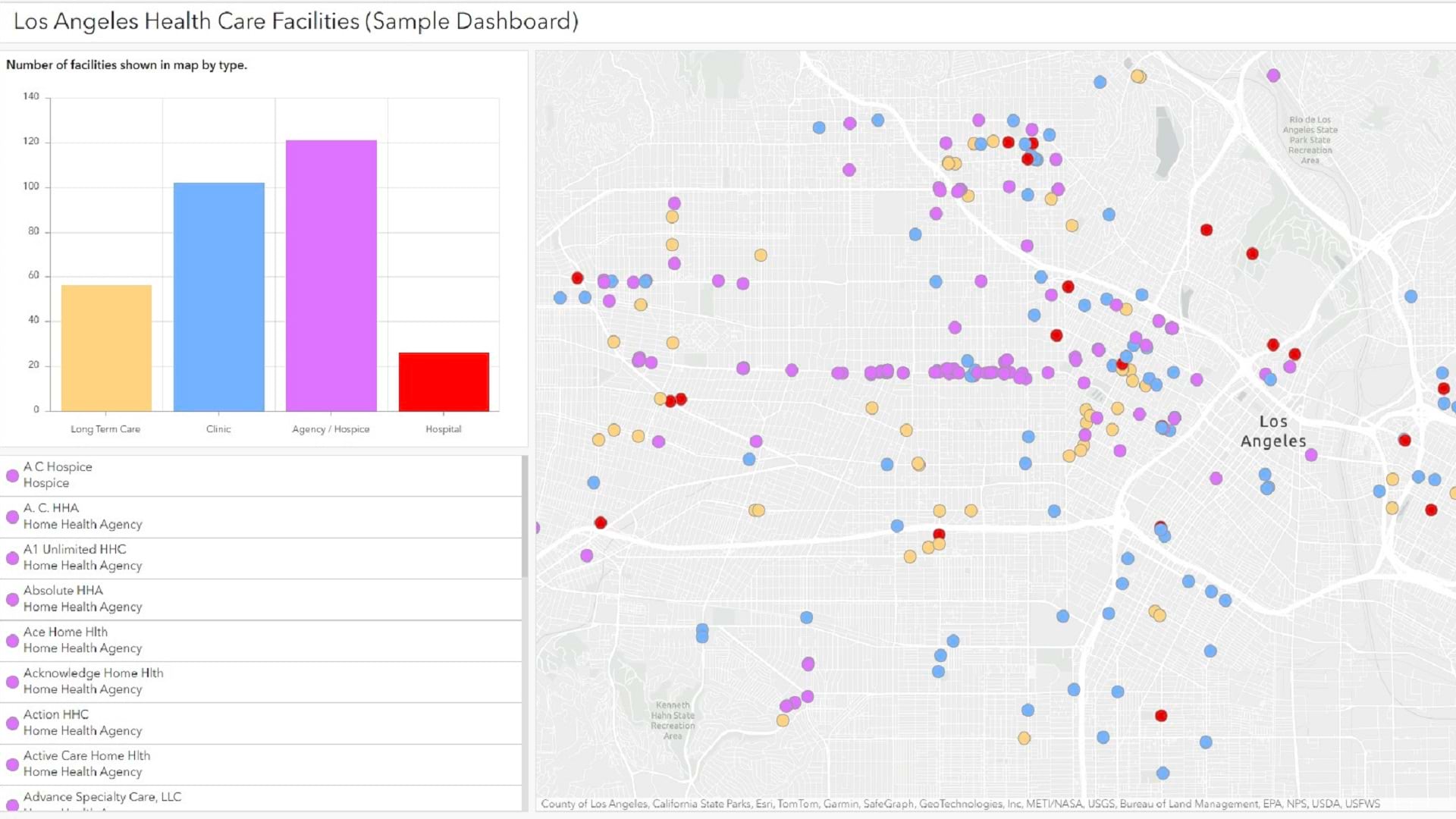
An increasingly popular form of health care could improve patient diagnostics with more information on location.
One of the aims of the Epidemiology and Environmental Health group from the Center for Animal Health Research (CISA) of the National Institute…

Collaborative Cities; Keeping People Safe; GIS Jump Start for Health Professionals

With a GIS-based app to monitor critical assets, the Saudi Arabian Oil Company ensures that its network of transmission lines operates safely.

Esri named a leader in location intelligence, launches new Ocean Health Hubs with OHI, and expands IoT developer opportunities.

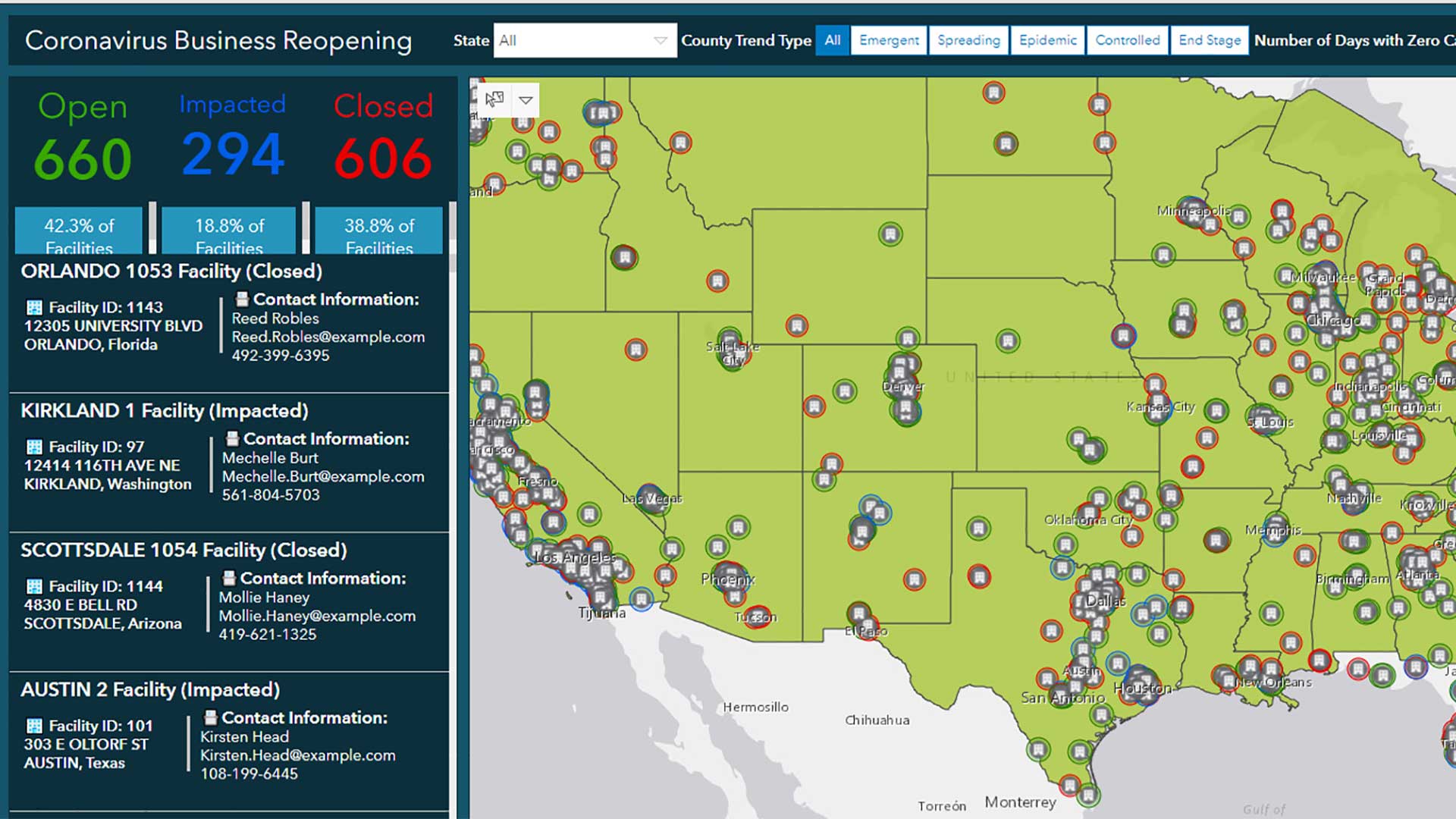
A detailed dashboard showed leaders where COVID-19 infections would spike next and, later, where more people needed to be vaccinated.

Organizations working on the UN Sustainable Development Goals apply GIS to create and share data and to analyze and prioritize actions.
Learn how to configure a simple interactive dashboard using ArcGIS Dashboards in this tip.

CDC uses mapping to monitor the spread of COVID-19 at the county level, following up on any spike to lend a hand in quelling every outbreak.
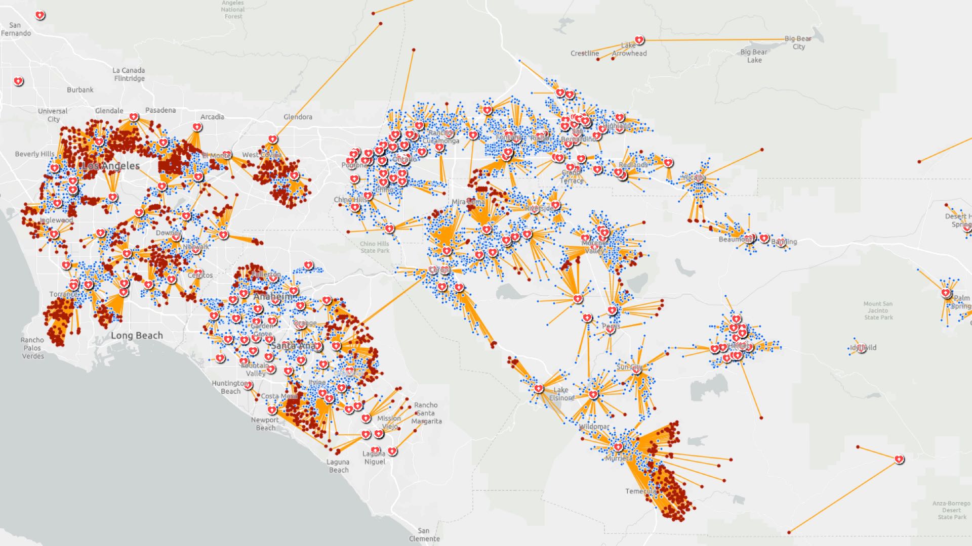
Location intelligence helps investigators trace COVID-19 infection routes, implement control measures, and gauge their effectiveness.