displaying 918 results
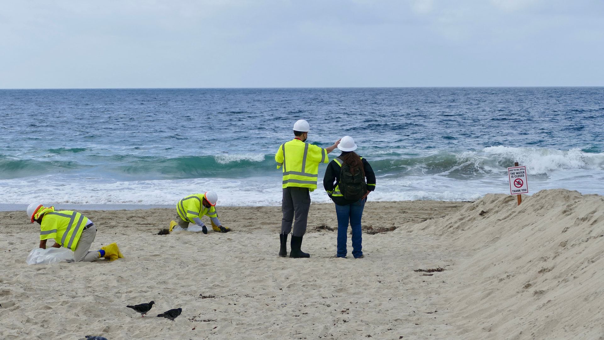
After 25,000 gallons of crude oil spewed into the Pacific Ocean, the Surfrider Foundation leveraged location to streamline data collection.
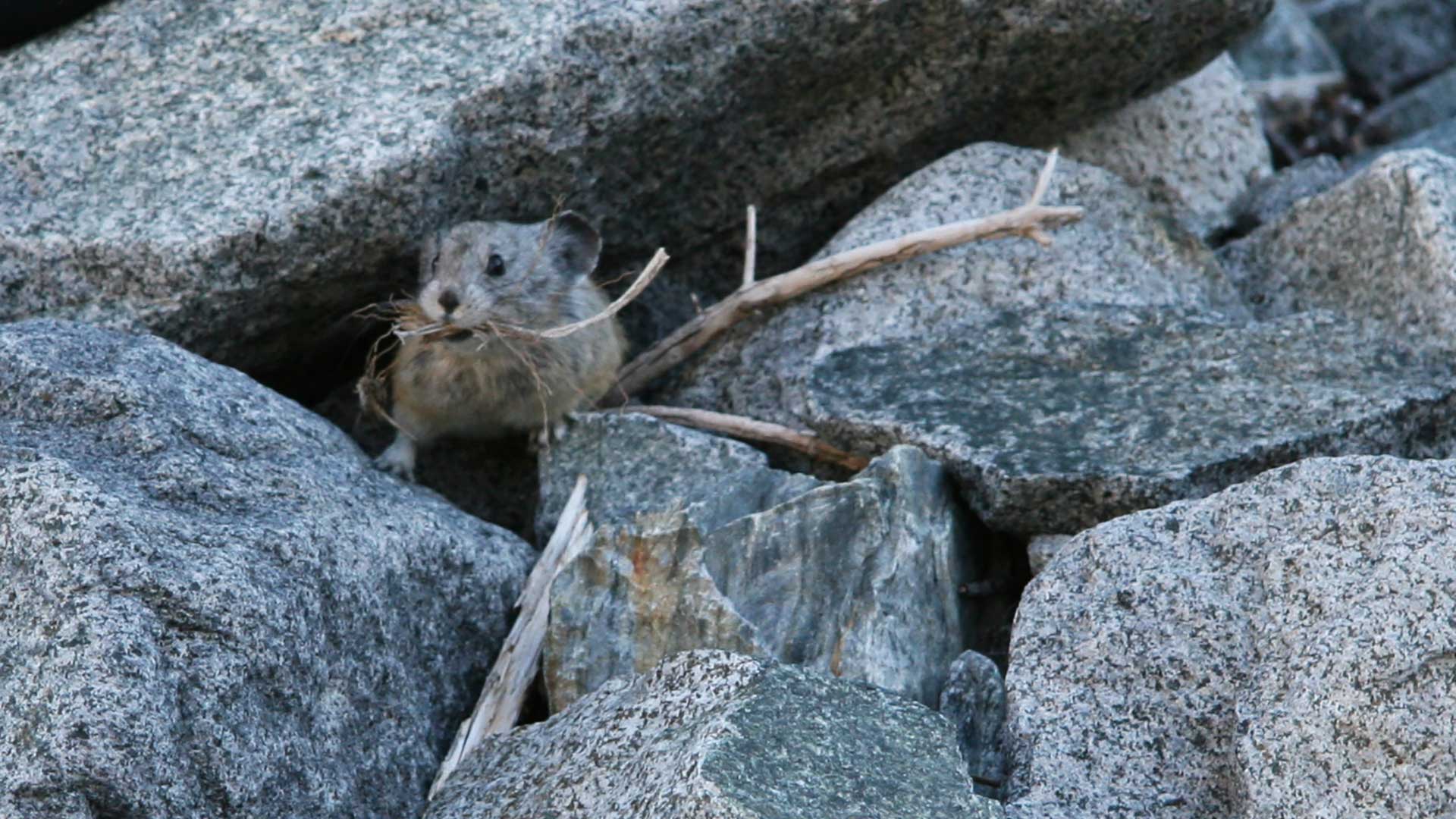
A team of university researchers used high-resolution imagery, ArcGIS, and R to find habitat necessary for the survival of pikas
The government of Queensland, Australia, use ArcGIS AppStudio to help keep its residents and wildlife safe.

To understand Random Forest models, an explanation of a Decision Tree classifier is a good starting point.
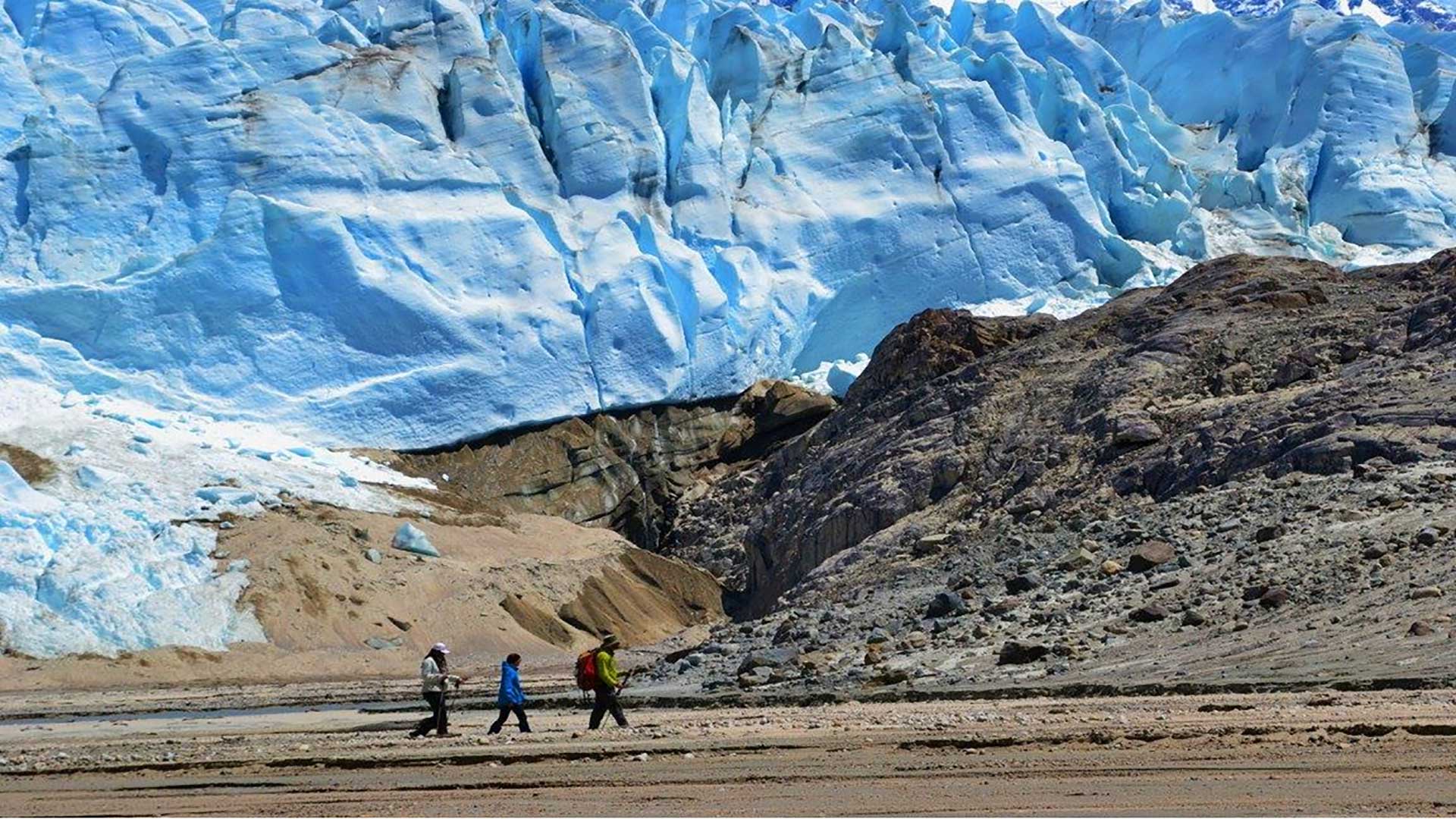
The National Geospatial-Intelligence Agency (NGA) studies the risk posed by glacial lake outburst flood (GLOF) events caused by the effects of cl
The 40 largest cities in the United States each have their own character and personality.
Three rivers surround 40,000 square kilometers of mysterious forest in the heart of the Democratic Republic of Congo (DR Congo). Until very...
Energy awareness is becoming a major focus for the United States federal government as both costs and demand rise.

Sean O’Brien, president and CEO of NatureServe, discusses the necessity of data-driven decision making in conservation.

Renowned biologist E.O. Wilson explains the urgency of protecting the earth's biodiversity.
Take a closer look at the most disadvantaged American communities and study their socioeconomic context using Tapestry profiles.
Conservation social scientist Dr. Meredith Gore discusses the value of technology and community interaction in investigating nature crimes.