In September, an endangered West Indian manatee paddled into Port Aransas on the Texas Gulf Coast, halting work on a $64 million ferry upgrade project inside the port. The federally protected species swam away unharmed following a three-hour work stoppage, according to CBS affiliate KHOU.
Sightings in Texas are rare, but manatee traffic might be picking up. Local biologists have reported changes in migration patterns, and prior to the sighting, Texas DOT officials advised construction crews to stay vigilant. Further sightings of the federally protected species could alter construction schedules or even ferry routes.
Companies in industries from retail to manufacturing to natural resources have an incentive to understand their ecological footprint. Driven by regulatory compliance and the quest for business continuity, they are increasingly adopting data-driven strategies to monitor and manage interactions with the natural environment.
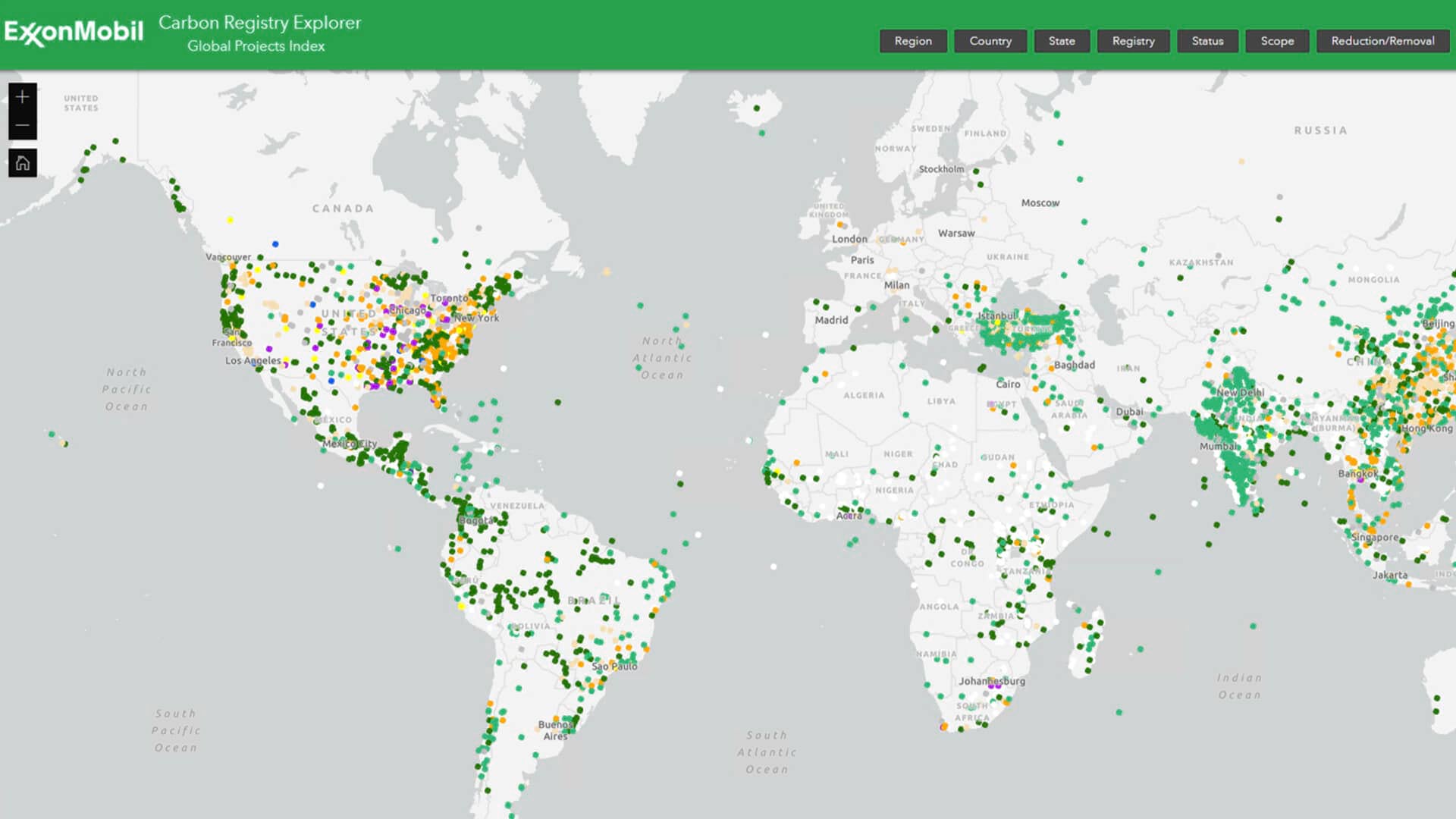
Many firms rely on geographic information system (GIS) technology to capture, organize, and understand data about the environments where they build facilities and conduct operations. Whether they’re tracking regulatory compliance, honoring customer commitments, or assessing operational goals, these companies recognize that the best path to environmental risk management is through an information-rich map.
The Outsourced Route to Environmental Awareness
For some companies, environmental management begins with a consulting firm.
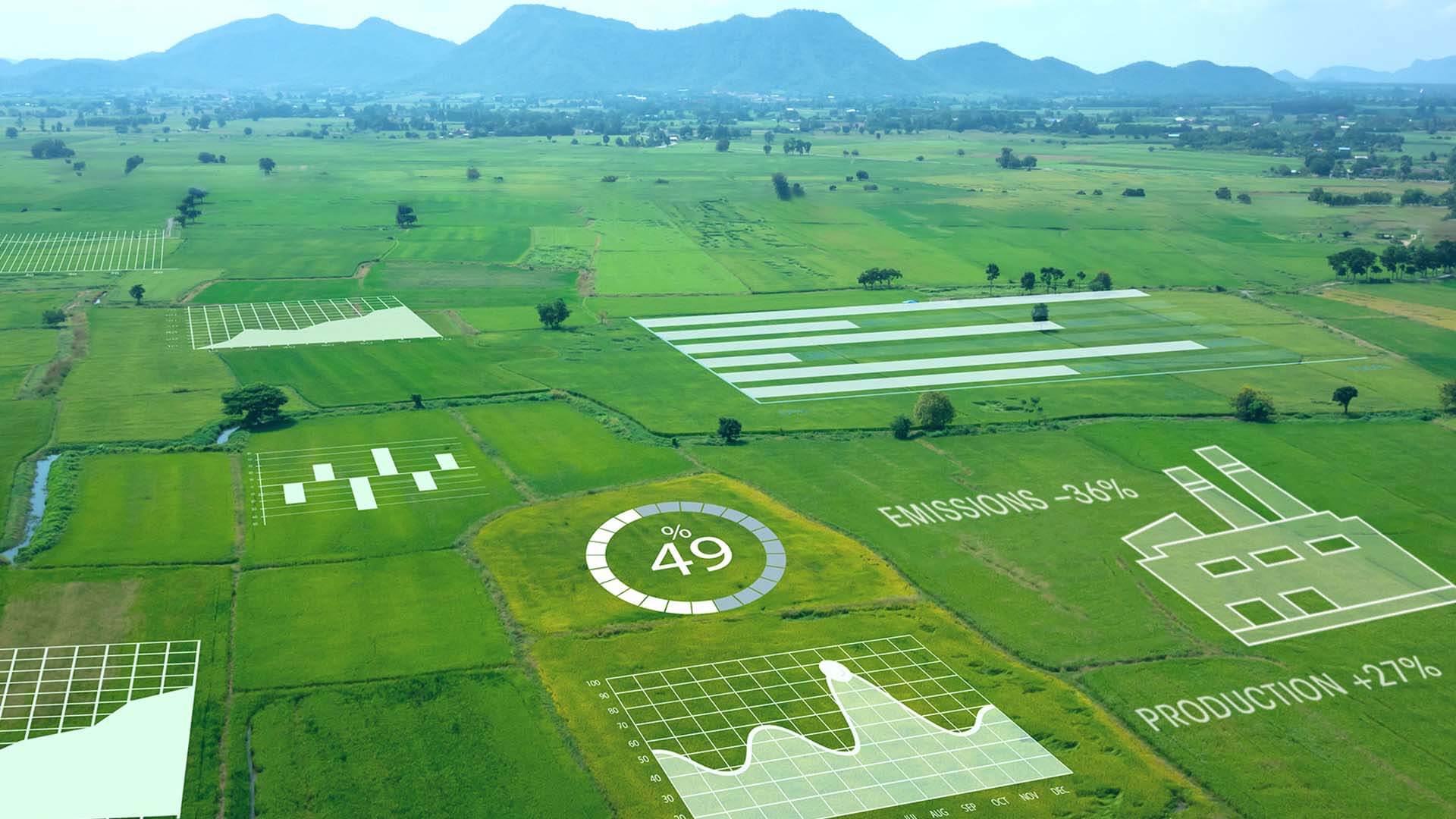
One Australian specialist uses GIS to advise energy companies building pipelines over long distances. The firm analyzes hundreds of datasets to determine how a project impacts an area’s biodiversity, water, soil quality, and socioeconomic conditions.
Much of that data is accessible within a modern GIS platform, and project managers supplement the insight with field surveys. Using a mobile app, field teams record on-the-ground observations, which are then synched to the platform and available for mapping and advanced spatial analysis.
Those maps and analytical outputs flow efficiently between the company and its clients, creating near real-time environmental awareness.
An In-House Team Aids Critical Decisions
The use of information-rich maps for environmental management isn’t restricted to specialist firms; many companies use in-house GIS professionals. Consider a Fortune 500 company that manufactures packaging materials. The company’s sustainability team uses GIS maps to monitor environmental threats to the forests it relies on.
Forest managers monitor granular details about company operations on a massive scale. By analyzing satellite imagery and field data in GIS, the company assesses the health of thousands of forest tracts.
Procurement teams use the maps to help decide which land to acquire and which logging companies to work with. At a glance, they can see which tracts host threatened wildlife, waterways, or flora.
This helps the company verify which foresters adhere to acceptable practices—and thus protect the industry’s future supply.
It’s more than good stewardship—it’s smart business.
With GIS-based views of construction projects or daily operations, companies are making better-informed decisions about compliance, honoring customer commitments, and strengthening business continuity.
Whether environmental awareness is created by an in-house team or a third-party specialist, a clear view of on-the-ground conditions is the foundation for business continuity and sound strategic planning.
The Esri Brief
Trending insights from WhereNext and other leading publicationsTrending articles

December 5, 2024 |

June 23, 2026 |

March 3, 2026 |

March 17, 2026 |

April 7, 2026 |

June 2, 2026 |