displaying 22 results

ArcGIS GeoBIM delivers an easy-to-use web-based experience to explore and collaborate on BIM projects and use data for multiple systems.

GIS was used to map the thousands of flags dedicated to those who died of COVID-19 in Washington, DC.

Government and commercial organizations must adopt a geographic approach to achieve a sustainable future.

Ensuring women have the right to own land could lift millions of people out of hunger and reduce rural poverty,
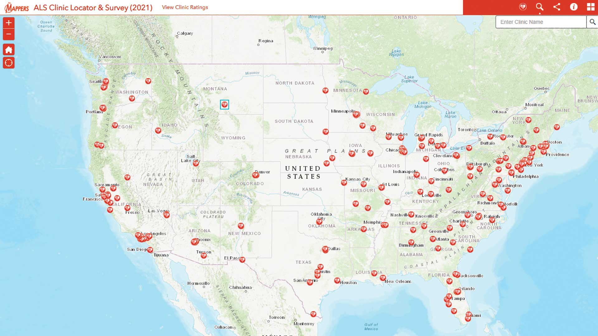
Pat Dolan used his GIS expertise to build tools to help the amyotrophic lateral sclerosis (ALS) community.

The Idaho Transportation Department (ITD) used mobile vehicle-based data collection and automated data extraction to document its highway system.

The United States Border Patrol is using GIS to improve its search and rescue (SAR) operations for migrants in distress.
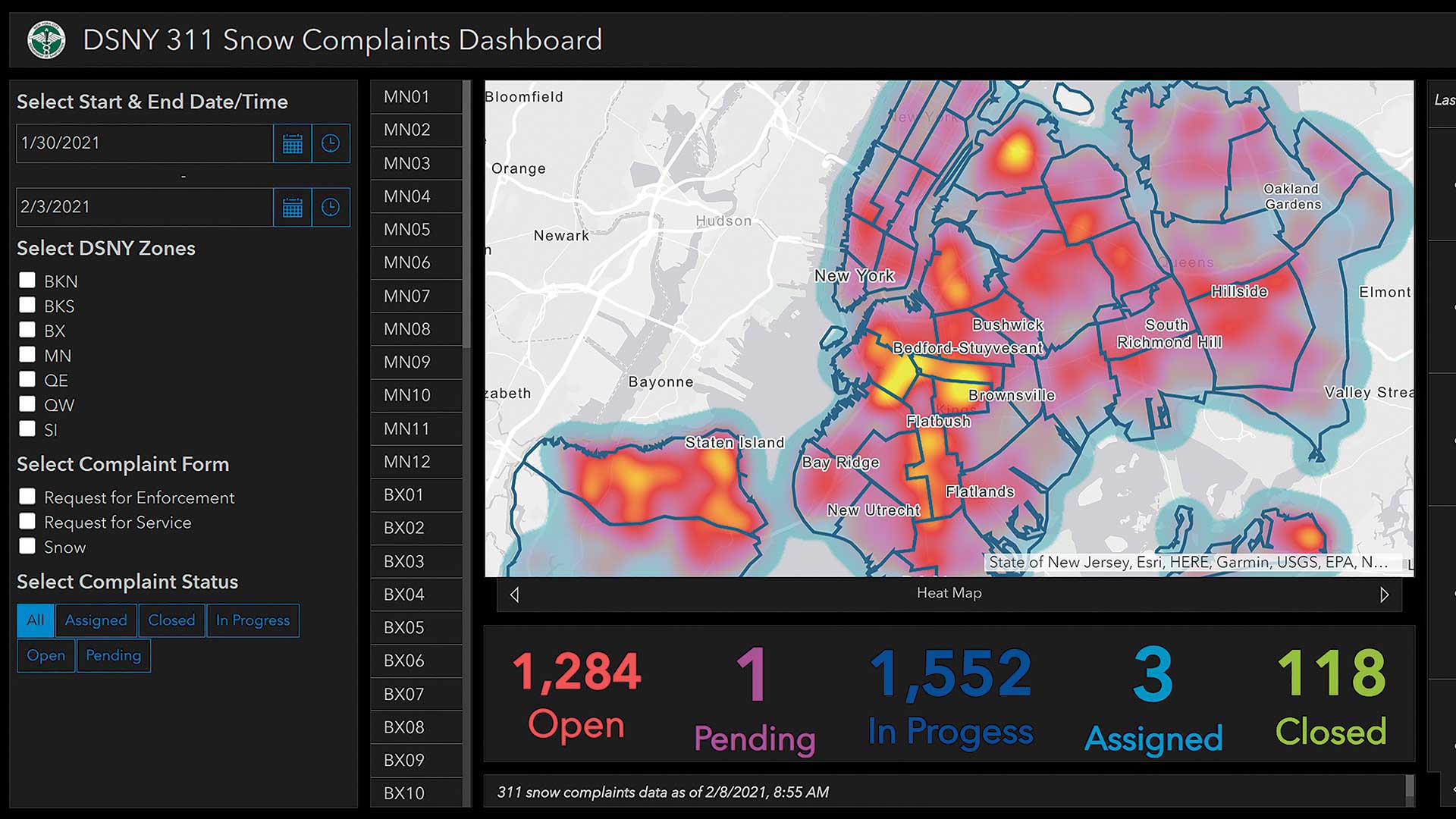
The City of New York employs GIS and live feeds to provide near real-time situational awareness to manage snow removal activities.

The City of Austin, Texas, developed a comprehensive plan to migrate to ArcGIS Pro.
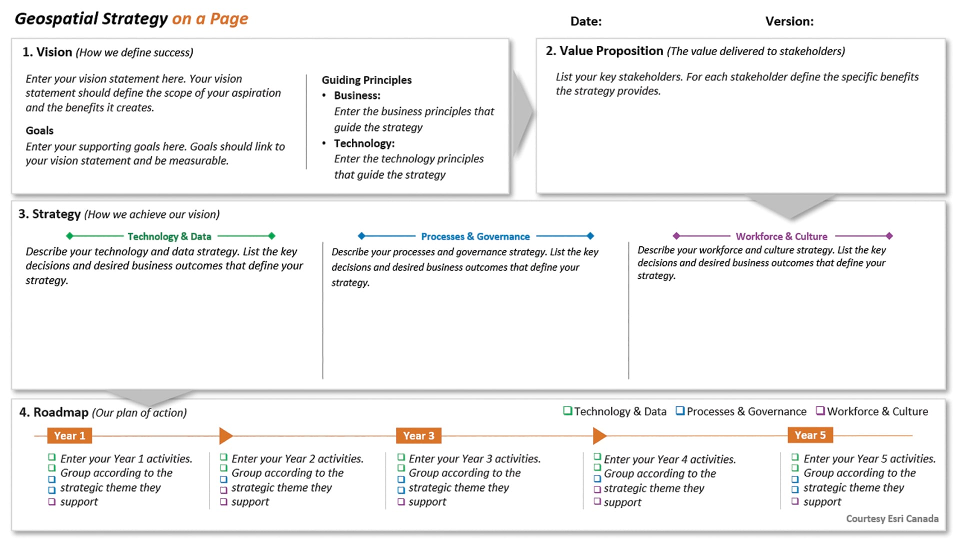
Make a simple, stripped-down visual that communicates your organization's goals and direction so that it doesn’t become shelfware.

Self-service government uses GIS to deliver services more efficiently.

A maintenance strategy is essential to the success of a GIS.