displaying 17 results
Cartographer John Nelson uses ArcGIS Pro to turn a vintage forest density map into a 3D map that uses modern forest density data.
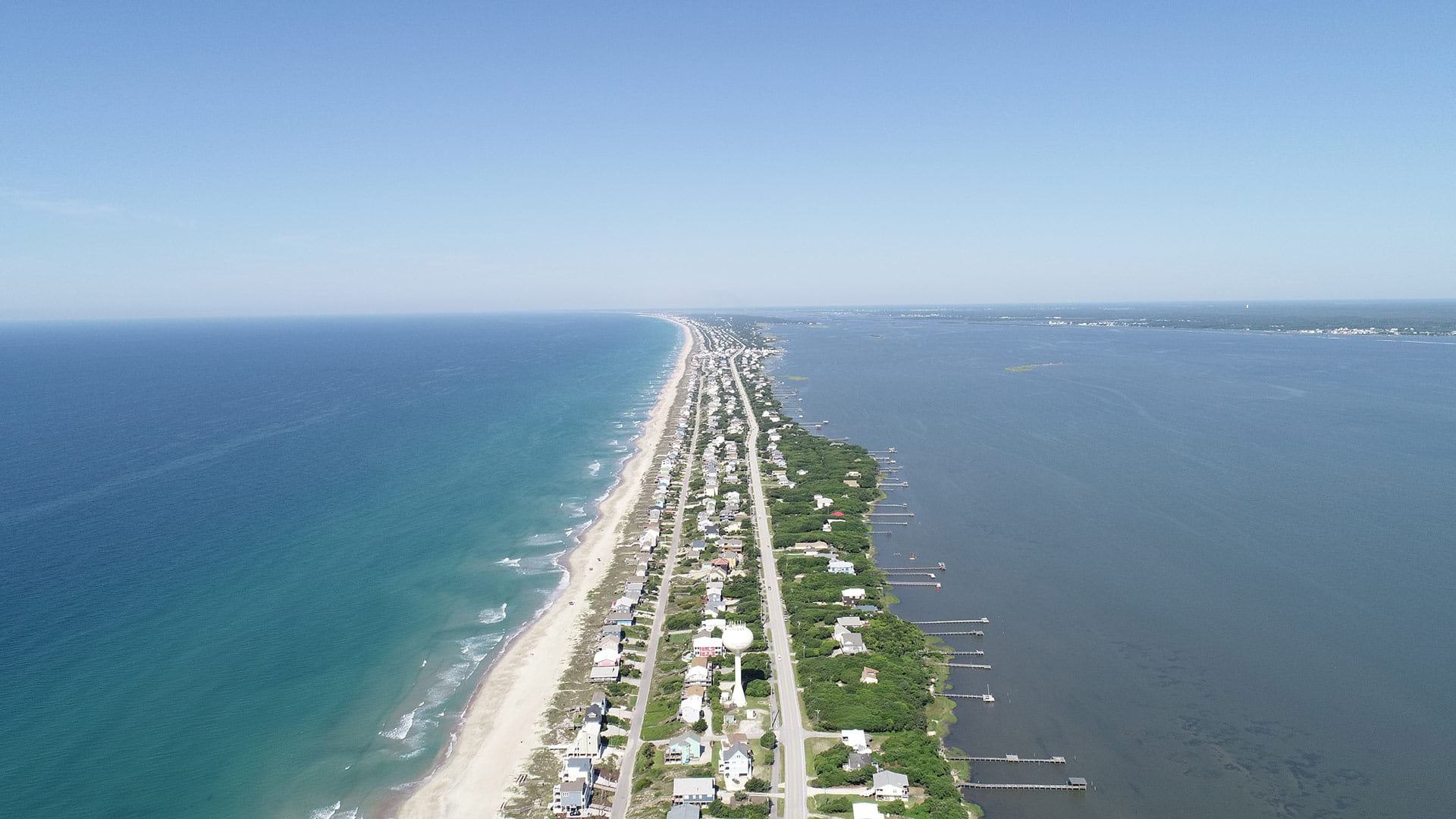
Residents of Emerald Isle, North Carolina, use a GIS web app to find out when trucks collecting yard debris are in their neighborhood.
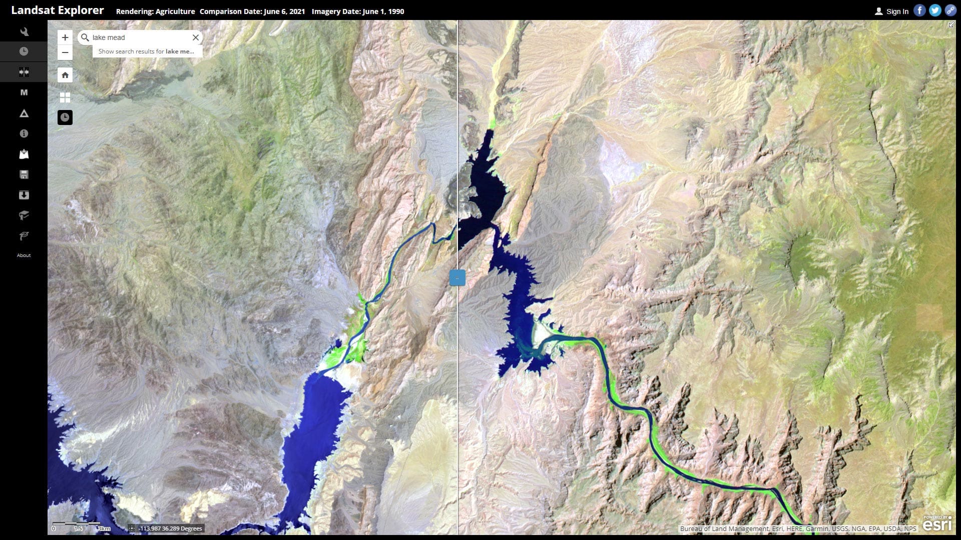
Learn how to explore Lake Mead water levels over time using ArcGIS Living Atlas of the World content and Landsat Explorer.

Explorers and leaders met online with Esri president Jack Dangermond to talk about how they are advocating for and creating a sustainable future.

Nespresso, the Louisville/Jefferson County Information Consortium, and the University of Michigan won the top awards at the 2021 Esri UC.
Staff at Telluride Ski & Golf explain how they use a cloud-based geospatial infrastructure or digital twin to manage operations.
Stephen Bourne from Atkins talks about using city simulators to understand climate change impacts.
Esri Consumer Spending Data helps you understand consumer spending trends and measure local demand for goods and services.
Learn about the history of GIS mobile apps, the popular uses for them, and what might be coming next.
Find out how to create easy-to-understand pictograms of skiers, snowboarders, snowmobiles, and tractors for a ski resort.
Offerings of the two-day course, Preparing Data for GIS Applications, will be held online throughout 2021.
Sign up for Spatial Data Science: The New Frontier in Analytics, a massive open online course (MOOC) starting October 27, 2021.