Throughout the American countryside there are hundreds of mines bisecting the earth beneath the feet of the average citizen. The mines are a relic of a past life. They run beneath towns, houses, schools, and everyday communities. Currently there are operations designed to seal old mine shafts for the safety of communities and the environment. To better understand where these mineshafts are and what they look like ArcGIS Earth can be used to visualize and conduct underground analysis of these subterranean networks.
Explosive Research
The town of Bruceton is a sleepy suburb to the south of downtown Pittsburgh. In Bruceton, is a research mine formerly utilized by the US Bureau of Mines to determine if coal dust was able to explode even in the absence of methane gas. To the surprise of many in the mining industry it became clear no gas was needed for coal dust to explode. This finding would go on to save thousands of lives in the mining industry.
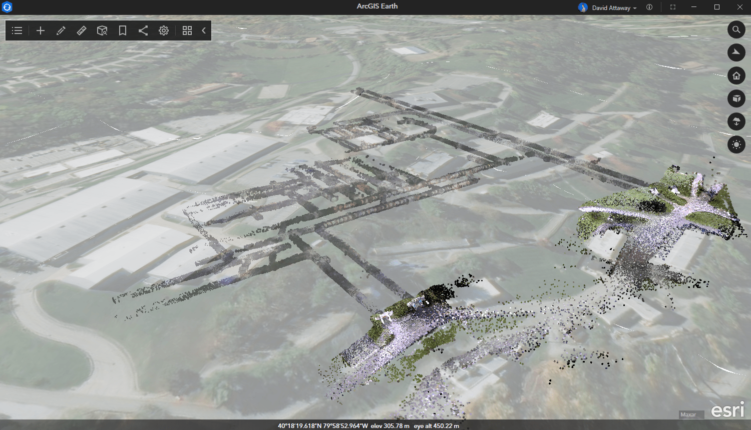
The mine now belongs to multiple federal agencies including the Federal Energy Technology Center, the National Institute of Occupational Safety and Health, and the Mine Safety & Health Administration. Using LIDAR technology, a rendering of the mine can be captured and visualized in ArcGIS Earth.
Subterranean GIS
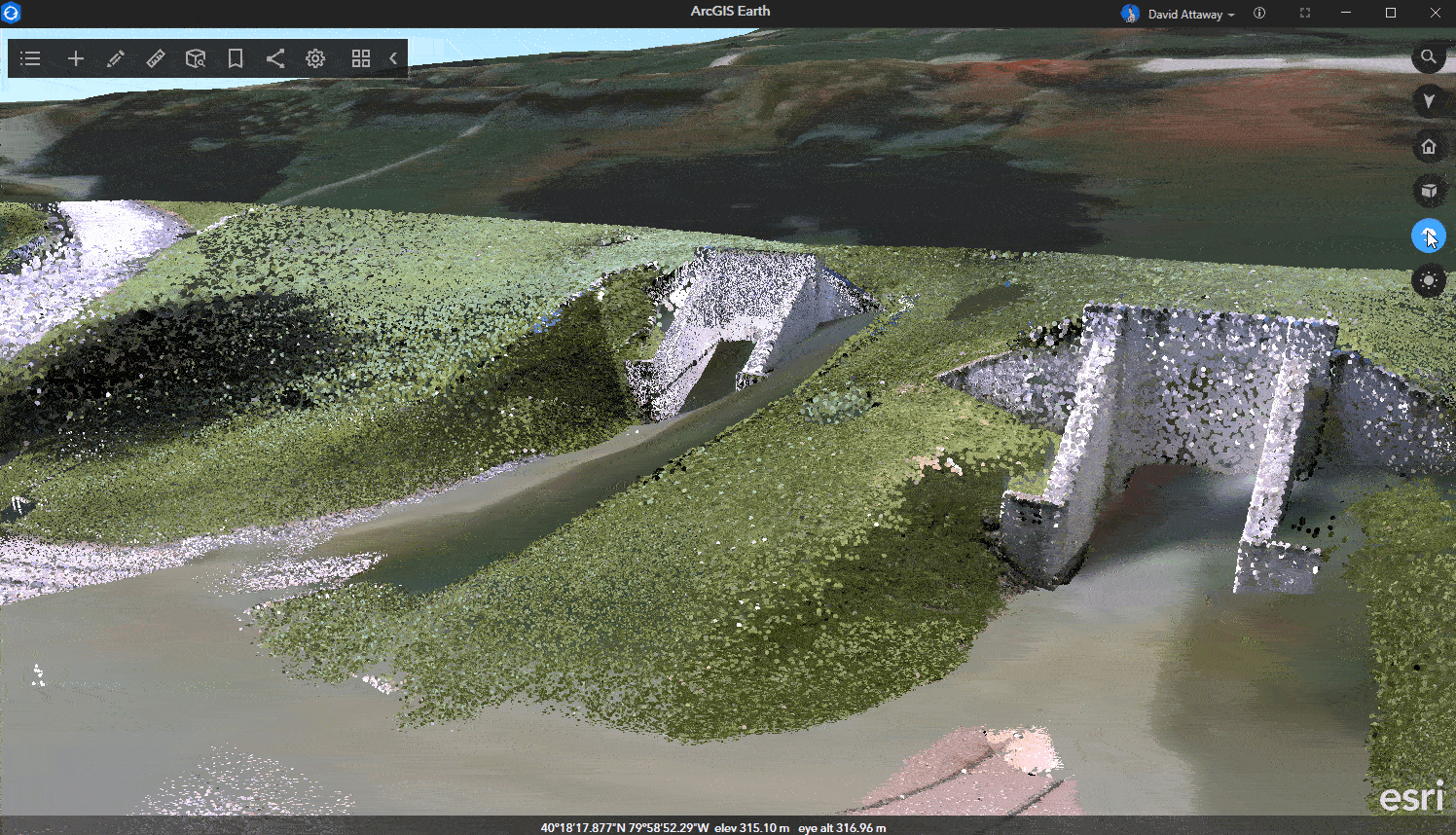
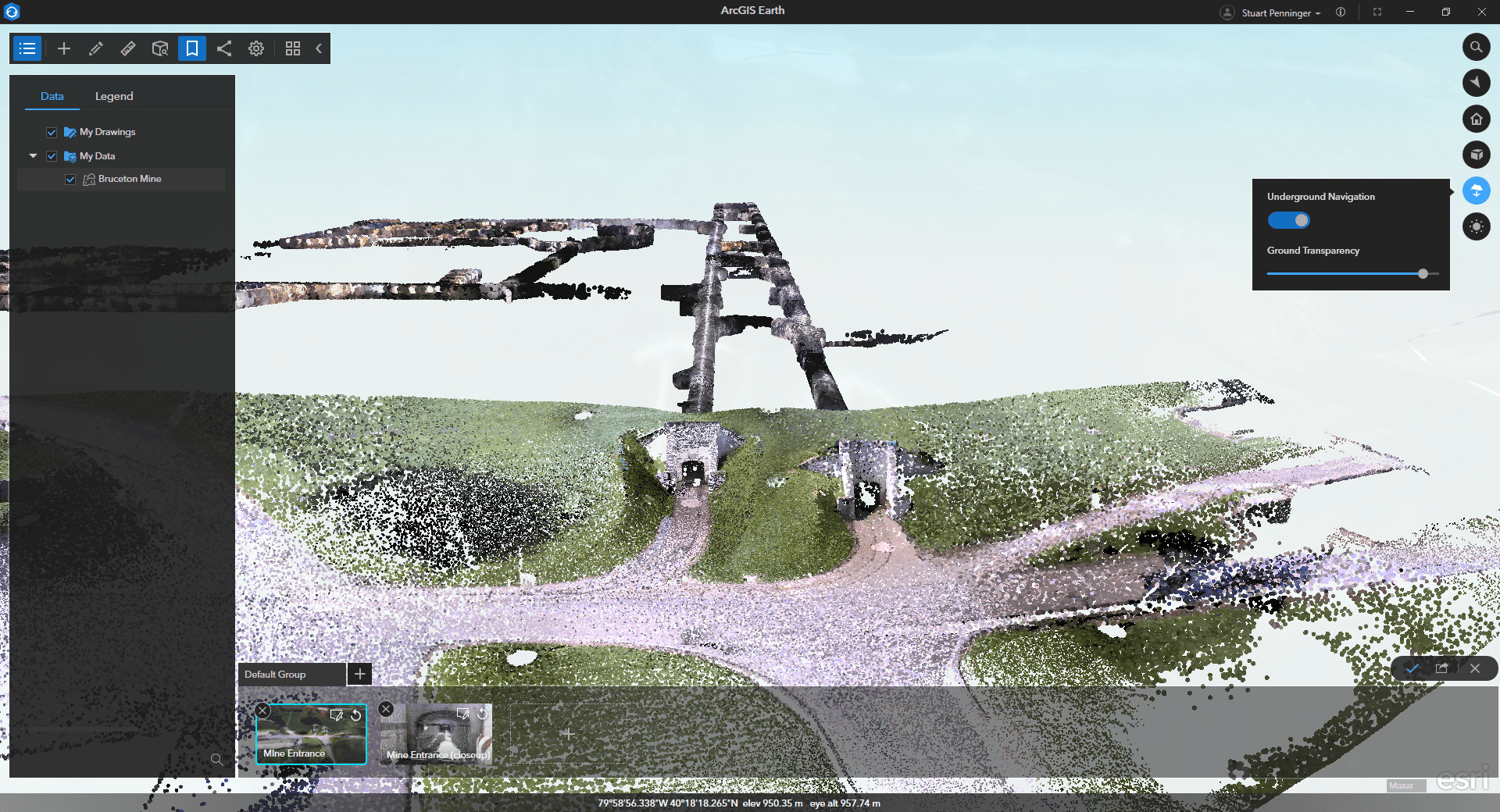
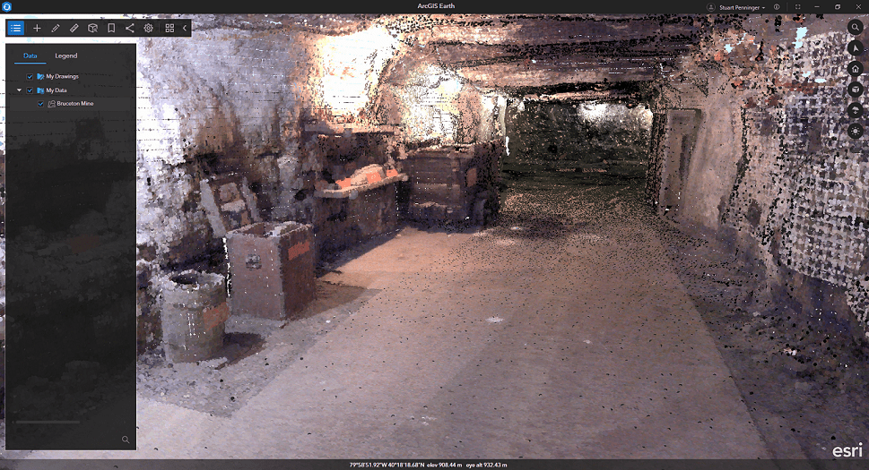
Using underground navigation mode, the entire mine network is shown as it spiders beneath the hillside near Bruceton. From ground level, the mine entrance stands out, but the introduction of underground navigation assists inspection of the rest of the mine. Thanks to ArcGIS Earth the 3D world is not confined to what can be found on the Earth’s surface but what lurks below is illuminated. The LIDAR point cloud comprising this scene layer package is precise enough to identify old workbenches and workstations within the mine complex.
ArcGIS Earth does not stop at visualization. To understand the mine complex, we must place ourselves in the shoes of a miner walking though the mine to see what they would see. Thanks to the Interactive analysis tools available including the line of sight tool we can visualize exactly what a miner would see as they go through their daily routine in the mine.

Underground visualization and analysis in ArcGIS Earth allow users to take another step in understanding the Earth. We are not limited to what we can see on the surface. We can take a step into speleology to understand the subterranean complexes made by man and even those carved out by natural processes. Underground visualization and analysis are essential for miner safety, spelunker awareness, and EMS personnel in case there is an unfortunate accident. ArcGIS Earth covers the whole gamut.
To learn more about ArcGIS Earth, visit our website. You can also download the newest release of ArcGIS Earth mobile and desktop, and visit the ArcGIS Earth Resources page for free training materials and tutorials.


Article Discussion: