We’re excited to share that ArcGIS Enterprise 10.8.1 is now available to all eligible customers worldwide!
The new release builds on ArcGIS Enterprise 10.8 to provide new possibilities and enhancements throughout the platform. If you attended the virtual Esri User Conference, you saw some of what 10.8.1 offers – now, here’s the full scoop!
Today, we’ll highlight some of the biggest new features, including improvements for content and user administration. In the coming days, the ArcGIS Enterprise team will share deep dives into new features and updates here on the ArcGIS Blog.
For the comprehensive guide to this release, see What’s new in ArcGIS Enterprise 10.8.1 in the product documentation.
Support note: ArcGIS Enterprise 10.8.1 is a long-term support release. For more information on support lifecycles for ArcGIS Enterprise, visit the blog Update to ArcGIS Enterprise Product Lifecycle.
New in the ArcGIS Enterprise portal
One of the first things you’ll notice in ArcGIS Enterprise 10.8.1 is a redesigned user experience in the portal, allowing you to view and update account settings and profile information. This redesigned user profile features an updated GUI and consistent experience with the rest of the platform.
You’ll see these changes throughout the ArcGIS Enterprise portal, when viewing organization settings, viewing a user profile, creating content, sharing and moving items, changing owners, resetting passwords, and bulk assigning groups from the Members tab.

Set default licenses and groups for new members
In previous versions of ArcGIS Enterprise, you could set the default user type and role for new members in your ArcGIS Enterprise portal.
In 10.8.1, you can also set the default add-on license assignment and group member defaults for new members. The defaults are automatically assigned to all new members with compatible user types.
For example, if your organization is set up to use ArcGIS Mission, you don’t have to assign the license to your new members individually – it’s now set for you and your members by default!

New privilege for version management
At 10.8.1, a new Version Management privilege can be added to custom roles.
Portal members assigned a role with this new privilege can manage branch version locks and view, alter, and delete branch-versioned data in ArcGIS Server feature services. When enabled, users are also granted the privileges to edit and edit with full control.
This new feature allows you to designate members who aren’t portal administrators as “version administrators,” who can make corrections in a version when completing quality assurance reviews.
Content and service management
Synchronize bulk published layers with a data source
Since bulk publishing was introduced in 10.7, you could publish ArcGIS Server map image layers and feature layers in bulk from a database data store item. If you made updates to the web layer schema or item details, you would have to overwrite the service.
Starting at 10.8.1, if you have bulk published layers, you can synchronize metadata and schema updates. Synchronization adds or removes layer items based on your access to the data in the database; it does not update the names when those changes are in the source feature class or table.
Important note for our friends using offline workflows: synchronizing bulk published layers with the data source has the potential to change the schema of the layer or even delete the layer. If the feature layer is deleted, offline edits cannot be synchronized and will be lost. So be sure to make sure all edits are pushed before syncing edits!
Migration tools
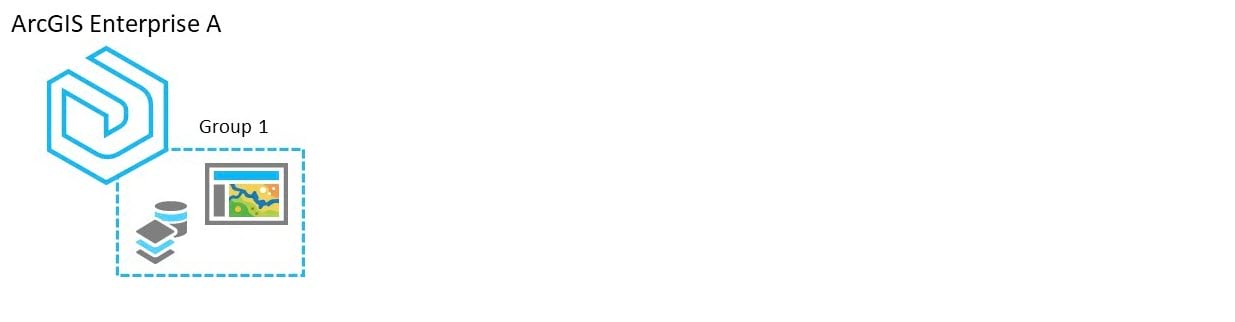
Get excited, starting at 10.8.1 you now have the ability to migrate content from groups . . . between different ArcGIS Enterprise portals!
In order to do this, data must be shared to a group; all related data must be shared to the same group as well for this workflow to be successful. For example, you can’t just share your web application, you must share the associated web map and hosted feature layer as well.
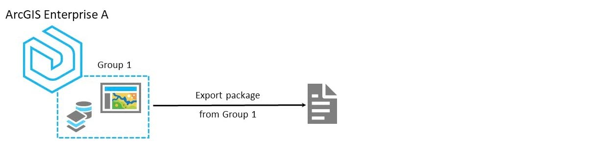
Once you have all the data in the group, you’re set to begin the export process through the portal’s REST API endpoint. Here, you generate an export package from group 1. This export package will consider item dependencies.
This export package is now ready to be imported into the second ArcGIS Enterprise portal; this is also done through the portal’s REST API. The import process will maintain item IDs, item dependencies, and look to update reference URLs to reflect the import environment’s name.
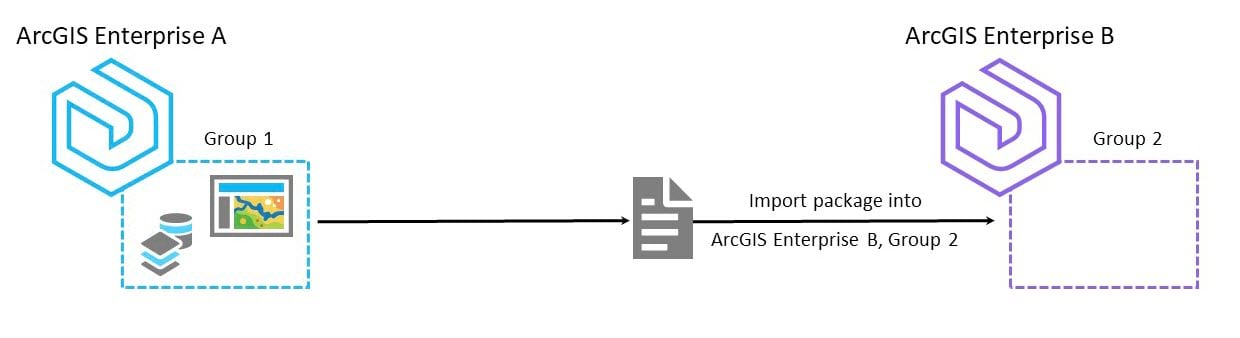
Upon import, new content will be created in the designated group in the new ArcGIS Enterprise portal. If the items already exist, you’ll be given the option to overwrite the current items.
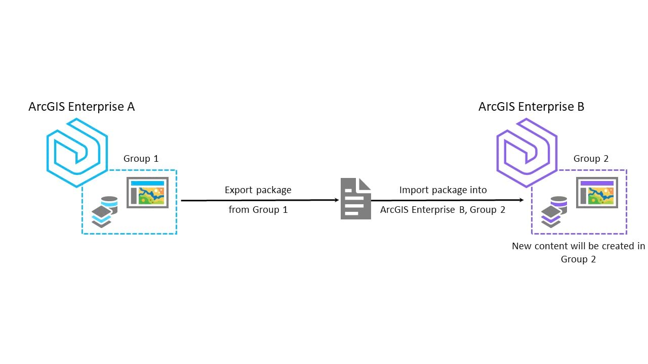
This new feature is great if you’re moving content from development to staging to production environments. You can even use it to move content between two disconnected environments.
Stay tuned for a blog covering more on migration tools!
New in ArcGIS Enterprise SDK
The 10.8.1 release brings lots of new features to ArcGIS Enterprise SDK!
Services with SOEs and SOIs can now use shared instances. This can be found in the new SupportsSharedInstances property on the web service.
Other new capabilities include image service and utility network service support. SOIs can now be developed for image services. Utility network services can use SOEs and SOIs to work with the utility network dataset.
Lastly, there is also Maven integration for Java SOE and SOI development. This feature integrates the SDK dependencies and packaging tools into multiple Maven artifacts, which provides the ability to build SOE and SOI projects under the Maven framework.
For more on what’s new in ArcGIS Enterprise SDK, check out the What’s New in 10.8.1 section of the ArcGIS Enterprise SDK documentation.
New in maps and apps
Map Viewer Beta
The next generation of Map Viewer has made big waves at conferences this year. Its beta version, which has been available in ArcGIS Online for the past nine months, is available with ArcGIS Enterprise 10.8.1 as an optional app.
Portal administrators can install and configure Map Viewer Beta for their portal members to try out. While you should keep in mind that it is still in beta stage and is not considered a finished product, we encourage you to dive in and explore the experience.

Besides the redesigned interface, the next-gen Map Viewer offers plenty of new features:
- Symbols, pop-ups, and filters will update instantly when you modify them in your web map.
- Use multiple content elements to build rich, engaging pop-ups, and can even configure multiple pages to a pop-up for clarity – perhaps put rich text on the first page with an image on the second.
- Print map layouts from the Map Viewer with more flexibility, including scale and DPI options.
- Make the most of Smart Mapping with new options such as the Dot Density style.
Check out Katy and Hilary’s blog for complete instructions to get Map Viewer Beta running in your portal! And – of course – please give us your feedback on GeoNet.
3D updates
10.8.1 brings improvements and new capabilities for your 3D data.
When publishing a building scene, the associated feature layer is also included so that you can edit and update the building scene layer itself.
There are also two new ways to update the contents of a hosted scene layer.
If you published the scene layer from a scene layer package, you can replace the layer’s contents using a second scene layer. This work maintains the original scene layer’s item ID, meaning the scene layer will remain accessible from existing scenes and apps.
If you published the scene layer from ArcGIS Pro and you edit the attributes of the associated feature layer, you can rebuild the scene layer cache to include only attribute updates.
Updating only attributes takes less time than rebuilding the entire cache.
Take a look at Matt’s blog on what’s new in 10.8.1 for Scene Viewer to learn more!
ArcGIS StoryMaps
Over the last year, you’ve seen the stunning work that’s possible with the redesigned ArcGIS StoryMaps platform. Rather than providing multiple apps for different story map styles, there’s a single StoryMaps Builder that’s flexible, powerful, and intuitive.
At 10.8.1, the new builder comes built-in to ArcGIS Enterprise! You’ll be able to access it from the portal app launcher.

For the full scoop on using StoryMaps in ArcGIS Enterprise 10.8.1, check out Michelle’s blog!
And to get ideas, tips, and inspiration for your next story map, take a look around the array of ArcGIS Blog posts the StoryMaps team have written.
ArcGIS Experience Builder
ArcGIS Experience Builder comes with ArcGIS Enterprise 10.8.1. This application allows you to create unique web experiences using flexible layouts, content, and widgets that interact with 2D and 3D data.
Start with templates to create mobile-adaptive apps, modify template layouts for a custom design on different screen sizes (whether that be your computer, your smartphone, or tablet!), or build apps from scratch for more creative freedom.
For more information on the ArcGIS Experience Builder, take a look at Bern Szukalski’s blog ArcGIS Experience Builder overview and concepts.
New in ArcGIS Enterprise administration
Next, we’d like to highlight two introductions that make life easier for GIS administrators.
At 10.8.1, you can now configure automated emails to be sent from your portal. When you set up Email Settings in the ArcGIS Portal Administrative API, the portal will be able to send emails in the following situations:
- Members in your Administrative Contacts list will receive automated reminder emails when your ArcGIS Enterprise licenses (for user types, add-ons, and organization capabilities) are 90 days or less from expiring.
- When a member forgets their password, they can request a Reset Password email be automatically sent to them.
On the ArcGIS Server side, license expiration notices will now appear in ArcGIS Server Manager when any of your server role or server add-on licenses are 30 days from expiring or have expired in the last 30 days.

New in server roles
ArcGIS Notebook Server
10.8.1 brings a major advancement for ArcGIS Notebooks, the integrated platform for Python-based data science and administration, with the introduction of notebook scheduling.
At 10.8, we introduced an administrative API operation, “executeNotebook,” which triggers ArcGIS Notebook Server to run a notebook remotely. Now, you can schedule automated notebook execution from within the notebook editor in your ArcGIS Enterprise portal.
To set up a schedule for your notebook, you’ll open the Tasks pane. Each task you create for the notebook is a schedule to automate the notebook’s execution, either once or on a recurring basis. You can optionally include additional parameters to be added when the notebook runs, and whether you want the results of the remote run to be saved.
Notebook scheduling opens up big possibilities! Perhaps you’re responsible for recurring data workflows such as wrangling, cleaning, or analysis. Maybe you want to have a big job run overnight. Or you want to regularly check your portal’s items for the quality of their metadata.
All of that and much more can be easily automated now – right from the notebook editor.
ArcGIS GeoEvent Server
ArcGIS GeoEvent Server now includes a new monitoring page, the ability filter by component state, new notification styles, and enhancements input and output creation workflows.
There are also geofence insight improvements: using the same integrated light-weight mapping client as the GeoEvent Sampler, users can now verify the geometry of their imported geofence against their choice of basemaps. Here’s more on what’s new in GeoEvent Server.
ArcGIS Image Server
At 10.8.1, ArcGIS Image Server includes improvements for imagery content, Ortho Maker, raster functions, and new tools in the map viewer. For the whole story, see what’s new in ArcGIS Image Server.
ArcGIS GeoAnalytics Server
The 10.8.1 release of ArcGIS GeoAnalytics Server now includes Geographically Weighted Regression, which has been added to the Analyze Patterns toolset. This tool uses a local form of linear regression that is used to model spatially varying relationships.
Enhancements to have also been made to the Reconstruct Tracks and Find Dwell Locations tools to support determining the first and last value in a track.
For a full list of what’s new, check out what’s new in ArcGIS GeoAnalytics Server.
Learn more
For the comprehensive guide to this release, see What’s new in ArcGIS Enterprise 10.8.1 in the product documentation.
Ready to get started? Head over to the My Esri website for your licenses and software. Enjoy!

Hi there – Very excited with the release of 10.8.1. In terms of the new Migration Tools available, I am happy to see improvements. A point of clarification, that the migrating content from Groups is only possible between Enterprise Portals and NOT from Online to Portal? Exciting article! Thank you.
Hi Anna! Thanks for the comment and glad you are looking forward to the new content migration functionality. You are correct that this is just between Enterprise and Enterprise at this time.
You can use distributed collaboration to share data between Enterprise and Online, but the use cases are a bit different (keeping layers and maps in sync between the two, rather than moving content from one to the other).
https://doc.arcgis.com/en/arcgis-online/administer/about-distributed-collaboration.htm