ArcGIS Living Atlas of the World provides foundation elevation layers and tools to support analysis and visualization across the ArcGIS system. These layers get updated quarterly with high resolution elevation data from federal agencies, open sources, and community maps program. Esri is providing these datasets as ready to use services that benefit the GIS community and extend the use of data in new and innovative ways. In this release, world elevation layers are updated with many high-resolution elevation datasets.
Terrain and TopoBathy layers are updated with:
- Institut national de l’information géographique et forestières (IGN-F) LiDAR derived 1 meter DTM’s covering the country of France.
- LiDAR derived 0.3 meter (1-foot) DTM’s covering Lancaster County of Nebraska, USA.
- INGV’s 10 meters DTM covering the country of Italy.
- Land Information New Zealand’s LiDAR derived 1 meter DTM’s covering partial areas of New Zealand. In this release, ~44,570 sq kms (~ 17208 sq miles) of new data has been added bringing total coverage to ~144,870 sq kms (~ 17208 sq miles) (see map below).

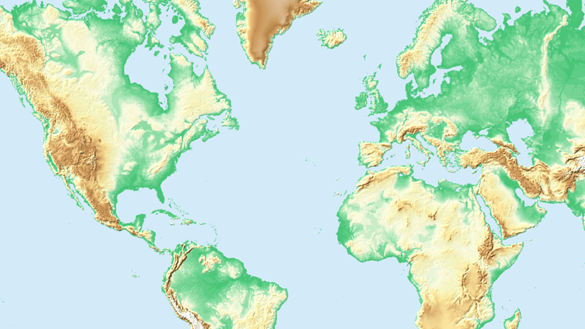
- USGS’s 3DEP 1 meter lidar derived DTM’s covering areas of the conterminous United States and Island of Hawaii. In this release, approximately 307,860 sq kms (~ 118,865 sq miles) of new coverage has been added. The graphic below shows the new addition (magenta) along with previously available coverage (green).

TopoBathy layer is updated with:
- Swisstopo’s 1-3 meters swissBATHY3D bathymetric datasets covering lake beds of Switzerland
- General Bathymetric Chart of the Oceans (GEBCO_2023) 15 arc second (approx. 464 meters) dataset covering entire globe. [GEBCO Compilation Group (2023) GEBCO 2023 Grid (doi:10.5285/f98b053b-0cbc-6c23-e053-6c86abc0af7b)]
New Raster Function:
Terrain and TopoBathy layers now have a new raster function ‘Elevation_Feet’ to dynamically provide heights/depths in feet. The function can be invoked from processing templates in ArcGIS Pro and ArcGIS Online Map Viewer. Pop-ups on elevation layers have been updated to provide heights in both meters and feet and can be used in webmaps and web apps.

Ready-To-Use Elevation Tools:
Ready-To-Use Elevation Tools (Profile, Viewshed and Summarize Elevation) are updated with the 10 meters DTM’s of Italy. Profile tool has been updated with GEBCO 2023 grid for 500 m (15 arc second) DEM Resolution option.
Let’s see a few examples highlighting the improvements.
Lyon, France – hilly urban areas depicted with lidar derived 1-meter DTM’s in comparison to 24 meters WorldDEM4Ortho

Saint-Laurent-du-Var, France – a suburb of the city of Nice depicted with lidar derived 1-meter DTM’s in comparison to 24 meters WorldDEM4Ortho

Whangamatā, New Zealand – improvements depicted with lidar derived 1-meter DTM’s in comparison to 24 meters WorldDEM4Ortho

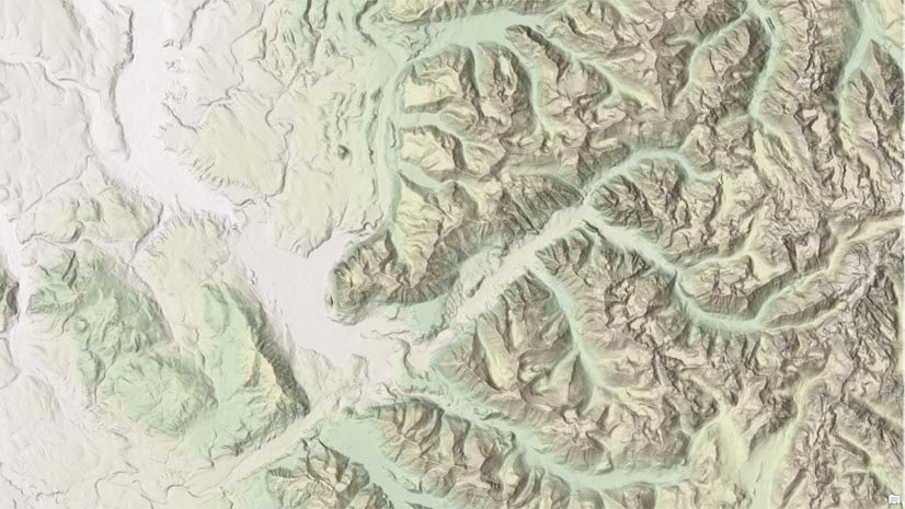
Colorado Springs, USA – urban areas depicted with lidar derived USGS 3DEP 1-meter DTM’s in comparison to USGS 10 meters

These data updates will be rolled out to the world elevation tiled services – Elevation 3D (Terrain3D and TopoBathy3D) and Hillshade (World Hillshade and World Hillshade (Dark) ) in early 2024.
To see the coverage extents of each source comprising World Elevation services, check out the Elevation coverage map.
You can help in improving these services by contributing high-resolution elevation data to Living Atlas of the World. To participate and learn more, check out the Esri Community Maps for Elevation program.


Article Discussion: