Annual 10-meter global coverage from 2017-2023.
Through our continued partnership with Impact Observatory, the annual Sentinel-2 10m Land Use/Land Cover Time Series has been updated with new data from 2023, expanding the time series to include global coverage from 2017-2023.
Land use/land cover (LULC) maps are a valuable tool for decision-makers at local, regional, and national levels around the world. Performing change analysis on a series of LULC maps over time can help to quantify and better understand the impacts of earth processes and human activity on our environment. This in turn informs policy and land management decisions, helping to support a sustainable future.
The easier we can make it for everyone to understand the value of these maps, and the easier we can make it to extract useful insights, the greater our reach will be and the greater our chances of having a positive and meaningful impact. This is why, last year, we released the Sentinel-2 Land Cover Explorer. Simple, Accessible, and Insightful, this app is part of our growing family of imagery explorer web apps designed to engage a broad community for Earth exploration and discovery.
Along with the 2023 content update, we also added a few enhancements to the app. See below for more details.
What’s new with Sentinel-2 Land Cover Explorer?
Well, we swizzled some things around to improve the interface and make for a smoother and more consistent user experience. We also add a few new features.
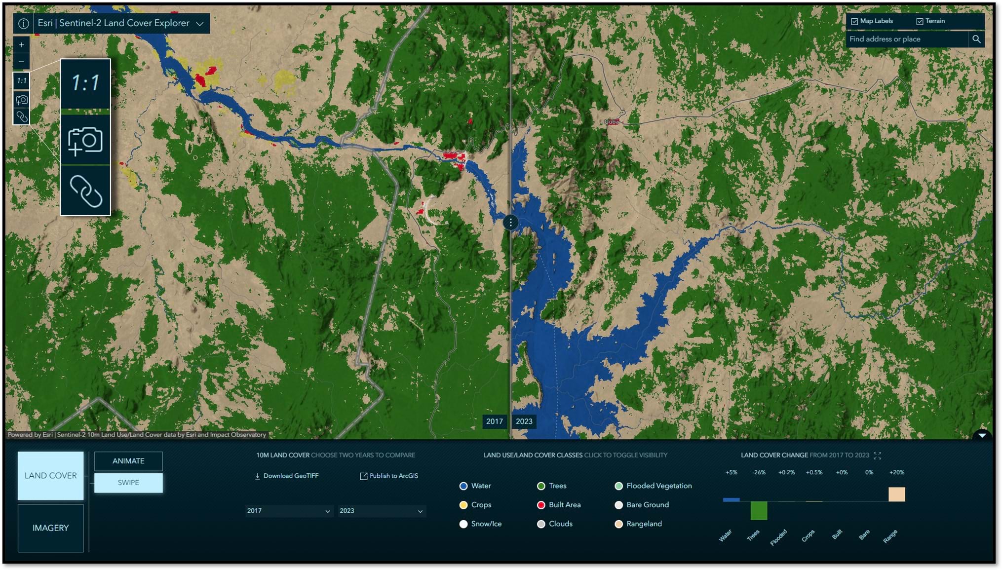
We added some new controls in the map panel:
- Click the 1:1 button to zoom the full resolution of the map at your location of interest.
- Click the camera button to quickly create a high resolution screen capture.
- Click the link button to copy a link the app in the current state to easily share with others what you are seeing.
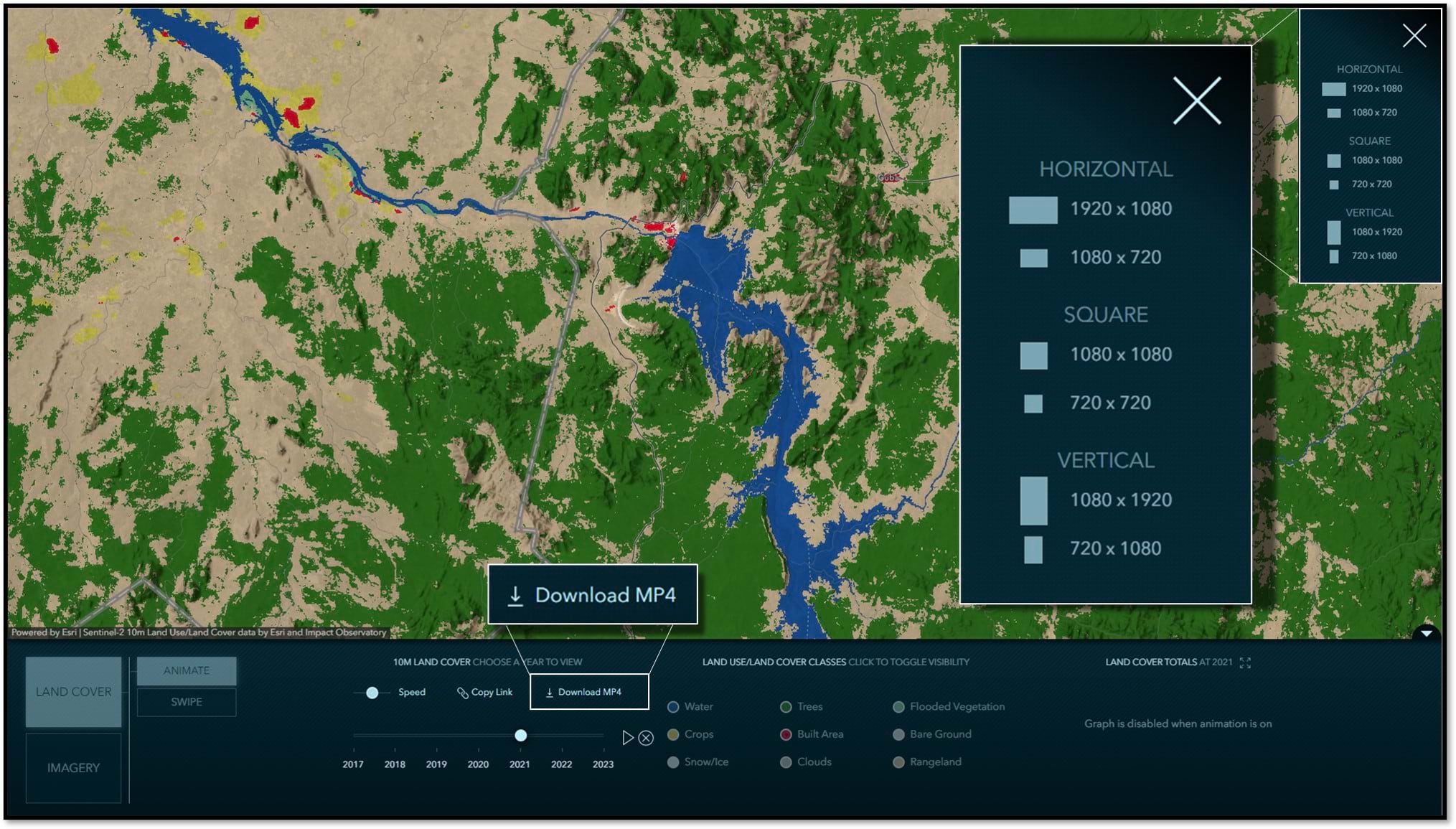
In animation mode, we added the ability to download MP4 videos. You can choose from a variety of aspect ratios and resolutions depending on where and how you want to share your animations. Click the image to jump in and try it.
That’s about it for updates. For a rundown of the other tools and capabilities in Sentinel-2 Land Cover Explorer, please refer to the Global Land Cover Revealed blog article.
The source code for Sentinel-2 Land Cover Explorer, and other imagery explorer apps, and be found on GitHub.
Many thanks to the team making it happen!
App development: Jinnan Zhang
App UX/UI and cartographic map designs: John Nelson
LULC archive and image service development: James Sill and Vijay Pawar
DevOps: Sreekumar Sreenath

Article Discussion: