ArcGIS Living Atlas of the World provides foundation elevation layers and tools to support analysis and visualization across the ArcGIS system. These layers get updated quarterly with high resolution elevation data from open sources and the community maps program. In this release, world elevation layers and tools are updated with a few high-resolution elevation datasets.
Terrain and TopoBathy
These layers are updated with the following datasets:
- Latvian 1, 10, and 20 meters lidar derived DTM’s covering the whole country of Latvia (Credit: LGIA)
- Lithuanian 1 and 10 meters lidar derived DTM’s covering the whole country of Lithuania (Credit: NZT)
- Slovak Republic’s 10 meters DTM’s covering the whole country of Slovakia (Credit: GKÚ)
- Salzburg’s 1 meter lidar derived DTM’s covering Salzburg state of Austria (Credit: Land Salzburg)
With these updates, Latvia and Lithuania now have 24 times more detail. Here are a few examples highlighting the improvements with before and after images.
Daugavpils Fortress, Latvia – fine details of an early 19th century fortress depicted with lidar derived 1-meter data in comparison to 24 meters WorldDEM4Ortho
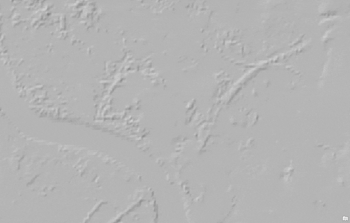
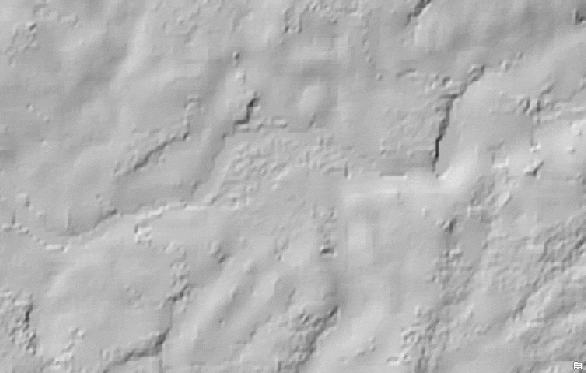
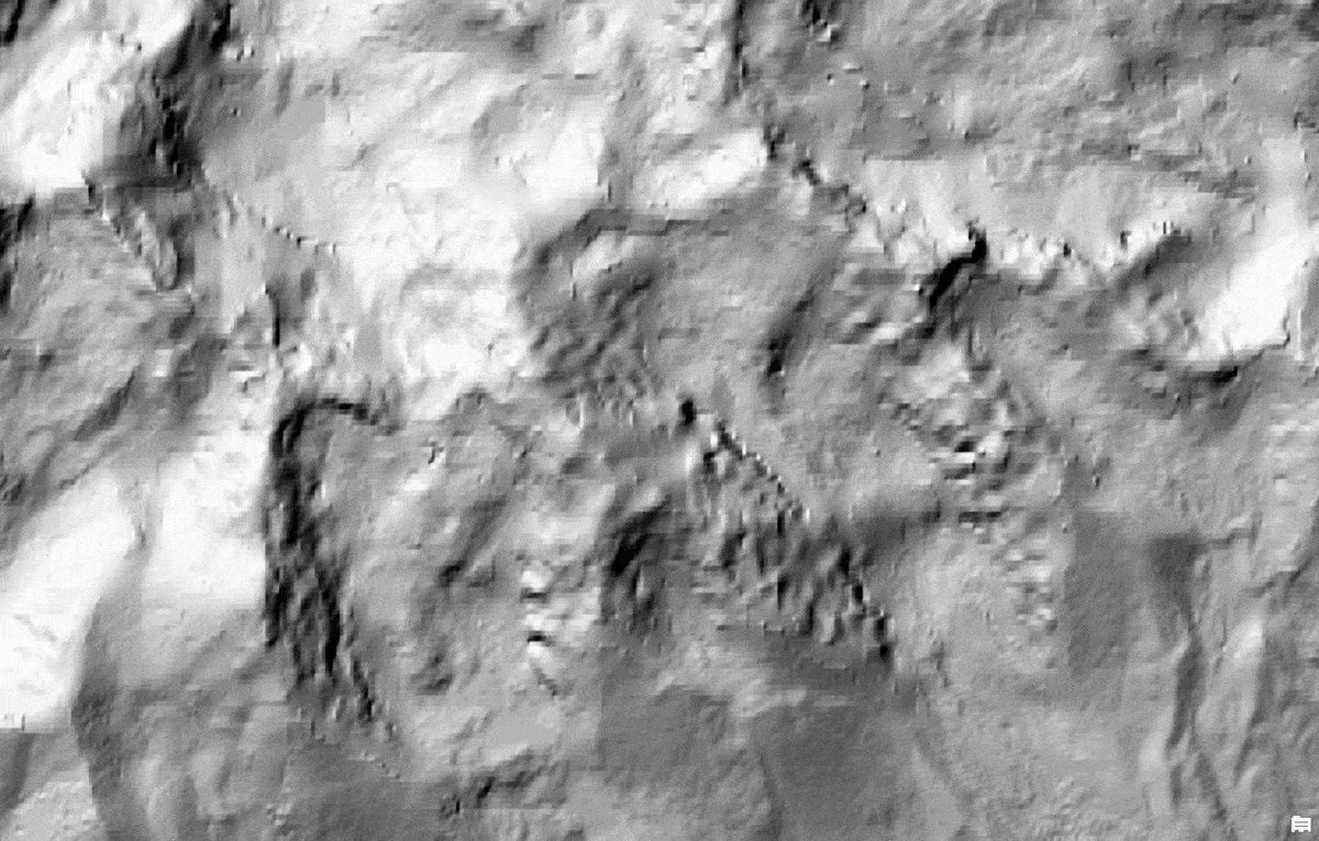
The Gauja Valley, Latvia – Gauja river and valley depicted with lidar derived 1-meter data in comparison to 24 meters WorldDEM4Ortho
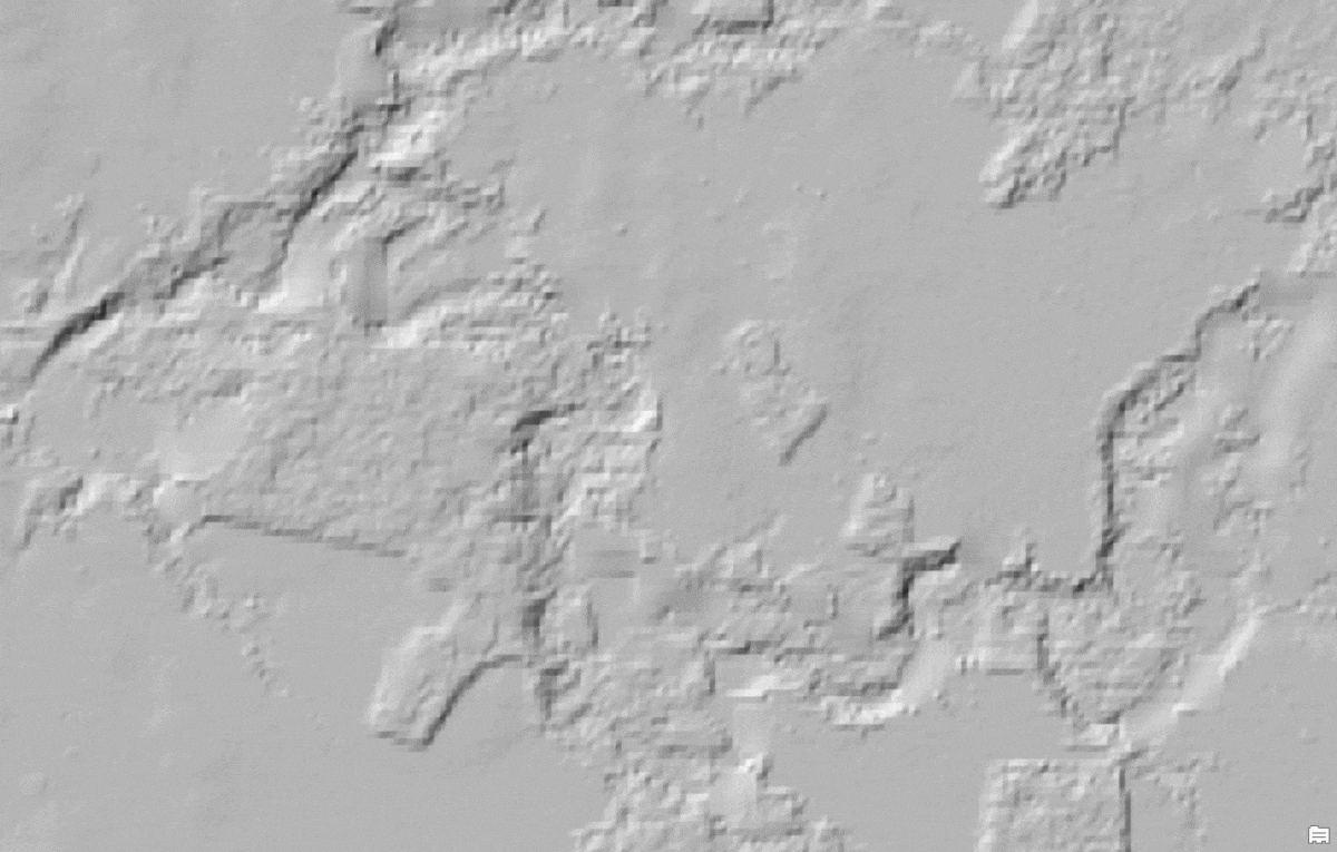
Minija River, Lithuania – the largest river in western Samogitia depicted with lidar derived 1-meter data in comparison to 24 meters WorldDEM4Ortho
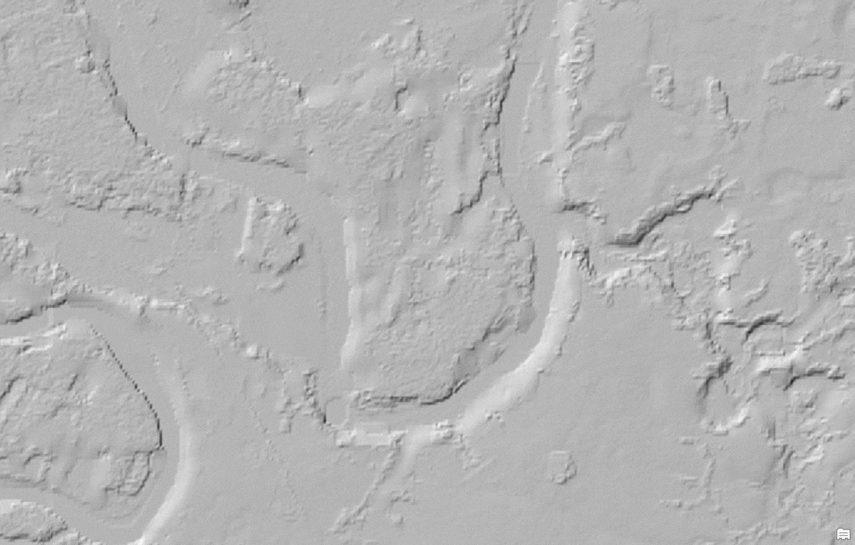
Nemunas Loops Regional Park, Lithuania – fine details depicted with lidar derived 1-meter data in comparison to 24 meters WorldDEM4Ortho
Gerlachovský štít, Slovakia – the highest peak (2655 meters) in the High Tatras, in Slovakia depicted with 10 meters data in comparison to 24 meters WorldDEM4Ortho
Elevation Analysis Tools
In this release, elevation analysis tools (Profile, Viewshed and Summarize Elevation) are also updated with 10 meters data for Latvia, Lithuania, and Slovakia. When these ‘Ready To Use’ tools are run using desktop clients (ArcGIS Pro, ArcMap) on the above geographies, and ‘DEM resolution’ is selected as ‘10m’ or ‘Finest’, the analysis will be performed using 10 meters data.
Elevation Profile generated across Gauja River, Latvia using LGIA’s 10 meters elevation data
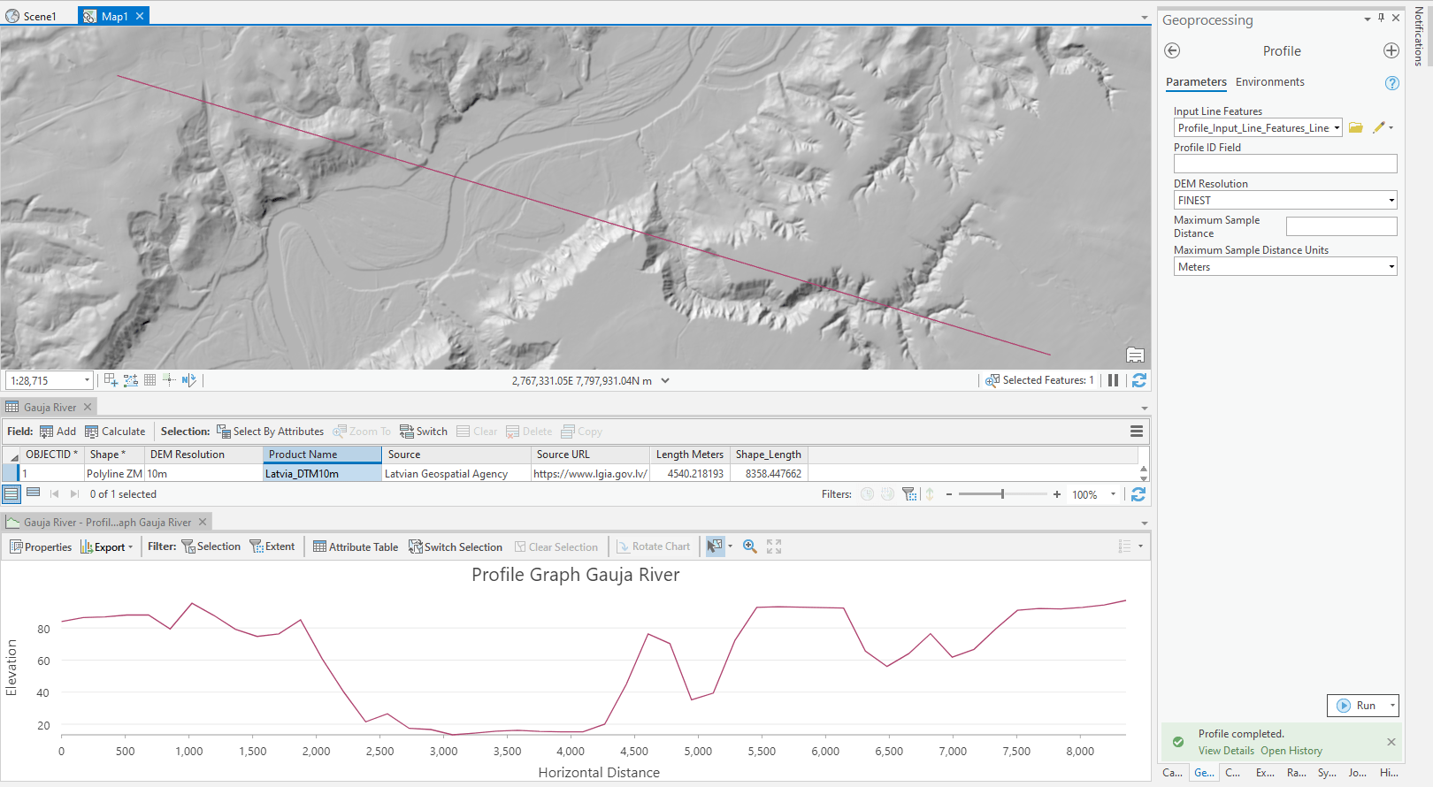
The Profile tool now uses the GEBCO 15 arc second (approx. 500 meters) dataset as default bathymetry instead of the GEBCO 30 arc second (approx. 1000 meters).
These data updates will be rolled out to the world elevation tiled services – Elevation 3D (Terrain3D and TopoBathy3D) and Hillshade (World Hillshade and World Hillshade (Dark) ) by the next quarter.
To see the coverage extents of each source comprising World Elevation services, check out the Elevation coverage map.
You can help in improving these services by contributing high-resolution elevation data to Living Atlas of the World. To participate and learn more, check out the Esri Community Maps for Elevation program.


Article Discussion: