A policy map collection is a great way to create a group of interactive web maps centered on a specific issue. Whether you want to raise awareness on a topic or you simply want to gather information on a community of interest, these map collections offer a unique way to share facts and information on a variety of platforms such as social media, email, and even websites where you can embed the policy map collection’s URL.
Did you know you that you can even modify the URL of your policy map collection? This offers an additional way of changing the way the collection looks before being embedded. In this blog article we’ll walk through some parameters that can be added to your URL that are used to limit the map content visible by your viewers and even remove branding from the layout.
What is Esri Maps for Public Policy?
Esri Maps for Public Policy is a site with a growing collection of interactive maps as well as other content. Here there is instant access to hundreds of maps ranging from topics in social equity, health, economics, sustainability, public safety, environment, transportation, and more. Maybe you’re interested in what housing is like in a community you’re moving into or how eco-friendly an area is. These maps are filled with important facts and information about communities throughout the nation showing where there is an opportunity to intervene.
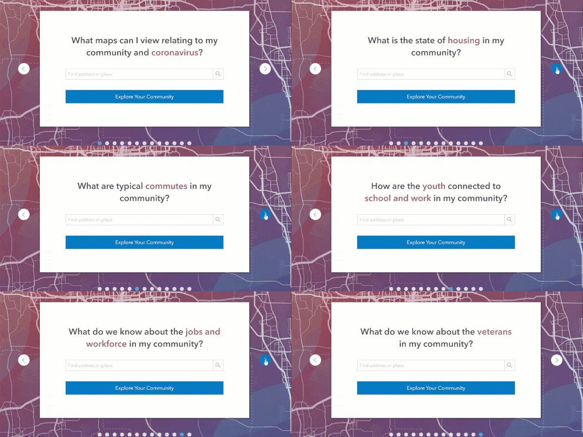
Building Your Collection of Policy Maps
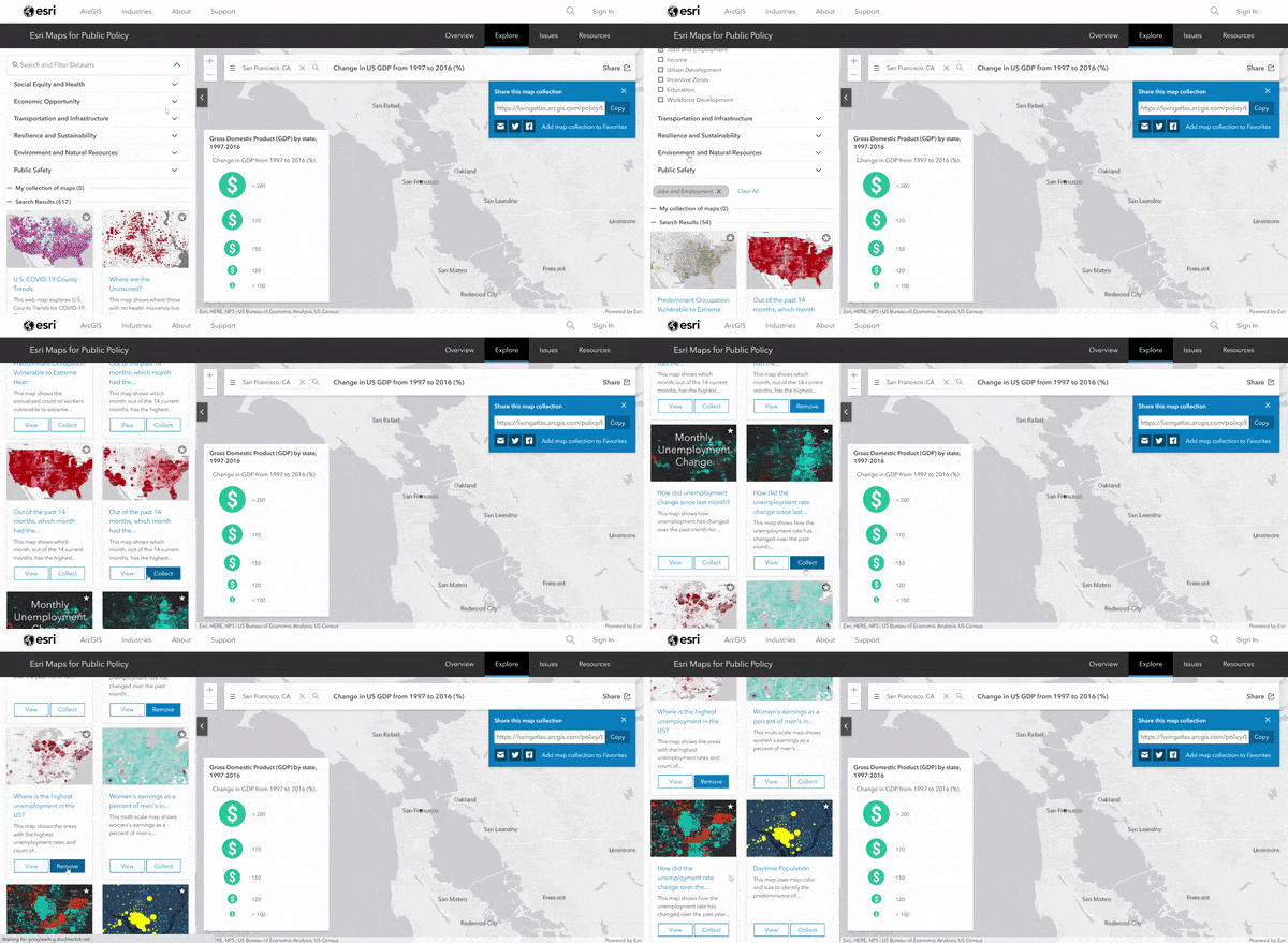
Now that we are familiar with the policy maps collection we can build our own as we navigate to Esri Maps for Public Policy. No ArcGIS Online account is needed to create your own collection!
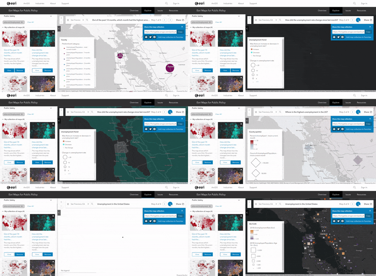
To begin with, we are able to create a collection zoomed into a location of interest. As a reference, I’ve created my own about how unemployment has changed in the area of San Francisco.
Viewers will be able to toggle through the four maps within the established location of San Francisco.
Modifying the URL to Customize Your Collection
Now that we have a collection of policy maps ready, we can embed it into our organization’s public-facing website to share this with our audience. The parameters can then be added to the URL in order to adjust what we want our audience to see.
1. Zooming into your community of interest
When you establish your area of interest in the collection, the location’s coordinates are automatically added to the URL. When embedding, this location can be changed in the loc= parameter by adding in another location in this section.

2. Removing an emblem
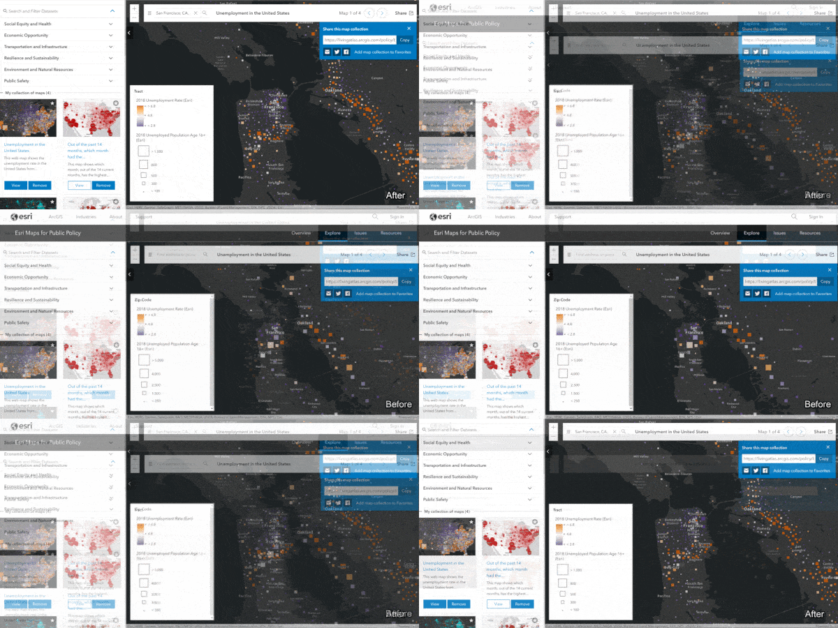
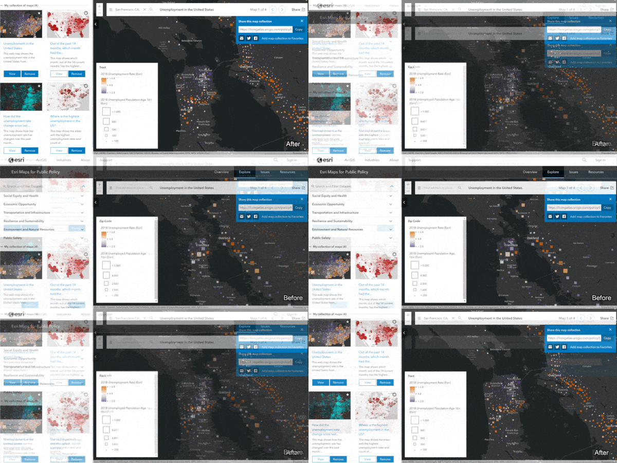
We can begin by adding #embed=true at the end of the URL in order to remove the Esri branding from the layout. This is done in order to have a simplified layout that focuses solely on your maps and allows for users to easily interact and share the maps.

The resulting map collection eliminates the ribbon options along with Esri branding.
3. Disabling a search bar
By default, Esri Maps for Public Policy contains hundreds of maps that could be viewed by your audience. If you want to limit the collection of maps to only show the ones you intend, you can disable the search bar in the window. By adding the parameter disableSearch=true at the end of our collection’s URL the policy map search bar in the left panel will be removed. Therefore, your audience will not be able to navigate and see the map options for other topics in the policy maps site.

The resulting map collection no longer has the topics and search bar in these left panel.
4. Hide the left panel by default
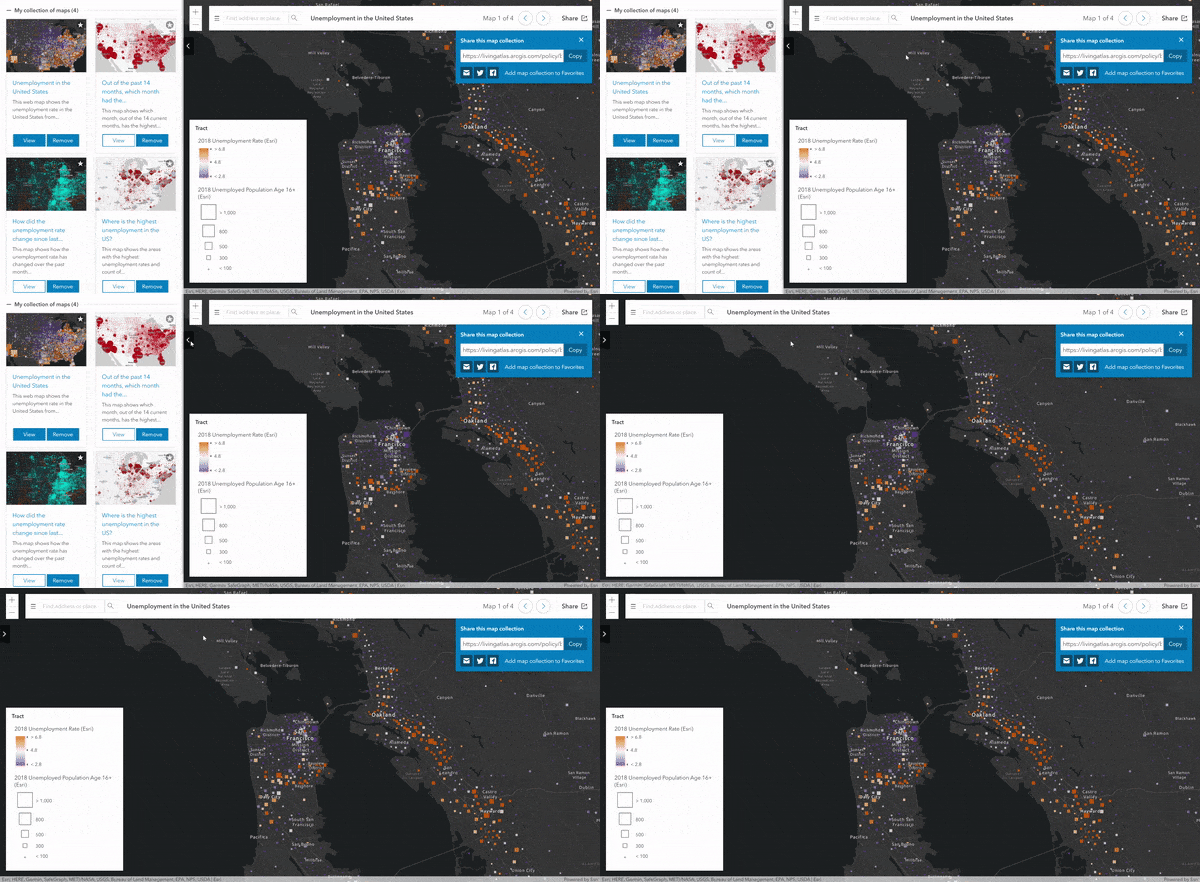
Another option when embedding these map collections is hiding the left panel. This is done before embedding the URL so that when the collection is embedded the panel is hidden and won’t be visible unless it is clicked on. The final view of the policy map collection will have a simplified layout that’s ready for instant sharing!
Summary
Esri Maps for Public Policy has hundreds of maps available with information on a majority of communities nationwide. The importance of these maps is that they can be tailored to your own community of interest and help reveal facts on a topic that is relevant to the location. Embedding and sharing your collection onto websites and other platforms allows for viewers to easily be able to interact with these meaningful maps.
Want to learn more?
- To learn how to use your policy map collection in the ArcGIS Story Maps interface this blog will give some detailed insight.
- More about sharing and exploring topics in your community.

Article Discussion: