The Generate Travel Areas tool in Map Viewer allows you to calculate the area that can be reached within a specified travel time or travel distance along a street network. This is helpful for planning fire station coverage, assessing access to public transportation, and even planning a travel route for your electric vehicle—the focus of this blog post.
Electric vehicles (EVs) have revolutionized the way we commute by offering eco-friendly transportation options. However, planning trips for electric vehicles requires careful consideration of the availability of charging stations and range limitations. This process can be simplified by using the Generate Travel Areas tool now available in Map Viewer. This blog post will explore the value of this tool and demonstrate how it can be used to generate travel areas for your electric vehicle.
The Generate Travel Areas tool serves as a solution for individuals and organizations looking to streamline EV trip planning or to assess the range of your vehicle. The tool enables users to visualize areas within the EV’s range, and it can identify charging stations within those areas. This allows EV owners to confidently plan trips while ensuring they have access to charging stations – preventing them from getting stranded along their route. Let’s take a look at how you can use the generate travel areas tool for this purpose.
Scenario
You are a new EV owner on the island of Newfoundland and you want to know where you can go with your new car to ensure you will have access to charging stations.

Solution
To use the Generate Travel Areas tool, sign into ArcGIS Online with your ArcGIS organizational account and import your data into Map Viewer. For this scenario, I’m importing the Electric Vehicle Charging Stations in Canada layer.

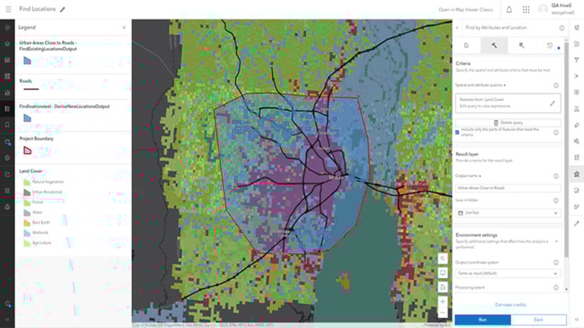
In Map Viewer, on the Settings (light) toolbar, click the Analysis button. Here, you will find many analysis tools that can be used to solve geospatial problems.

Since we are focusing only on the island of Newfoundland, this large dataset must be filtered to include only the charging stations on the island. We can use the Filter button on the Settings toolbar to accomplish this.
We will make a new expression to filter the charging stations to include the ones we are interested in. In this case, we are interested in the stations that are in the Newfoundland + Labrador state, that are publicly accessible, and are in the fast-charging category.

Now that the data is filtered to our specific needs, we can run the generate travel areas tool to show a map of our EV’s range. We want to know where our car can drive on the island to plan our drives properly. We will open the tool and use Electric Vehicle Charging Stations in Canada as the input layer.

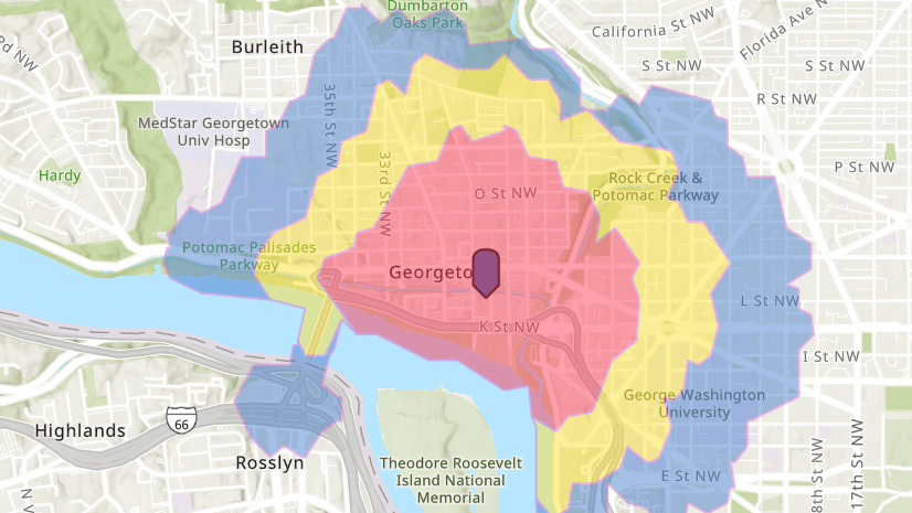
Once you run the tool based on the previously filtered charging stations and range of your EV, it will generate the travel areas on the map. These areas represent the regions where the EV can reach from its starting point (the charging stations) while staying within the range. In our case, the EV has a range of 160 kilometers.

The large purple swathes represent areas that are entirely accessible by your EV with a 160-kilometer range. This is an interesting result because with this range, people on the western side of the island can’t access the eastern side, and vice versa. Now you have created a map of the area in which you might be traveling. You can see where it is possible to go and where it is not – plan accordingly!
Learn more
The Generate Travel Areas tool offers a user-friendly and efficient solution for electric vehicle planning. Through visualization, users can accurately assess their vehicle’s performance and make informed decisions about their journey. Generating travel areas can be useful for many other applications including business service areas, supply chain optimization, and disaster planning. For a step-by-step walk through of how to use the Generate Travel Areas tool, see the Generate travel areas for charging stations tutorial.


Article Discussion: