The Scene Layers Team has been hard at work adding new functionality at the ArcGIS Pro 2.5 release. Let’s check out what’s been added!
I3S Version 1.7
The Scene Layers team continues to support I3S version 1.7 for additional scene layers types. At this release we are now writing out version 1.7 for building and integrated mesh scene layers in addition to 3D Object scene layers at the last release. 1.7 enhancements will lead to scalability and performance improvements in all clients across the ArcGIS Platform.
Integrated Mesh Improvements
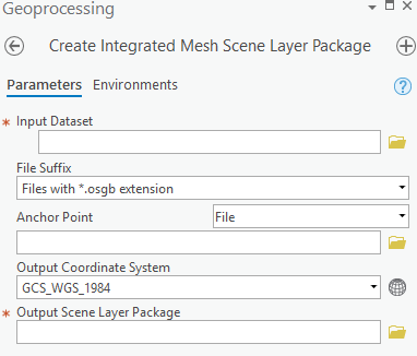
At this release we have added significant improvements to the Create Integrated Mesh Scene Layer Package tool. At a UI level we have added two additional parameters. We have extended the anchor point parameter to allow you to select an anchor point file in addition to a feature layer. The tool will now auto-detect metadata files but as a fallback you can always manually select the file in the tool. Supported files include metadata.xml, world and .3mx files. OSGB data does not include coordinate system information so it is important to utilize the anchor point parameter properly to ensure the model is georeferenced.
A new output coordinate system parameter was added to allow you to select the appropriate coordinate system. This includes support for WGS84, CGCS 2000 geographic coordinate systems as well as any projected and custom coordinate system.

We have also made significant improvements to how we convert OSGB data. The tool now writes out DXT textures into the scene layer package. DXT textures are compressed and lead to better performance in web clients such as the Scene Viewer. Please note this change will lead to larger slpks.
The previous implementation was only able to support OSGB data from Context Capture. We are now able to handle more flavors of OSGB data from a variety of 3rd party software. We have also improved the tool messaging. For example, the tool will report incorrect file references within the OSGB files.
Support for custom coordinate systems
All create scene layer package tools now support custom coordinate systems. In the output coordinate system parameter you can now select a projection file with a custom coordinate system. The well-known text (WKT) will be written to the scene layer package and clients that support custom coordinate systems (Currently only ArcGIS Pro) will be able to consume these scene layers. For a list of the supported linear units see the I3S specfication.
Make Scene Layer Tool enhancements
The Make Scene Layer tool now supports building and point cloud scene layer packages and services. The make scene layer tool can be leveraged for use in python and modelbuilder workflows.
Support for Bathymetric Attributed Grid files as elevation sources
ArcGIS Pro now supports adding Bathymetric Attributed Grid (BAG) files as elevation sources. The BAG format is a non-proprietary gridded, multi-dimensional bathymetric data file developed by the Open Navigation Surface Working Group and commonly used by NOAA for mapping seafloor and river bottoms.
Arcade expression support
Scene Layers now support arcade expressions in symbology and labeling. When the scene layer is consumed in ArcGIS Pro, the expressions can be viewed but not changed as it is cached with the scene layer.
For any questions or issues please post on Geonet or reach our to Technical Support. We’re excited for even more functionality coming at the next release so watch this space!
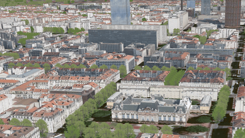
Yosemite Integrated Mesh provided by Vricon


Commenting is not enabled for this article.