What comes to mind when you picture a satellite image?
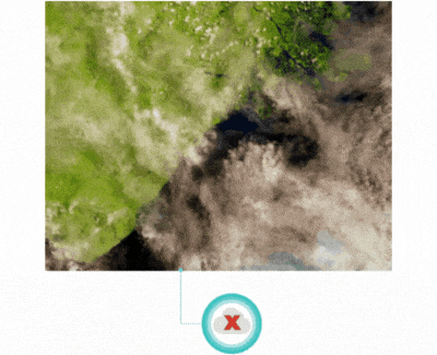
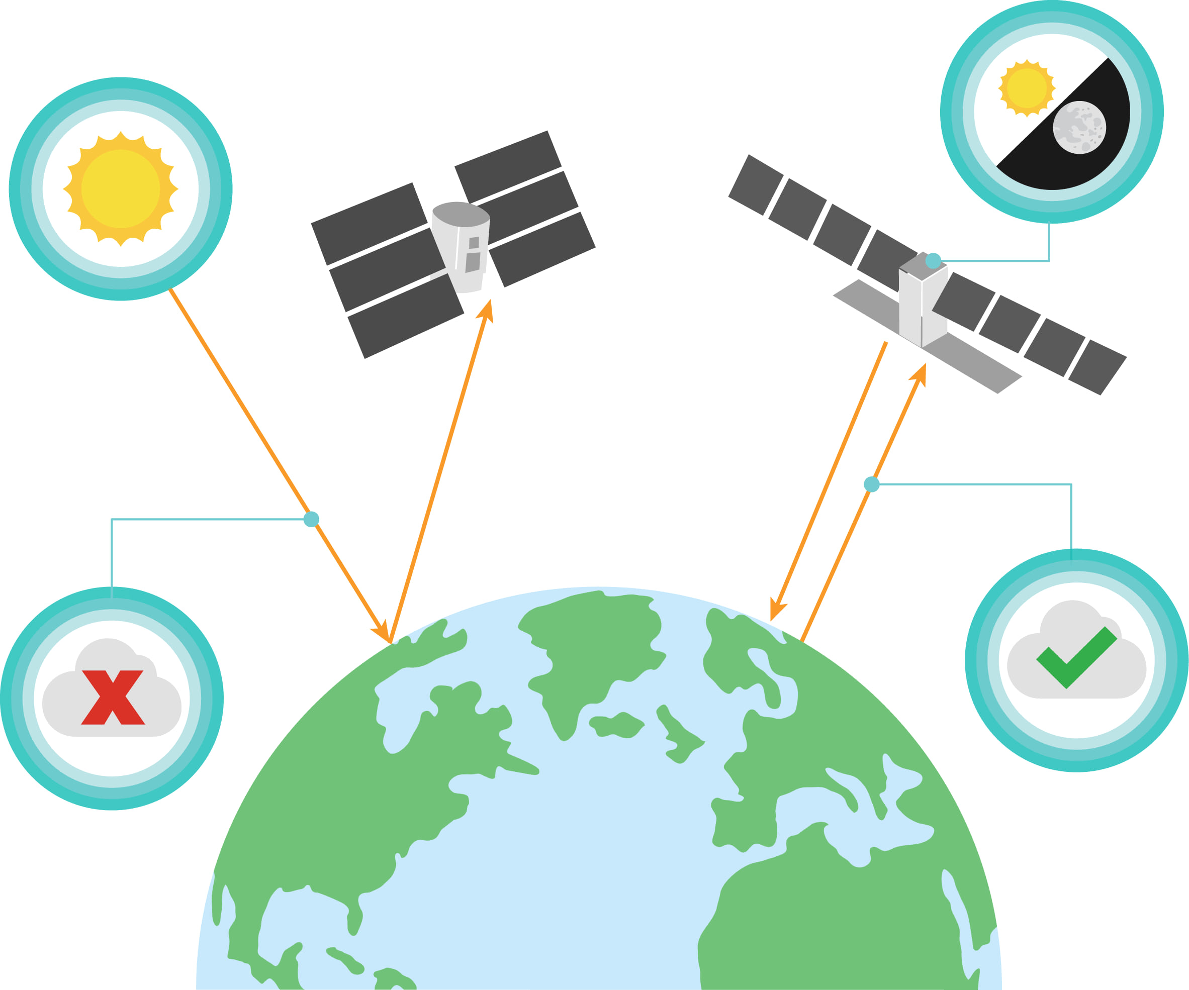
If it’s a photo of the earth taken from a bird’s eye view, then you like many others are most familiar with satellite imagery that is an “optical image”. This type of imagery uses “passive sensing”, which means that the sun acts as a light source to capture visible light. It works in a similar way our phone camera takes a picture without the flash enabled. Unfortunately, when the sun goes down or there are clouds in the sky, a satellite with an optical sensor is unable to get clear images. In cases when daylight or weather is an issue for optical sensors, satellites with Synthetic Aperture Radar (SAR) sensors can help and deliver solutions for real-world problems. This means that we can now study places at the poles where the Artic is dark during the winter months or in tropical regions where there is high moisture and cloud coverage.
What can SAR be used for?
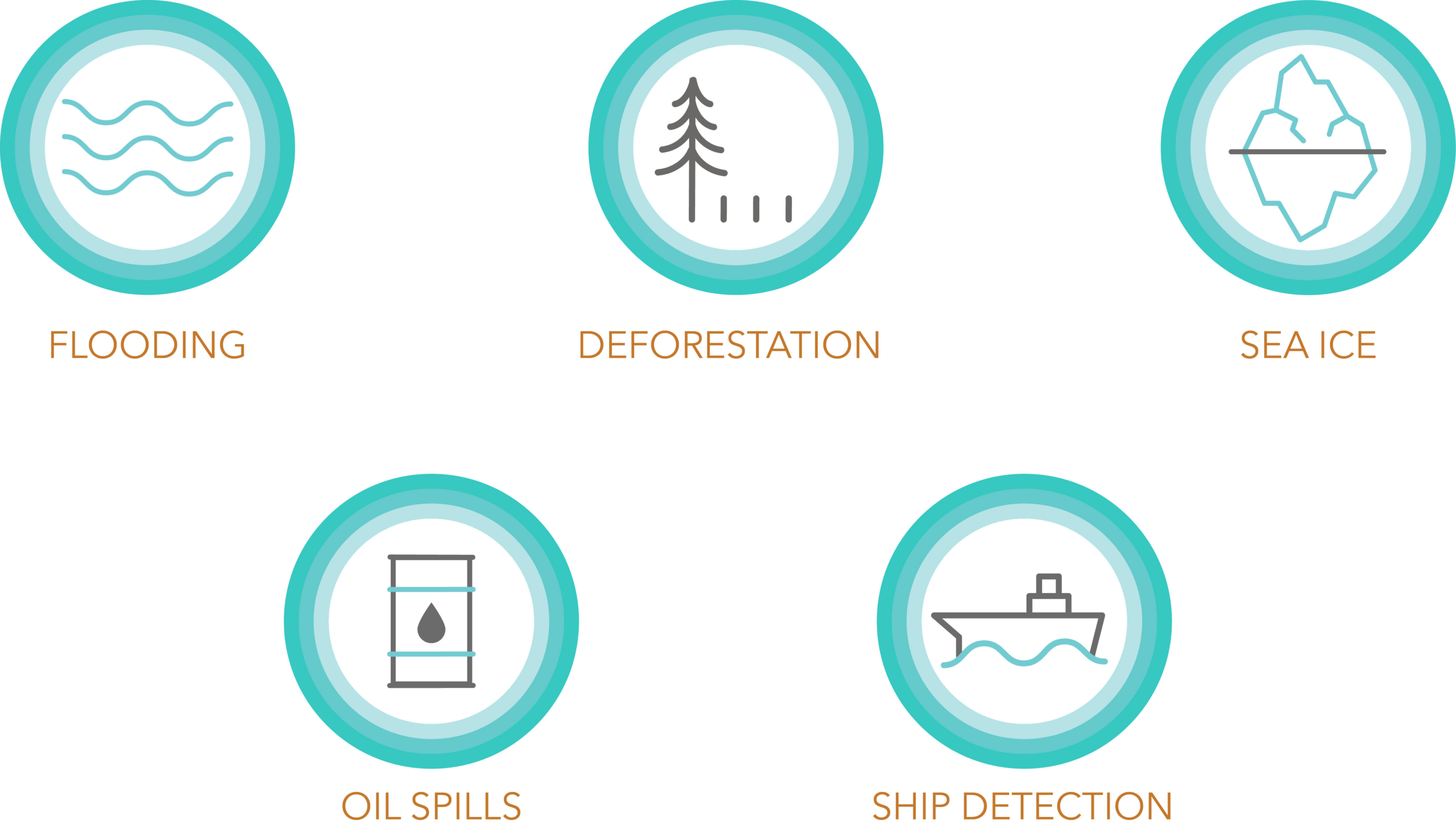
Since SAR can penetrate through darkness, clouds, and rain, it can be used to detect changes in the environment due to natural or human induced events such as flooding, oil spills, deforestation, ship detection, and sea ice (to name a few).
How does SAR work?
SAR sensors use “active sensing”, which do not rely on the sun for a source to produce a “SAR image”. This sensor sends signals to the Earth’s surface and the reflected signals that travel back to the sensor are called the “measured backscatter”. A SAR image is simply a 2D rendering of the measured backscatter.
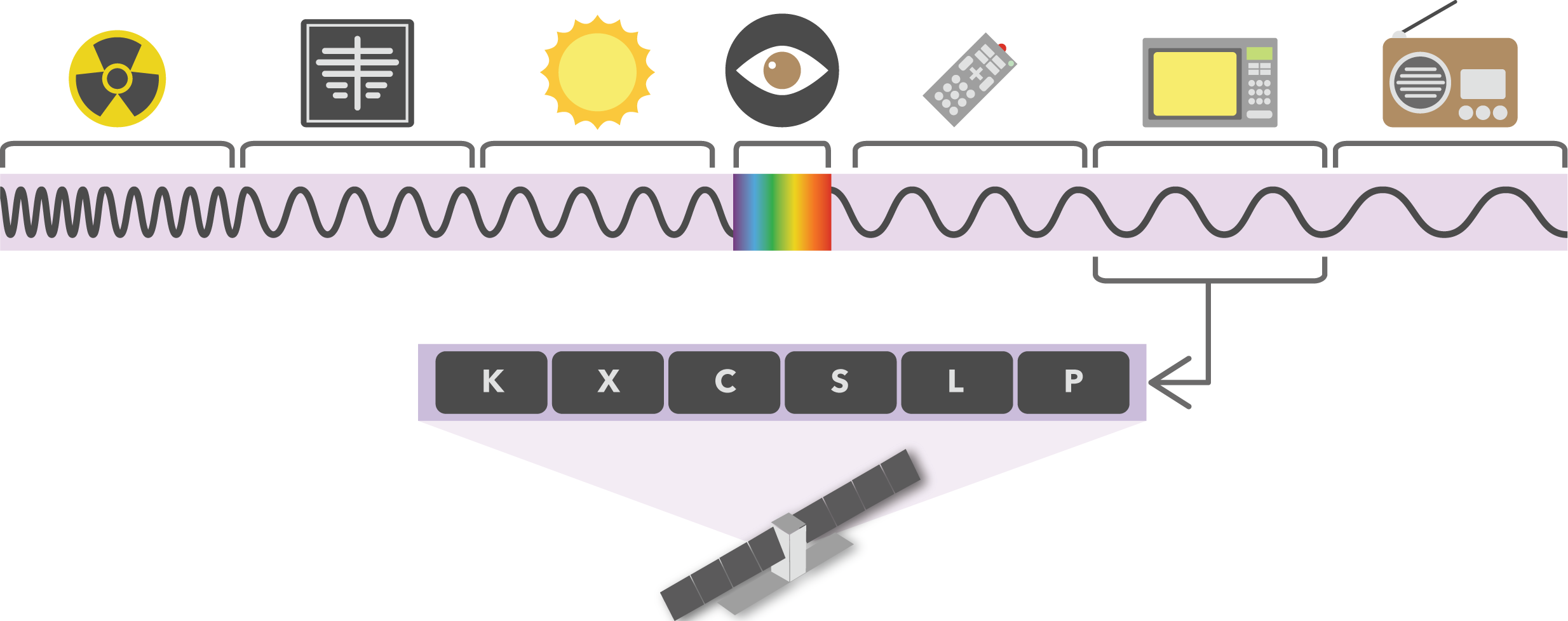
The type of signal sent from the sensor is a pulse of electromagnetic energy that can “see” through clouds, smoke, and rain. The wavelength of the signal determines the penetration depth; the longer the wavelength the deeper the signal can penetrate and see through a terrain’s vegetation.
But wait, what exactly is Synthetic Aperture Radar?
First, I’ll start by explaining “Radar”. R-A-D-A-R stands for RAdio Detection and Ranging. The satellite’s sensor transmits pulses of radiofrequency energy to detect objects and determine the distance (ranging) relative to the satellite.
That just leaves the “Synthetic Aperture” part.
Using optical technology, we can adjust a camera’s aperture, opening through which light travels, to increase the brightness and resolution of a photo to capture a clearer image.
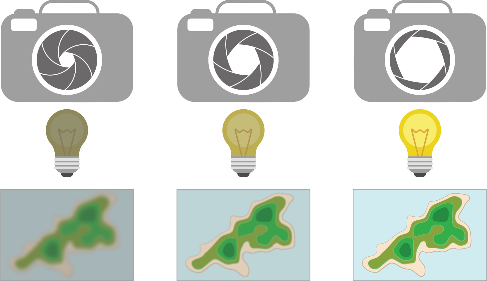
The “aperture” in SAR uses similar concepts to that of a camera in that increasing the aperture increases resolution. However, in this case the aperture has to do with how much energy an antenna can receive, and the resolution is a spatial resolution. Since a satellite antenna would need to be hundreds of times greater in size to capture images of the Earth’s surface (which would be ridiculously large and physically impossible to launch into orbit), we “synthetically” simulate a large aperture. As the satellite orbits, the SAR sensor sends and records several pulses to the ground as it passes over an area. This advanced data recording combined with signal processing techniques, enables a SAR sensor with a short antenna to synthetically elongate its antenna, which enhances its spatial resolution to produce a single high-resolution SAR image.

What are the benefits?
In summary, anytime, anywhere, SAR can be used for locating and mapping the Earth, characterizing changes over time, and tracking moving objects. As previously mentioned, SAR can be used to detect changes in the environment due to natural or human induced events such as flooding, oil spills, deforestation, ship detection, and sea ice. However, there are many more SAR applications than just these. With that said, I along with the Esri Imagery and Remote Sensing team invite you to explore the exciting new insights that SAR data can provide.
If you would like to explore some applications using SAR data and take a deeper dive into the world of SAR visit the StoryMap – Guide: Fundamentals of Synthetic Aperture Radar (SAR).


Commenting is not enabled for this article.