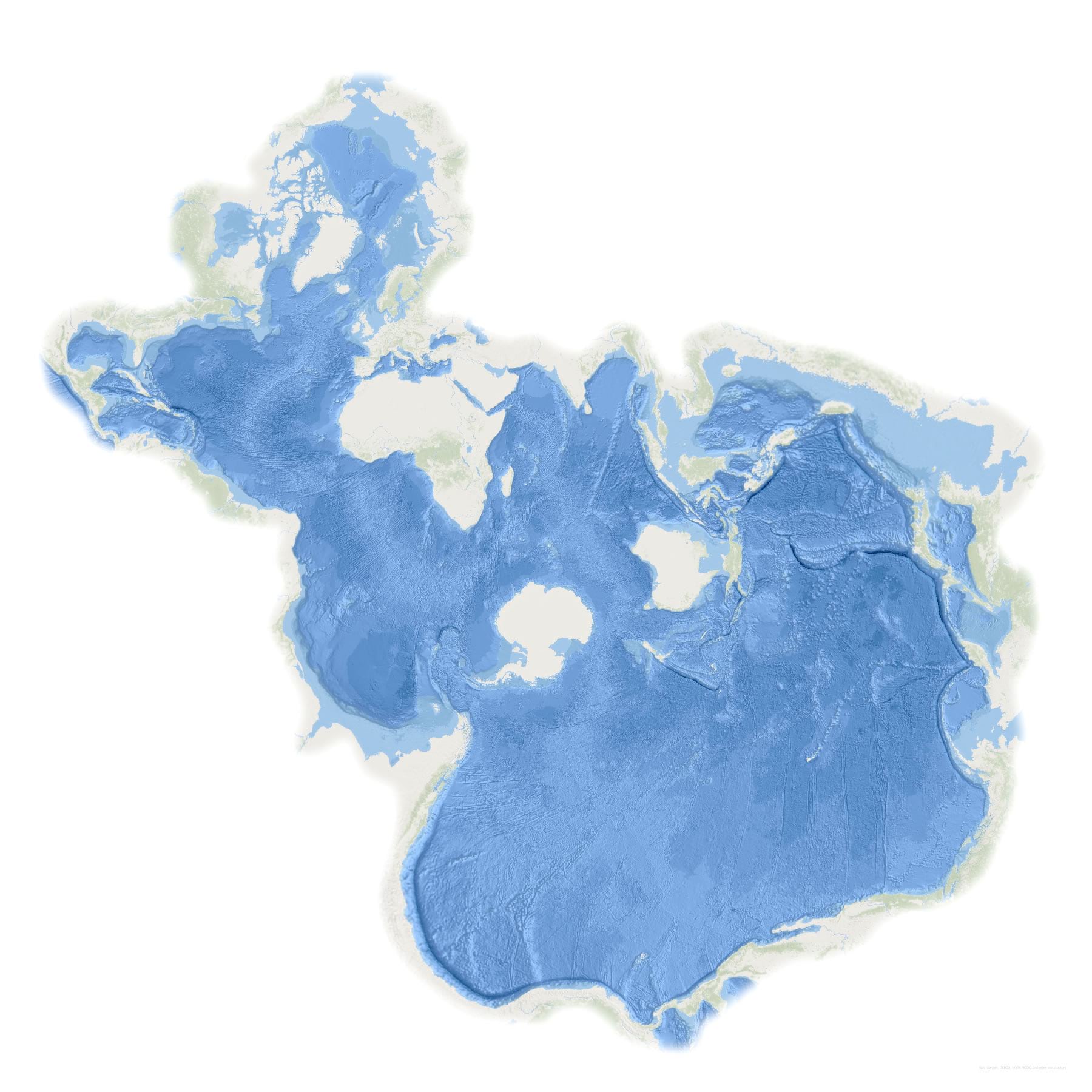
The Spilhaus World Ocean in a Square map shows you…deep breath…the world’s oceans (or is it ocean?) as one collective body of water. You know, like they actually are. Also, isn’t Spilhaus a name that just sounds like it would be an oceanic map? In any case, it’s named for a pretty remarkable human.
Maybe you read about the geo-sleuthing into the history and mathematics that brought this map to life, or saw some of the teaser maps made solely and unabashedly to whip up unbridled enthusiasm, or saw that Forbes article, or maybe you read about it in this curious reddit post that made it to the front page of the internet. Or maybe not! Maybe this is a whole new water world to you. In which case, come on in; the water is fine.
Here’s what makes this project special:
We made layouts that create an uninterrupted view of the oceans. Because repeating geography is a bit of a mathematical black hole in GIS, the Spilhaus map clips a bit of water at the perimeter in the Gulf of Mexico and the Bering Straits.
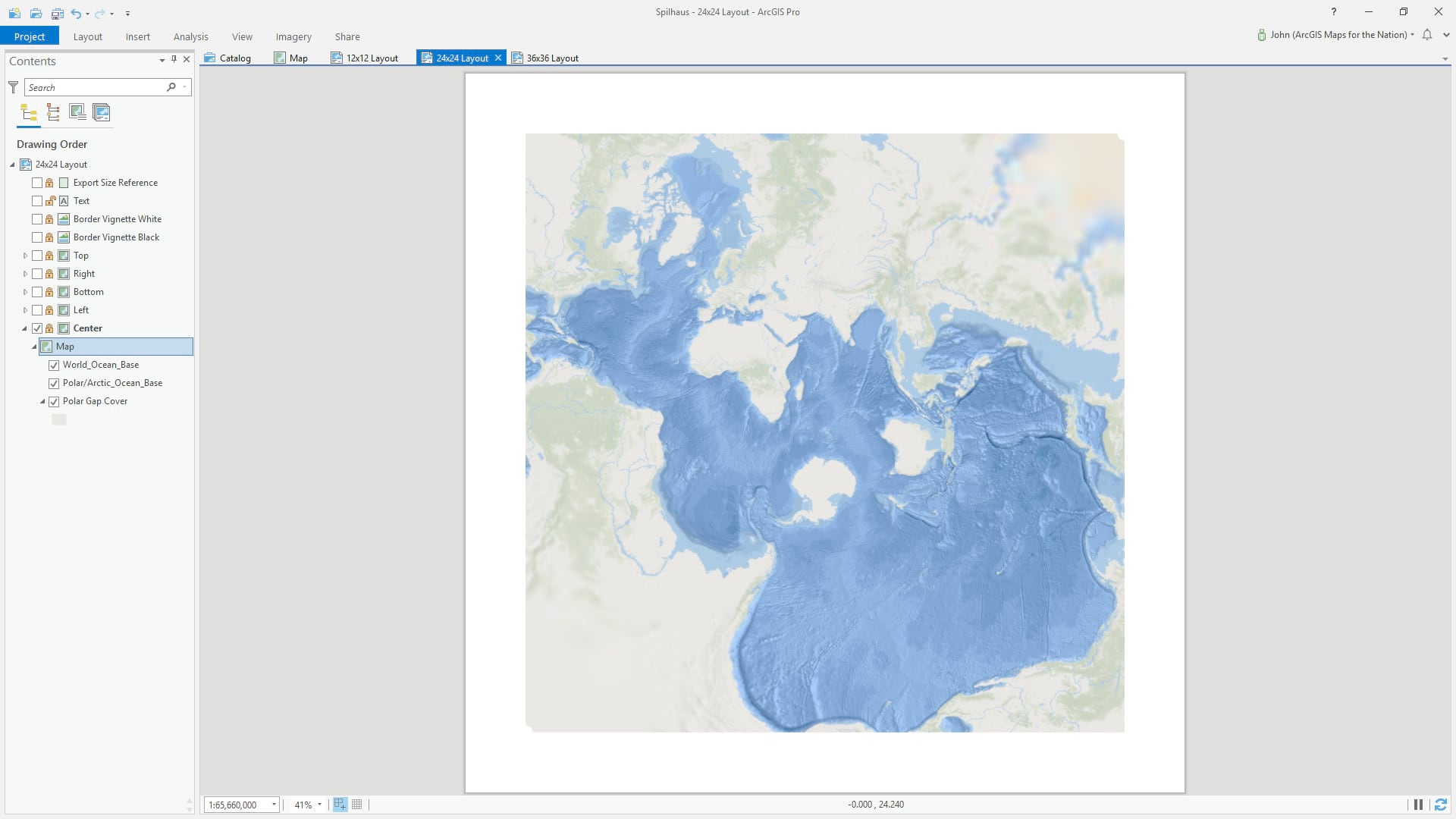
But in a layout, you can repeat a map as many times as you like, and also rotate them. So now we have an uninterrupted layout (with some helpfully-redundant bits of peripheral ocean).
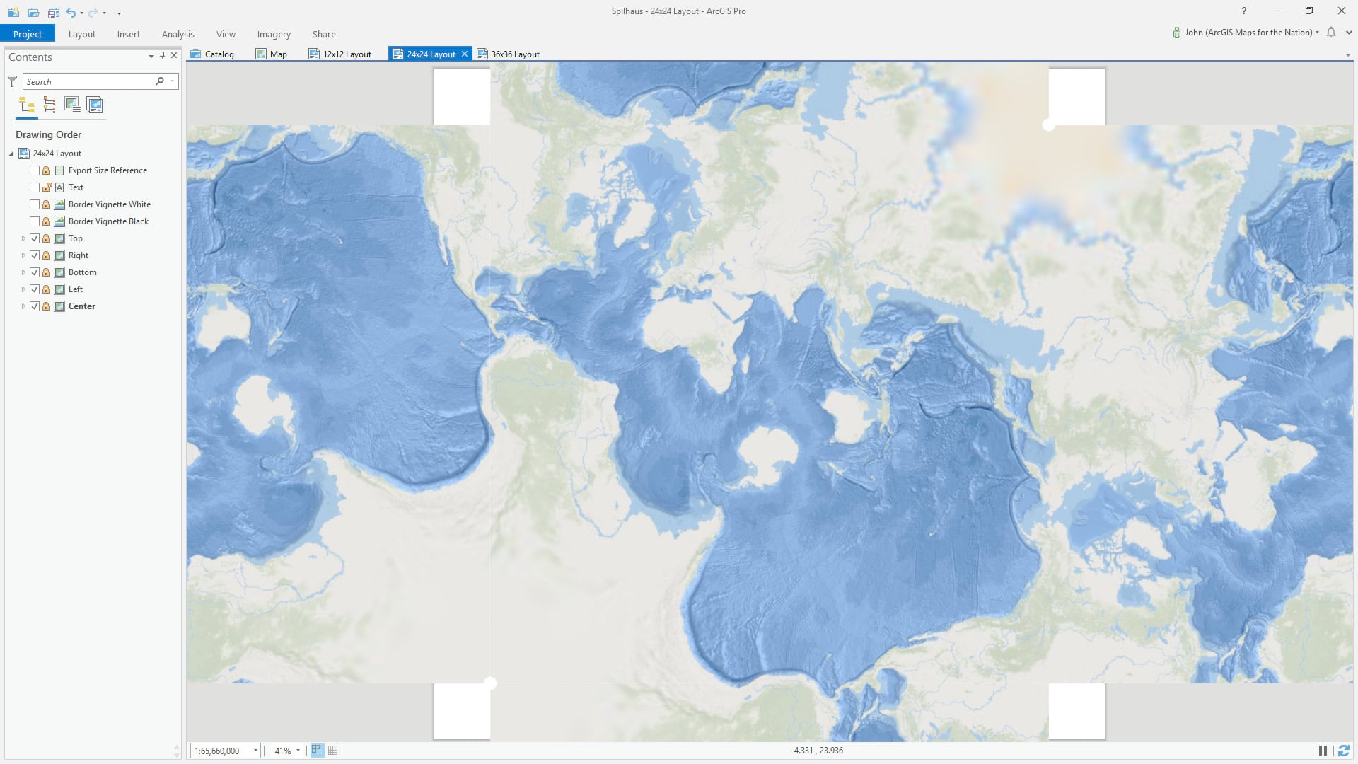
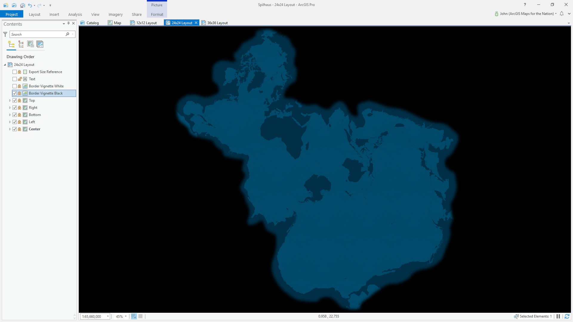
Gosh, look at that mess, though. Time to clean it up with a handy overlay graphic that helpfully occludes the land and overly-duplicate portions so we get a single glorious look at the one world ocean.
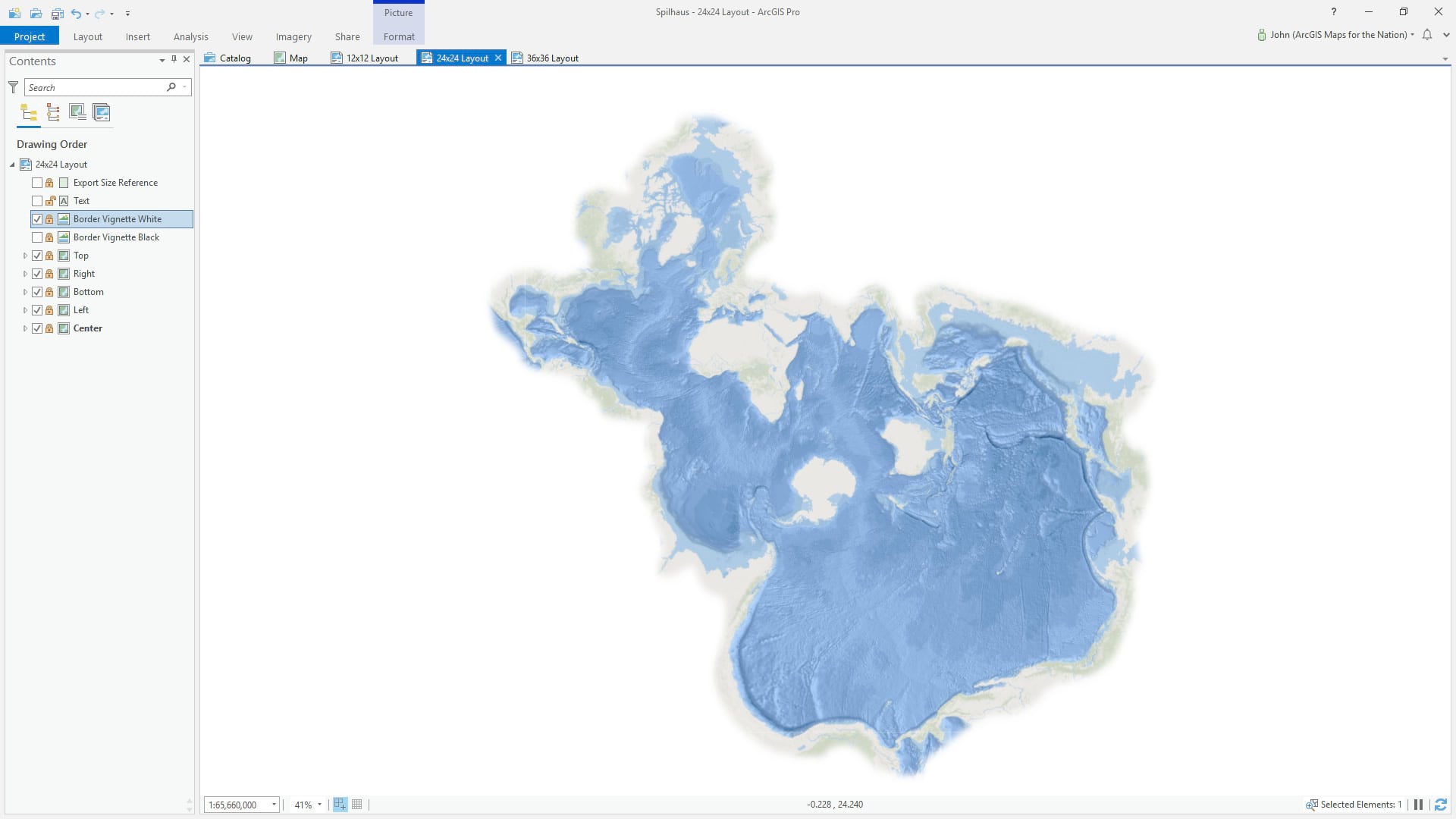
And you’ll notice in the project there is an alternative vignette overlay graphic in black, if that matches your map styling better.
So Spilhaus on, my mappy friends! A world of stirring globally unified oceanic visualizations awaits your inception.
Love, John

Commenting is not enabled for this article.