When disaster-related debris presents a threat to public health and safety, a community may act to negate the threat and ensure its economic recovery. In the immediate aftermath of an incident, the speed at which debris can be cleared from roads determines how quickly life safety resources can be mobilized. Before recovery and rebuilding efforts can begin, debris must be efficiently assessed, and if debris removal activities are not monitored according to federal guidelines, reimbursement may be at risk.
The Emergency Debris Management solution can be used to expedite initial debris clearance, assess volume, and monitor the removal of disaster debris accumulated on roads, right-of-ways, and public facilities.
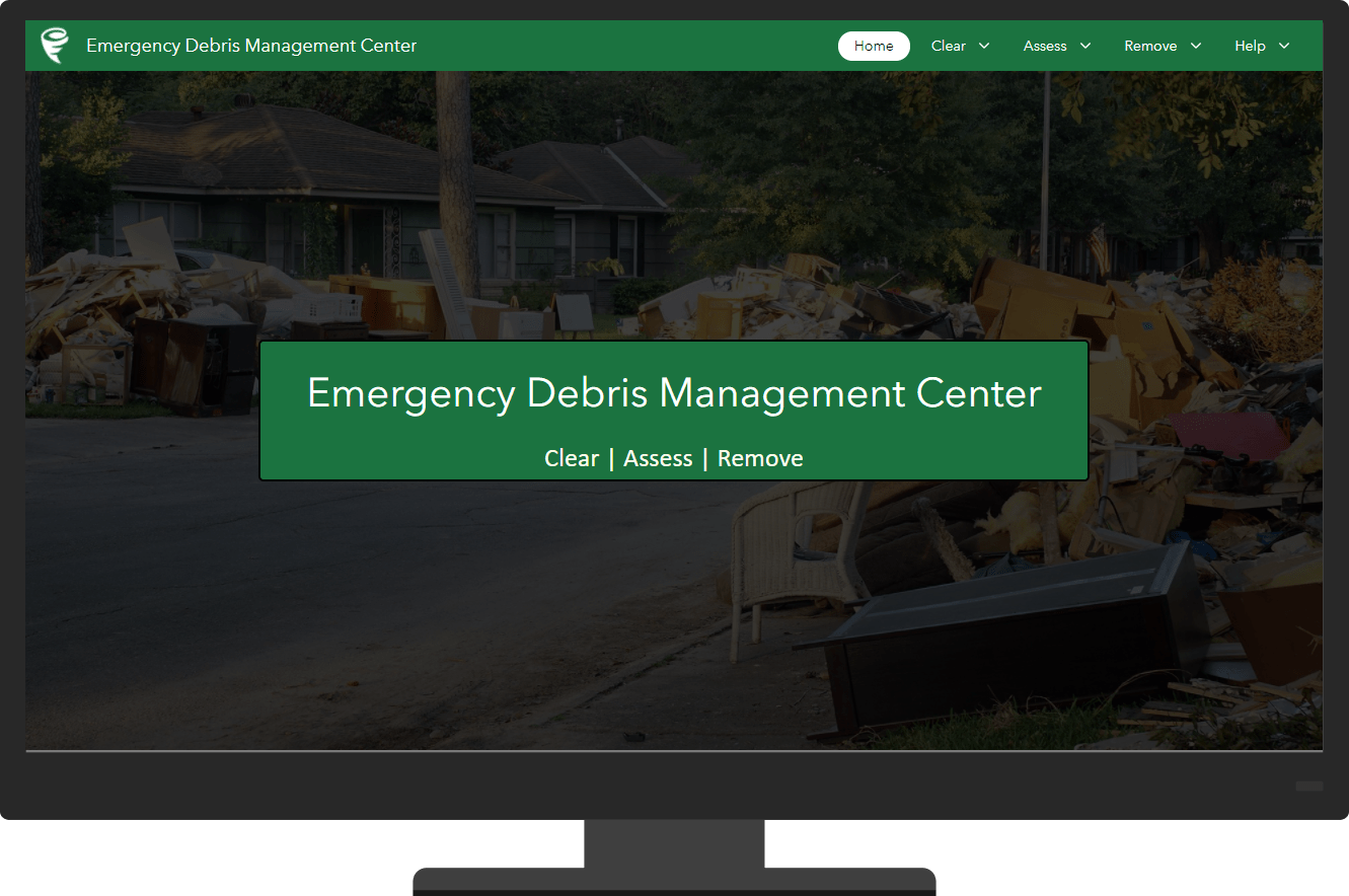
This solution is typically implemented by public works departments, emergency management agencies, and local governments that want to improve the efficiency of their debris management operations and ensure federal guidelines are met.
Prepare for emergency incident
To prepare for disasters, effective organizations train in advance of an incident, using mock exercises to familiarize personnel with the processes and technology they will use in the field during a real disaster. The Emergency Debris Management Center app can be used to train mobile workers on the apps they will download and use to perform their debris clearance, assessment, or removal work in the field. To get mobile workers in the field quickly, the solution includes role-based security groups that ensure personnel have the permissions required to perform their assigned job function.
Expedite initial debris clearance
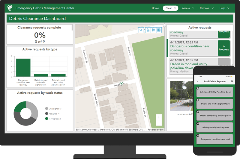
After a disaster strikes, emergency managers must rapidly identify and clear obstructed roads so medical and search and rescue teams can provide critical life safety services to the community. The Emergency Debris Management solution includes a series of information products that can be used to report roads obstructed by debris, assign reports to field clearance crews, update the status of clearance assignments, and monitor the clearance process.
Assess debris removal needs
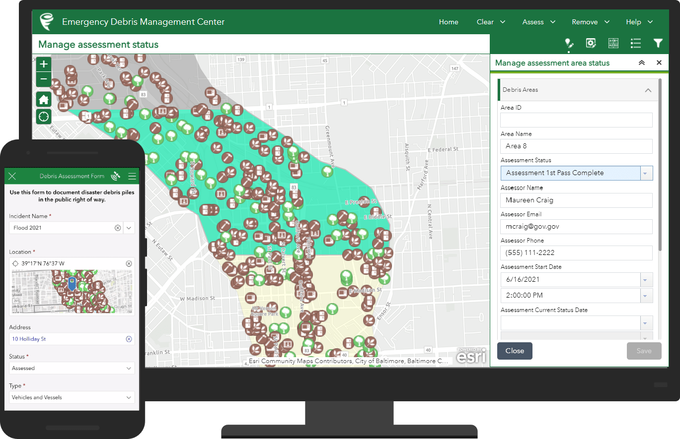
Once a disaster incident has passed, communities begin the recovery process by assessing debris; how much has been generated, where it is located, and what types of debris exist. This information can be used to justify requests for federal disaster assistance under the Stafford Act.
Emergency Debris Management can also be used to perform debris assessments, manage assessment work areas, and monitor progress of assessment efforts.
Monitor debris removal activities
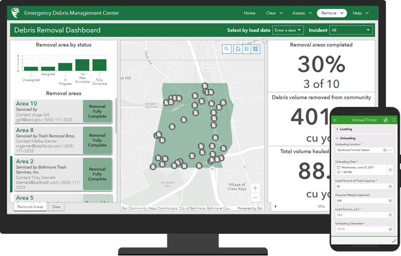
Removal of disaster debris is often the first visible step a community takes on the road to recovery. Organizations managing debris removal face challenging tasks like educating the public on debris removal procedures, coordinating the work of removal service providers, managing disposal sites, and adhering to monitoring processes required for Federal reimbursement.
The Emergency Debris Management solution includes a series of information products to support debris removal workflows, including certification of trucks used in debris removal, completing debris monitoring load and unload tickets, managing removal provider work areas and status, monitoring the removal process.
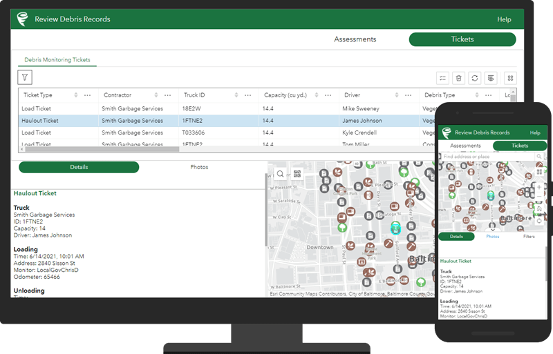
Contractors, FEMA personnel, or other stakeholders can use the Debris Records Reviewer app to view, filter, and export debris assessment or monitoring ticket records. As a mobile responsive app, the Debris Records Reviewer can also be used by mobile workers to visualize debris records while on the go.
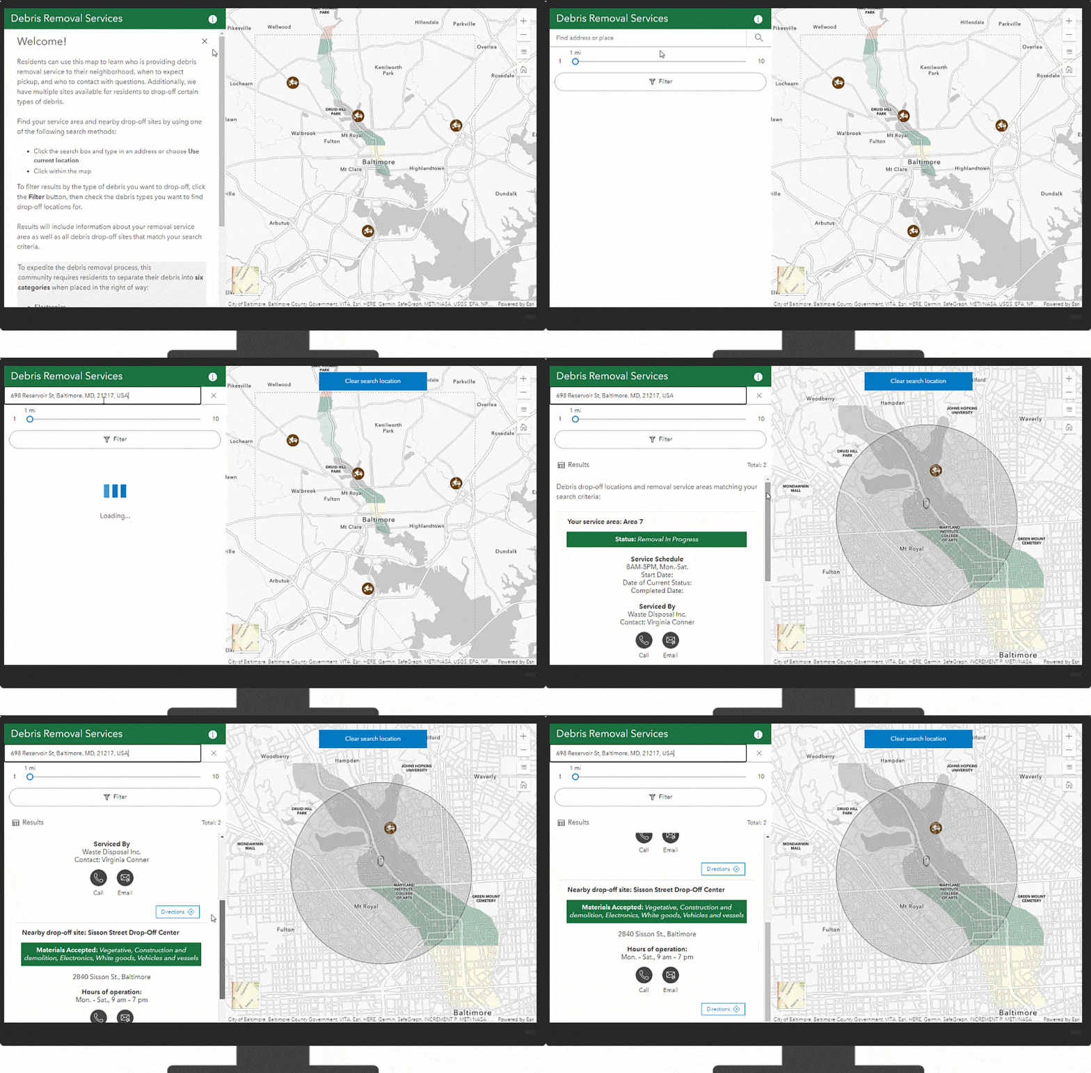
Finally, community members can use the Debris Removal Services app to understand debris removal requirements, the pickup schedule for their property and where debris can be dropped off.
Additional resources
Learn more about the Emergency Debris Management and how you can quickly deploy this solution on the ArcGIS Solutions site. For questions and feedback, chat with us on Esri Community or contact Esri Support Services.
Note, the June 2021 release also includes an improved Damage Assessment solution. It complements the Emergency Debris Management solution and helps you collect damage reports, assign initial damage assessments, monitor the impact of a disaster on the community, brief internal stakeholders, and share information with the public.


Article Discussion: