ArcGIS Solutions align with your business needs, transform your use of ArcGIS, and help you maximize the investment you are making in location-based data and technology.
In the June 2021 release, you will find several new ArcGIS Solutions for state and local governments, utilities, and public safety agencies. There are also many enhancements to the existing solution portfolio that can be leveraged by organizations of all types.
New ArcGIS Solutions
Here is a quick summary of what’s new in the June release:
AED Inventory can be used to maintain an inventory of automated external defibrillators (AEDs) and share the location of AEDs with internal stakeholders and the public.
Emergency Debris Management can be used to expedite initial debris clearance, assess volume, and monitor the removal of disaster debris accumulated on roads, right-of-ways, and public facilities.

Lead Service Line Inventory can be used to develop a lead service line inventory and monitor the replacement of service lines required to comply with the Environmental Protection Agency’s (EPA) Lead and Copper Rule Revisions.

Outage Damage Assessment can be used to perform damage assessments and respond to outages caused by severe weather conditions and emergency incidents.

The Outage Damage Assessment solution is typically implemented by electric utilities and communication organizations that want to quickly assess the extent of damage, effectively allocate crews, and make informed decisions during storm restoration.
Enhanced ArcGIS Solutions
This release also includes major enhancements to the following:
Damage Assessment can be used to conduct initial damage assessments after a natural disaster or catastrophic incident.
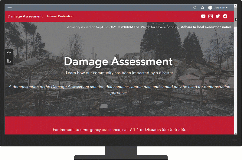
The Damage Assessment solution is typically implemented by emergency management agencies that want to quickly understand the impact of a natural disaster, or catastrophic incident, and immediately assign resources to appropriate response and recovery activities.
Emergency Management Operations
Emergency Management Operations can be used to manage incident operations and maintain situational awareness during emergency response and recovery phases.

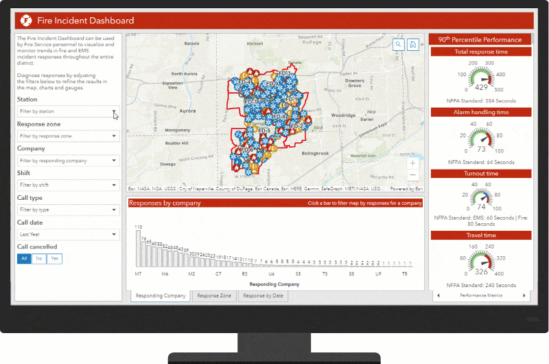
Fire Incident Dashboard can be used to visualize fire and emergency medical service (EMS) incidents sourced from computer-aided dispatch or records management systems and monitor associated response times.
But that’s not all. Several other solutions were also updated in this release:
- Coronavirus Recovery Dashboard
- Coronavirus Vaccine Distribution Dashboard
- Crime Analysis
- Daily Activity Dashboard
- Fire Hydrant Inspection
- Fire Service Maps
- Performance Management
- Special Event Operations
- Special Event Permitting and Operations
- Vaccine Coverage Analysis
Finally, learn more about any general improvements, lifecycle changes and issues that have been addressed in this release.
Visit our product destination for more information.

Article Discussion: