The August 16, 2023 release of ArcGIS StoryMaps included what at first glance might seem like an unassuming new item. When you go to publish a story, you’ll see the expected options for refining story details and setting sharing levels:
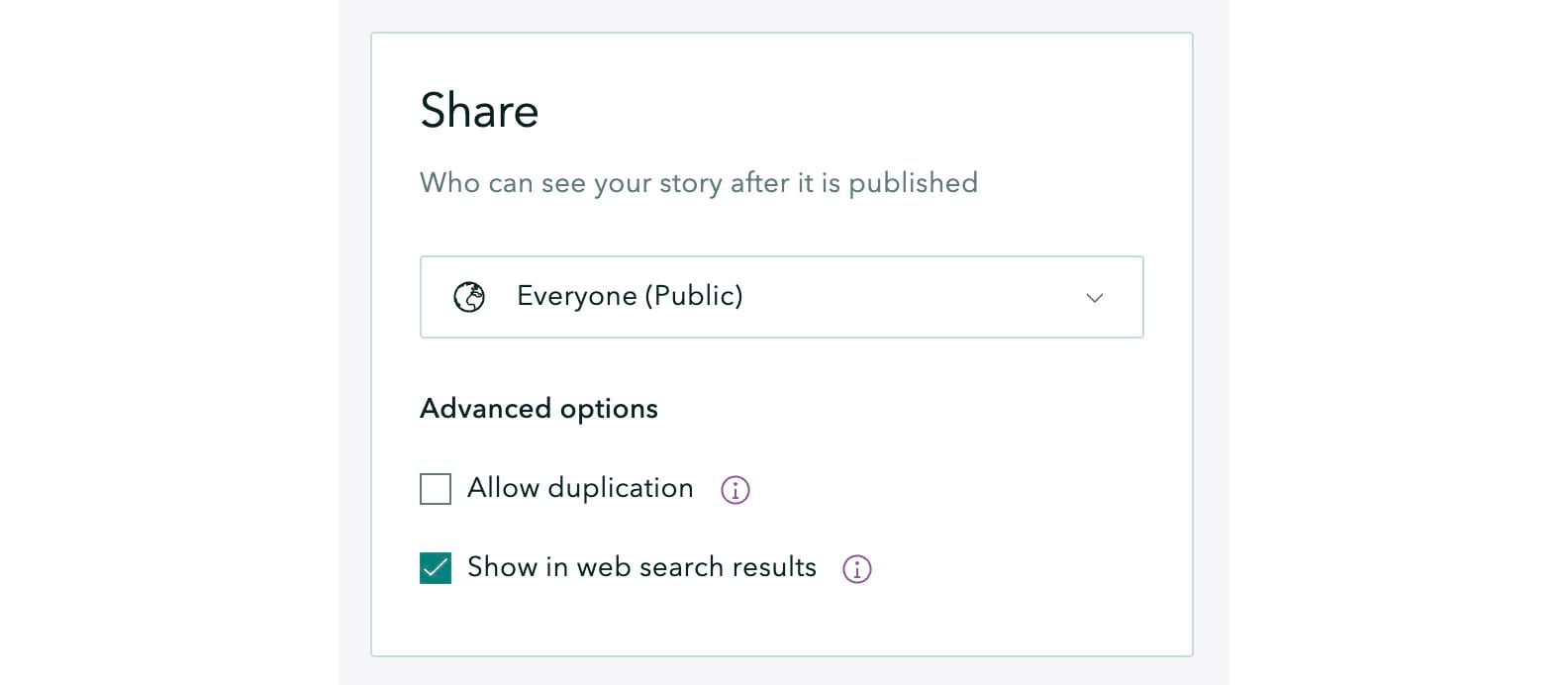
Since that release, if you set the sharing level at “Organization” or “Everyone,” you’ll have access to a set of “Advanced options” consisting of two checkboxes. The second of those allows you to opt out of exposing your story to web search results. That’s cool if you want to share your story with your friends and associates by sending them the story’s URL but would rather not let it be discovered by anyone doing a web search.
But it’s the first checkbox — Allow duplication — that I’m most excited about, and that creates whole new realms of possibility with ArcGIS StoryMaps. Let’s explore the implications of this function. First, here’s how it works:
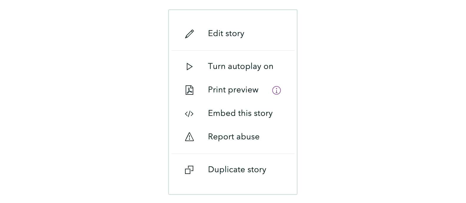
The Allow duplication function facilitates easy duplication of stories not just within an organization, but for anyone with an ArcGIS organizational account who is viewing a story. When the Allow duplication box is checked by a story’s publisher, all viewers of that story who are signed into an account will find a Duplicate story item in the little three-dot menu in the navigation header. A single click creates a copy of the story within their account.
A few use cases
So what’s the big deal? Here are a few ways you might take advantage of this feature.
• Educators
Let’s say you’re a middle school teacher. You’d like your students to create an ArcGIS StoryMaps story on a current item in your curriculum, but you’d rather not waste precious classroom time and effort teaching your students how to create a story from scratch. You can create a skeletal story complete with section headers, immersive sections, and places for multimedia content. When you publish your outline story, opt to allow duplication. Then ask your students to open your story and click “Duplicate story.” Challenge them to then flesh out their stories with their own text, and perhaps photos and maps, too, and then publish their stories for you to review and grade.
Let’s say you want to share your skeletal story with other educators, both within your school system and across the country. Just send them a note with the story URL and let them duplicate it!
• Non-profits
Another scenario: You’re the executive director of a land trust or conservation organization that administers a number of protected areas. You’d like to show the world — and your donors — the beauty, importance, and value of the preserves you manage. You author an ArcGIS StoryMaps narrative about one of your preserves. Your story locates the preserve, describes its assets, provides a virtual walking tour of it, and features photos and videos. Once you’ve published your first story, you can enable it to be duplicated within your organization so your colleagues can create stories about other preserves, swapping out content but retaining your organization’s branding and using a consistent, reader-friendly story structure.
• GIS Professionals
Yet another use case: You’re the GIS manager for a municipal government. You want to create reports about your city, perhaps describing the current year’s capital improvement projects, or progress toward reducing pedestrian fatalities, or examining crime patterns. Your team creates story templates on these and other topics and makes them available for duplication within your team and by other teams and departments. Before long you start to see new suites of stories by teams who have been inspired by your examples to create and share their own templates.
• International organizations
One more: You work for an international NGO that is helping local and national governments track their progress toward achieving the Sustainable Development Goals. You team with one country to create a report. You’re pleased with the result, so you duplicate the story and publish an outline version that other governments can duplicate and flesh out with their own information. In fact, STGs Today at the Sustainable Development Solutions Network has developed a template that enables countries to create “Voluntary National Reviews” in StoryMaps form, tracking their SDG activities.
What’s next
Now I hope you understand why I’m so excited about that little Allow duplication option. That said, I’m even more excited about what’s to come. We’re currently working on an array of functions that would allow story authors to create templates that seamlessly integrate instructions using text that appears only in the builder. An author using a template would be instructed to add photos, or create maps, or insert text within the sort of skeletal stories I’ve described above. This will facilitate the creation of story templates and further broaden the horizon of opportunities.
Give it a try!
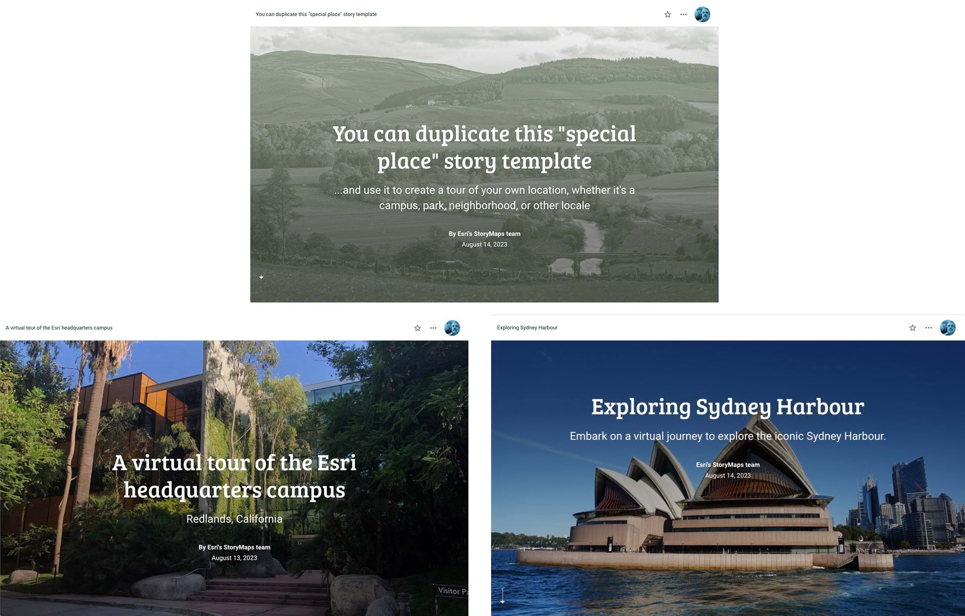
We’ve created a template that’s intended to be used to feature a special place, whether it’s a campus, park, preserve, historic district — you name it. We’ve also created two sample stories, one featuring the Esri headquarters campus, the other Exploring Sydney Harbour, as examples of how the template can be used to paint a multimedia picture of a location.
Try duplicating the template and swapping out its text, images, map locations, and other elements with your own content. Then share your stories with us, along with your suggestions. We look forward to seeing what you come up with!
A word of caution
We’ve long advocated for responsible storytelling, especially in terms of using multimedia content. It’s vitally important that you use material that’s either in the public domain, is fully rights-free, or for which you’ve received explicit permission. Perhaps it goes without saying, but content within any stories that you make available for others to duplicate should be free of any use restrictions.
The use cases I’ve outlined above represent the tip of a very large and exciting iceberg. I hope you’ll find additional, innovative uses of this new feature, and that you’ll share them with us. Happy storytelling!

Article Discussion: