The world’s largest geographic information system (GIS) conference took place July 14-18 in San Diego, California — both in-person and virtually. Thousands of professionals from across the globe united at Esri’s User Conference (UC) around the 2025 theme: GIS—Integrating Everything, Everywhere.
The 2025 conference theme underscored the power of GIS in bridging disciplines, industries, and communities to foster collaboration, innovation, and sustainable decision-making on a global scale. Fitting well into this theme was the integration of GIS with building information modeling (BIM) and computer-aided design (CAD).
-

The 2025 Esri User Conference theme is GIS—Integrating Everything, Everywhere.


Explore the UC Expo and Esri Showcase
ArcGIS offers robust integration capabilities with BIM and CAD data, enabling professionals to visualize, analyze, and manage design and construction information in geospatial context. Users stopped by the architecture, engineering, and construction (AEC) industry area in the Esri Showcase to learn more about BIM/CAD workflows in ArcGIS.
The UC Expo offers an excellent opportunity to engage with over 200 exhibitors like Autodesk and discover their GIS-powered products and services. Have a technical question or want to learn what’s new in ArcGIS? The Esri Showcase is where you can connect with over 2,000 Esri experts at kiosks across product and industry areas. You can even take self-guided classes in our Learning Lab.
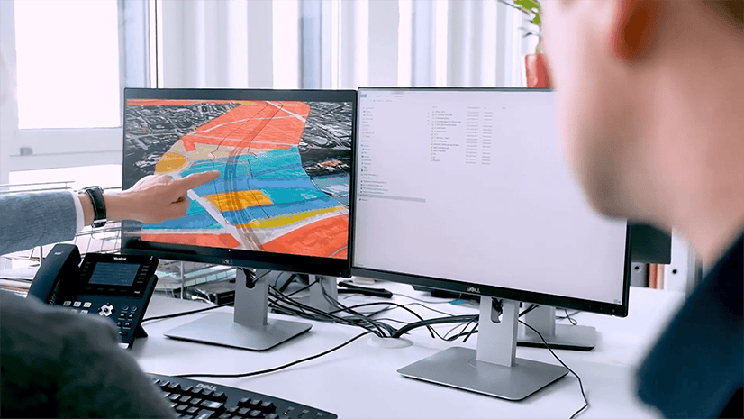
Explore the interactive UC 2025 map made with ArcGIS Indoors

Explore BIM/CAD integrated offerings in the AEC industry area
Hundreds of users visited the AEC area in the Esri Showcase to connect with experts about our BIM/CAD and Autodesk integrated offerings, including ArcGIS GeoBIM, ArcGIS for AutoCAD, and ArcGIS for Autodesk Forma.
They also learned more about the many ways to integrate BIM and CAD in ArcGIS, as well as connecting to other ArcGIS capabilities like field operations and more.
AEC Showcase hours
Tuesday, July 15 | 9:00 AM – 5:00 PM
Wednesday, July 16 | 9:00 AM – 5:00 PM
Thursday, July 17 | 9:00 AM – 4:00 PM
Highlighted sessions on integrating BIM/CAD
Below is a list of spotlighted sessions that were available in the UC 2025 agenda. For a more comprehensive view of all sessions offered, explore the detailed UC agenda or this curated agenda of BIM/CAD sessions.
ArcGIS GeoBIM: Optimize BIM Workflows with 3D GIS
Tuesday, July 15 | 1:00 – 2:00 PM PDT
ArcGIS GeoBIM helps design and construction project teams collaborate by bringing geospatial context to engineering management for Autodesk Construction Cloud and BIM 360. Stakeholders collaborate using configurable web apps that simplify communication and situational awareness. Learn how to use ArcGIS GeoBIM to locate engineering documents in geographic context, create schedules that link construction activities to engineering documentation, visualize detailed 3D construction-site logistics, and collect on-site conditions with ArcGIS Field Maps to create new issues for action.
ArcGIS: Construction Planning
Tuesday, July 15 | 2:30 PM – 3:15 PM PDT
Join us to learn how GIS technology elevates construction planning with precise site analysis, optimized resource allocation, and improved collaboration among stakeholders. Discover how integrating GIS with BIM enables you to visualize project designs within their environmental context, identify potential site challenges early, and streamline planning workflows. From pre-construction analysis to real-time site monitoring, GIS equips construction teams to make data-driven decisions that boost efficiency, cut costs, and minimize project risks.
ArcGIS Pro: Autodesk Integration with the Esri System Using CAD and BIM Data
Tuesday, July 15 | 2:30 – 3:30 PM PDT
Thursday, July 17 | 1:00 – 2:00 PM PDT
Explore techniques for using Autodesk CAD and BIM data, such as Civil 3D files, to support your GIS workflows in ArcGIS Pro. Learn how to geoposition your data and convert it to a geodatabase for visualization, analysis, and publishing to ArcGIS Online for sharing with your organization. This session is recommended for those who have some familiarity with CAD, BIM, Autodesk, DWG, DGN, Civil 3D, BIM Cloud Connection, and georeferencing.
ArcGIS for AutoCAD: An Overview
Wednesday, July 16 | 8:30 – 9:30 AM PDT
Thursday, July 17 | 2:30 – 3:30 PM PDT
ArcGIS for AutoCAD is an app that connects CAD and GIS professionals for information sharing and decision-making. Learn how this extension enables direct editing of GIS data and precise geolocation of drawings within AutoCAD. Explore how it informs the design process with rich geospatial context and ensures that drawings are consumable within ArcGIS. See workflows that show how edits made in ArcGIS are fed back to AutoCAD, enabling ArcGIS and AutoCAD teams to work with the same data synchronously. This session is recommended for those who have some familiarity with AutoCAD, ArcGIS for AutoCAD, feature service editing, geolocation, Civil 3D, and data management.
Digital Delivery for Infrastructure Projects
Wednesday, July 16 | 10:00 AM – 10:45 AM PDT
Explore the integration of CAD, BIM, and GIS in the context of a water distribution project. Speakers focus on digital delivery methods that enhance efficiency, accuracy, and collaboration throughout the project life cycle. By combining the strengths of CAD, BIM, and GIS, stakeholders can optimize design, analysis, and management processes for water distribution systems. Topics include practical applications, benefits, challenges, and best practices for using these technologies to achieve sustainable, resilient water infrastructure.
ArcGIS Pro: Working with BIM data
Wednesday, July 16 | 10:00 – 11:00 AM PDT
Thursday, July 17 | 4:00 – 5:00 PM PDT
Learn how ArcGIS Pro helps you not only visualize this information but also access the rich attributes and 3D content in your GIS by directly reading Industry Foundation Classes (IFC) files and Autodesk Revit files. See how to construct building scene layers from BIM models, and learn how to share digital models in web scenes. This presentation describes key methods for using your BIM files as part of a broader geospatial environment earlier in the design process. This session is recommended for those who have some familiarity with BIM, AEC, Revit, Autodesk, BIM Cloud Connection, georeferencing, IFC, and buildingSMART.
ArcGIS: GIS-BIM Integrations and Supporting IFC
Wednesday, July 16 | 11:30 – 11:50 AM PDT
BIM is a widely adopted process for creating and managing attribute-rich models of structures, buildings, roadways, railways, and bridges. GIS and BIM technologies increasingly combine to serve the phases of asset life cycles, from planning to maintenance and operations. Learn more about the value of GIS-BIM integrations in ArcGIS that involve Industry Foundation Classes (IFC), an open, international BIM standard. This session is recommended for those who have some experience working with or in the AEC industry.
Enhancing Projects and Operations with GIS-BIM Integrations: An Overview
Wednesday, July 16 | 2:30 – 3:15 PM PDT
Want to know more about BIM connectivity in ArcGIS Pro, connectivity in design environments, and ArcGIS GeoBIM workflows? This presentation provides foundations, best practices, and forward-looking guidelines for 3D capabilities in ArcGIS, direct integration of design files, and cloud-to-cloud integration with ArcGIS GeoBIM. If you are an AEC consultant, owner, or operator, you will be better able to visualize, monitor, and gain value from a wide assortment of project datasets. Gain insights into ArcGIS connections to design, construction, and operations workflows. This session is recommended for those who have an interest in the connection of BIM and GIS on AEC projects.
Creating and Managing 3D Content
Thursday, July 17 | 11:30 – 12:15 PM PDT
Thursday, July 17 | 2:30 – 3:15 PM PDT
Explore new ways to create and maintain different types of 3D content, with 3D buildings, BIM models, underground models, and 3D layers in ArcGIS. This presentation demonstrates the different workflows for editing 3D web layers and updating existing 3D content. This session is recommended for those who have an interest in creating and handling 3D layers.
ArcGIS Experience Builder and ArcGIS GeoBIM Widgets: How to Build a Construction App
Thursday, July 17 | 1:00 – 1:45 PM PDT
ArcGIS GeoBIM provides out-of-the-box widgets to help you easily access Autodesk Construction Cloud content from custom applications. Speakers demonstrate how to drag and drop widgets and use 2D and 3D project layers built with ArcGIS GeoBIM and thereby create a no-code ArcGIS Experience Builder app that helps you analyze issues from Autodesk Construction Cloud. This session is recommended for those who have an interest in customizing ArcGIS GeoBIM workflows by using out-of-the-box widgets.
Join us for the next UC in-person or virtually
Register to attend the next UC in-person and experience it in full. Can’t make it to San Diego? Not a problem! Esri also gives you the option to register for digital access from wherever you are. You can also sign up to watch the plenary only at no-cost.
This blog article was updated on September 29, 2025.


Article Discussion: