In this morning’s Developer Summit plenary, Jay, Lauren, Rohit, and our presenters demonstrated how ArcGIS brings analytical methods and spatial methodologies to life to uncover hidden patterns to predict and drive decision making. Spatial machine learning and deep learning AI models are integrated into ArcGIS to help you solve complex problems.
If you missed today’s plenary or you’ve seen it and are ready to learn more, we’ve got you covered. Here, we’ve provided an overview of today’s themes along with companion blogs and articles to learn more. Once recorded plenary videos are available, we’ll include links to them within each respective blog.
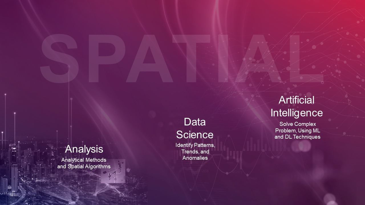
Today’s demos were centered around data, which is fundamental to solving spatial problems and to ultimately drive better understanding and decision making.
Through ArcGIS, we saw a variety of ways in which we can bring many different data types and formats together in a systematic way. From data collection to data management to securing data access via web services, the system is optimized for visualization and analysis.
And, once your data is prepared and ready for analysis, you can use ArcGIS Pro, ArcGIS Enterprise, and ArcGIS Online as a complete system to manage your workflows. Below is an overview of each main section and provides links to learn more.
System overview and highlights
Vinay uses ArcGIS Image to analyze burn impact and severity from California wildfires using a large imagery dataset in the cloud.
Hong uses ArcGIS to analyze spatiotemporal patterns of timber harvest across time using change detection tools with time series imagery.
Spatial Analysis
Bethany shows how GeoAnalytics is used to process and analyze over 6 million records of ocean vessel data. Using the data, she studies the environmental impact of ocean vessel traffic.
Suzanne shows us ArcGIS Velocity, a new offering within ArcGIS Online. ArcGIS Velocity is a fully hosted solution and delivers real-time and big data functionality.
Spatial Data Science
In this section, see how ArcGIS integrates with external systems to bring spatial data science to life with open and powerful experiences for data scientists.
Lakeisha walks us through the new Data Engineering tools in ArcGIS Pro to explore food insecurity trends to ultimately inform policy decisions.
Jie summarizes the results of partnered research to identify whether certain communities are disproportionately impacted by the health burdens of air pollution. In doing so, she shows how to use Time Series Forecasting tools to study the data across both space and time.
Nick highlights some exciting new enhancements in the R-ArcGIS Bridge through a case study on ecoregion mapping in the United States.
Alberto studies the relationship between voter ID laws and voter turnout to determine whether some communities are disproportionately impacted.
Geospatial AI
In this section, see how AI is integrated into ArcGIS at multiple levels.
The arcgis.learn module in ArcGIS API for Python is designed for your end-to-end deep learning workflows from model training to deployment.
We see how the use of Esri provided pre-trained models can be used as-is or as base models that you can fine tune for your workflows.
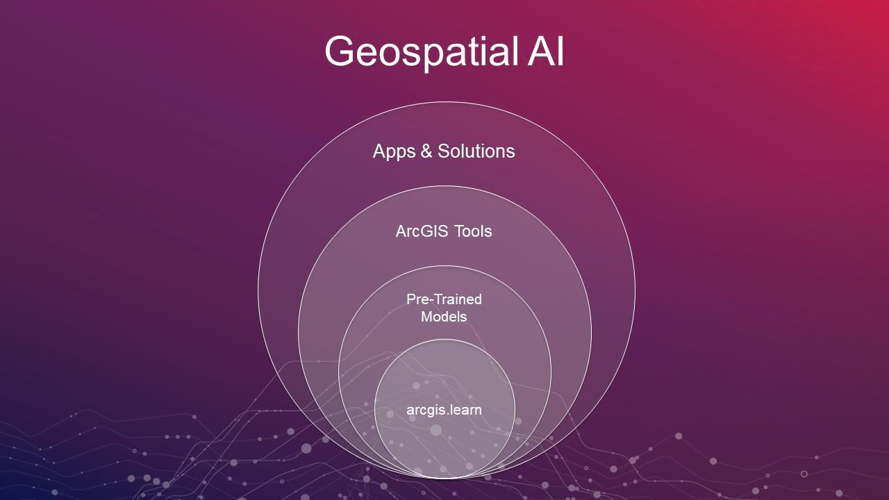
AI tools in ArcGIS Pro make deep learning approachable for analysts and the app frameworks in ArcGIS enable developers to create AI-enabled Apps and Solutions.
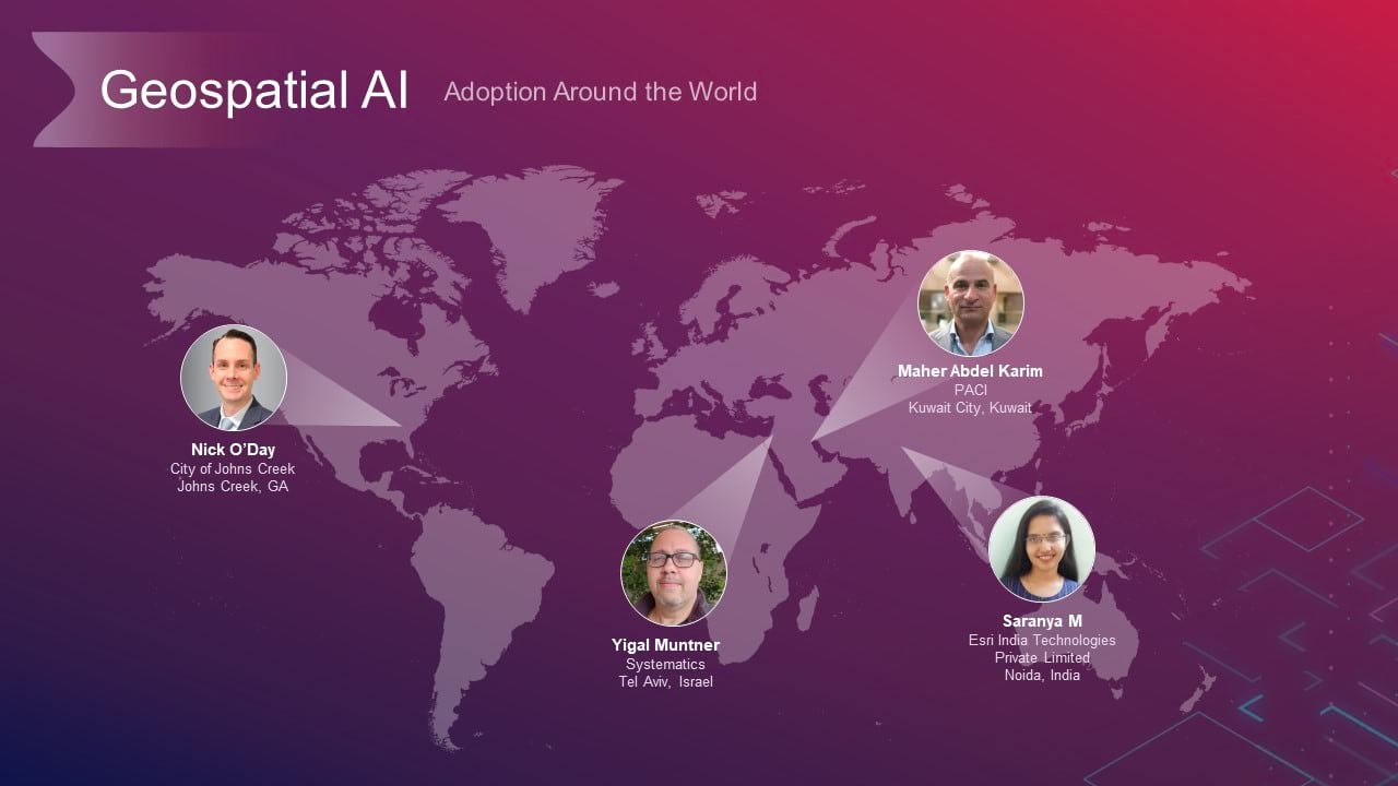
In this section, hear from our own community of developers and data scientists as they show you how they’ve adopted Geospatial AI in their real-world projects. They’ve joined us from around the world.
Maher Abdel Karim from The Public Authority for Civil Information (PACI) shows how to use an AI model to keep their GIS data (roads, buildings and parking lots) updated. Maher uses arcgis.learn to train this model.
Saranya M from Esri India reveals how they used AI to extract railway assets and their dimensions from point clouds. Saanya fine-tuned Esri’s pre-trained Power Line Classification model for this task.
Yigal Muntner from Systematics Israel walks us through the seamless process of using deep learning tools in ArcGIS Pro. By employing the pre-trained model to extract windows and doors, we see in this demo how Yigal and his team could detect them in the 3D scene and use them for visibility analysis.
In addition to the interactive object detection tool, ArcGIS Pro includes tools for deep learning on imagery and 3D point clouds. Atishay shows how this support is being extended to Full Motion Video for automated object tracking.
In this demonstration, Nick O’Day from the City of John’s Creek, GA shows us how the deep learning capabilities of ArcGIS coupled with ArcGIS AppStudio helped them build an AI enabled mobile app to map the trees in their community.


Article Discussion: