Our library of pretrained deep learning models in ArcGIS Living Atlas of the World is growing! Eliminating the need for huge volumes of training data, massive compute resources, and extensive artificial intelligence (AI) knowledge, users can leverage pretrained models to accelerate their geospatial workflows and extract meaningful insights from imagery.
As of September 2022, users can now choose from 43 different pretrained models to use. These models are available as deep learning packages (DLPKs) that can be used with ArcGIS Pro, Image Server and ArcGIS API for Python.
Here is an overview of our newer models:
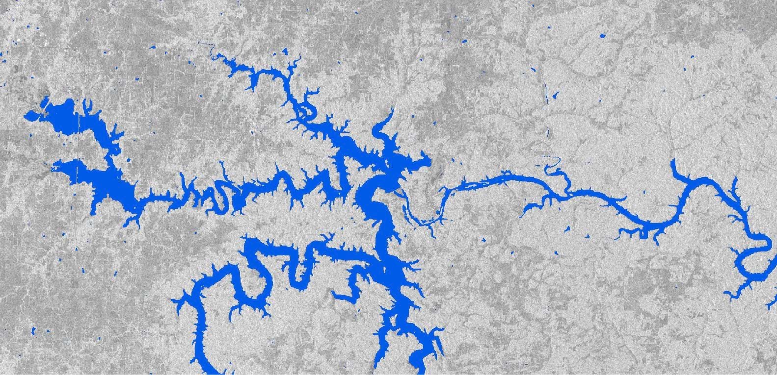
Water Body Extraction (SAR) – USA
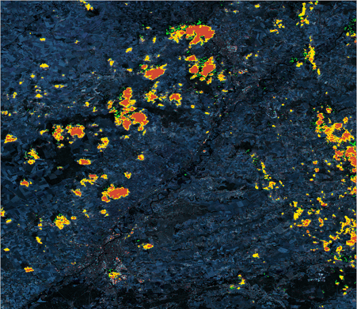
Water management activities such as monitoring the changing course of rivers and streams, regional planning, flood management, agriculture require survey and planning, including accurate mapping of water bodies. Hence, extraction of water bodies from remote sensing data is critical to record how this dynamic changes and map their current forms. This deep learning model can be used to automate the task of extracting water bodies from SAR imagery.
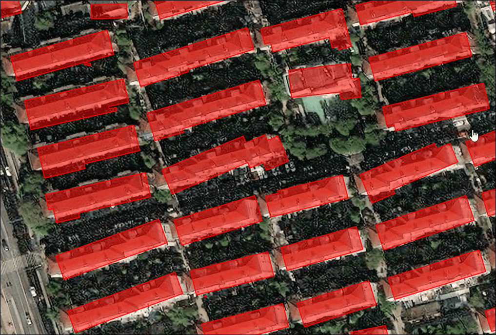
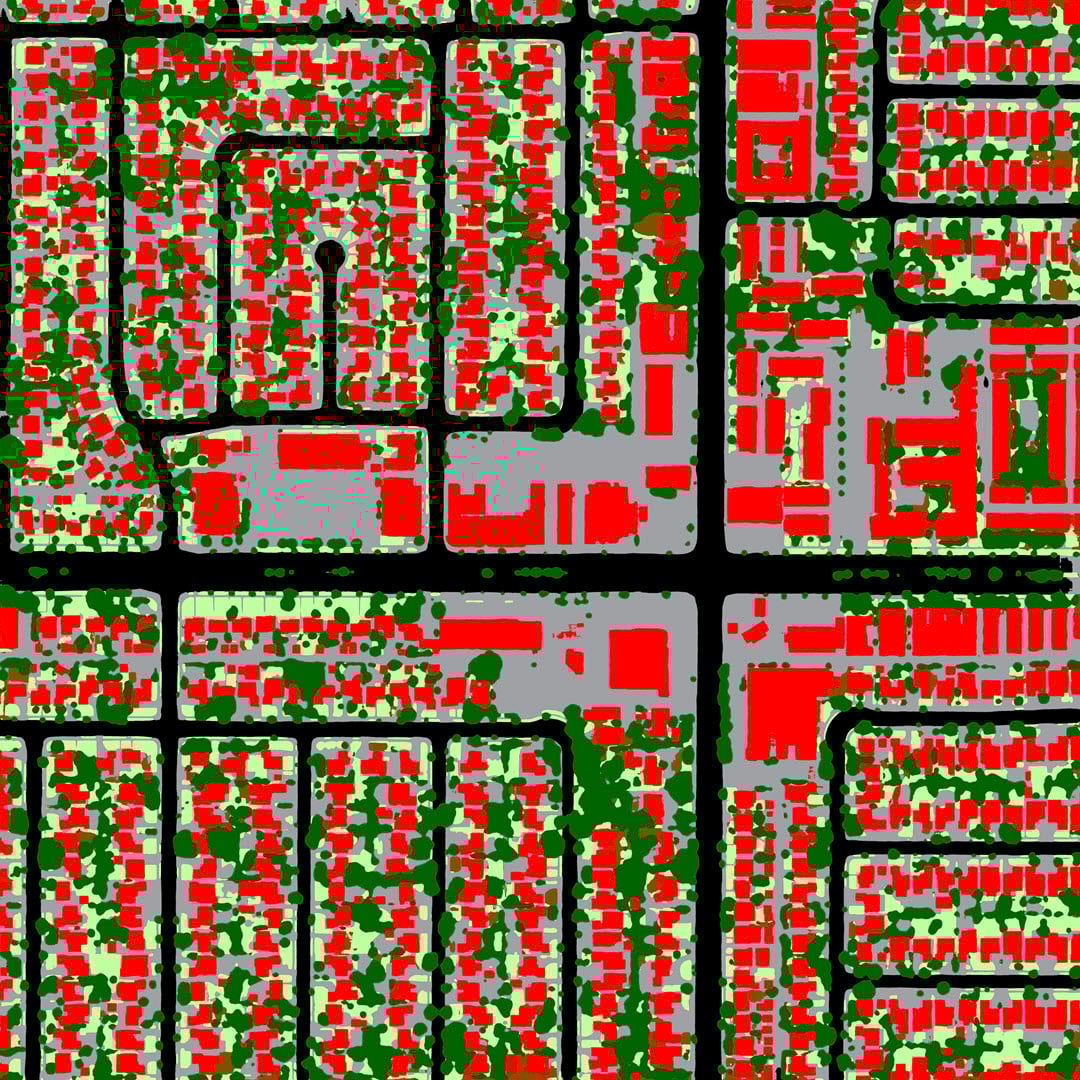
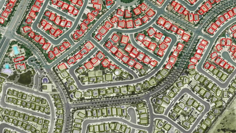
Building Footprint Extraction – China
Digitizing building footprints from imagery is a time-consuming task and is commonly done by digitizing features manually. Use this deep learning model to automate this process; reduce time and effort required for acquiring building footprints in China from high-resolution (15–25 cm) imagery.
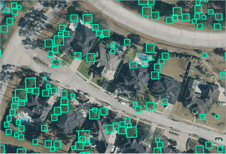
Tree Detection
Tree detection can be used for applications such as vegetation management, forestry, urban planning, and so on. This deep learning model is used to detect trees in high-resolution drone or aerial imagery.
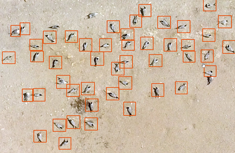
Seabird (Tern) Detection – Africa
The Royal tern and Caspian tern are two of 350 seabird species. These adult terns could be of size 45-60 cm weighing 350-750 gm. Their size puts them in the category of small objects and thus we need very high-resolution imagery to detect them. This deep learning model helps automate the task of detecting seabirds (Royal and Caspian terns) from high-resolution aerial imagery to help map effective site protection areas for seabirds.
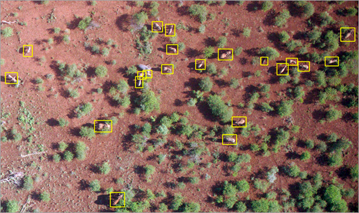
Elephant Detection
Elephants are the largest terrestrial living species and are endangered due to many reasons. To avoid life-threatening incidents, and for their conservation, monitoring the elephants and their movements is of high importance. This deep learning model helps automate the task of detecting elephants from high-resolution aerial imagery.
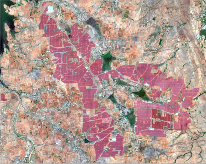
Solar Photovoltaic Park Classification
Solar power is a clean source of energy. To replace conventional power sources, solar power generation must be scaled which is done by creating large solar photovoltaic parks. Traditional ways of obtaining information on these solar photovoltaic parks, such as surveys and on-site visits, are time consuming and error prone. Use this deep learning model to automate the process and reduce the time and effort required for solar park classification.
Country Classification
Accurate locations of people or places of interest are important to drive business and improve government services. For accurate location, correctly geocoding addresses is necessary. This deep learning model can be used to classify addresses into their respective countries. It categorizes incomplete addresses by automatically assigning the country they belong to.
Named Entity Recognition
This deep learning model is used to identify or categorize entities from text. An entity may refer to a word or a sequence of words, such as the name of an organization, person, or country, or date, or time, in the text. This pretrained model detects entities from the text and classifies them into the predetermined category.
Cloud Mask Generation (Sentinel-2)
Satellite based remote sensing sensors often encounter cloud coverage, due to which clear imagery of the earth is not collected. The clouded regions should be excluded, or cloud removal algorithms must be applied before the imagery can be used for analysis. This model can be used to automatically generate a cloud mask from Sentinel-2 imagery, with three classes of varying densities of clouds.
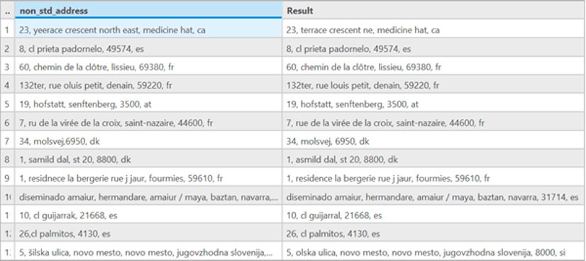
Address Standardization
The Address Standardization pretrained model is used to transform incorrect and nonstandard addresses into standardized addresses. Address standardization is the process of formatting and correcting addresses in accordance with global standards. It includes all the required address elements (street number, apartment number, street name, city, state, and postal code) and is used by the standard postal service. This deep learning model is trained on an address dataset provided by openaddresses.io and can be used to standardize addresses from 10 countries.
Conclusion
To access these pretrained deep learning models, navigate to ArcGIS Living Atlas of the World and search for “dlpk packages” to view the library. Each model includes helpful documentation to get you started.
Have questions? Reach out in the Imagery & Remote Sensing community and we can assist you with your inquiries.
What other pretrained models would you like to see?


Article Discussion: