Some content referenced in this article may no longer be available as the COVID-19 situation progresses.
This is a joint blog post co-authored by Kyle Watson and John Nelson. We will walk through how to create a regionalization of the healthcare-asset environment in light of the ever-changing challenge of Coronavirus and Covid-19.
Definitive Healthcare has generously made available their hospital bed count data based on hospital point locations to Living Atlas. We have looked at this data at a county-aggregation to get a per capita sense of beds (in the context of other risk factors), and extended that concept by tallying hospital beds into the transportation-based economic territories of Craigslist Zones.
In conversations with health professionals, we are hearing that it’s not about hospitals themselves but their number of beds that is the commodity of understanding the allocation of staff and equipment as health systems adapt to combat the virus. This has been specifically affirmed recently, for example, in this Detroit News article wherein John Fox, CEO of Beaumont Health, points out the current task of balancing beds regionally to flex with demand…
…the distribution should be balanced within the region, Fox said. And hospitals should not have to send a patient to an outstate location three hours away when there are openings within the region, he said.
“The hotspot in Michigan right now is Region 2,” Fox said. “You have some hospitals on total overload and some on less.
“The purpose of the state, from an emergency management standpoint, is to even it out.”
Using the Definitive Healthcare beds as an input, the Business Analyst tools can generate balanced territories of roughly equal bed counts. Why? Resources, staffing, and materials need to be distributed efficiently and effectively in balance with beds. If this is something you are interested in generating, here is how to do it…
1. Bring in the hospitals/beds data and set up the Create Territory Solution. The territory solution is the foundational structure for all-things-territories, based on the input layer.
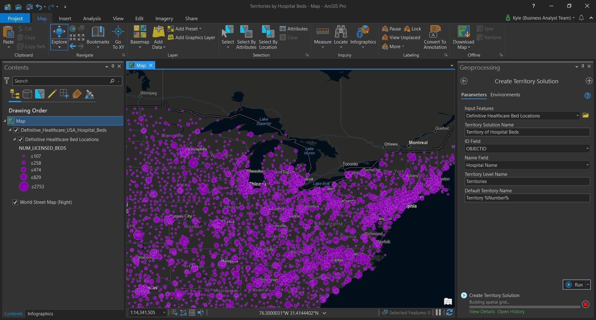
Once created, the territory solution layer activates a context menu at the top with options for working with territories.
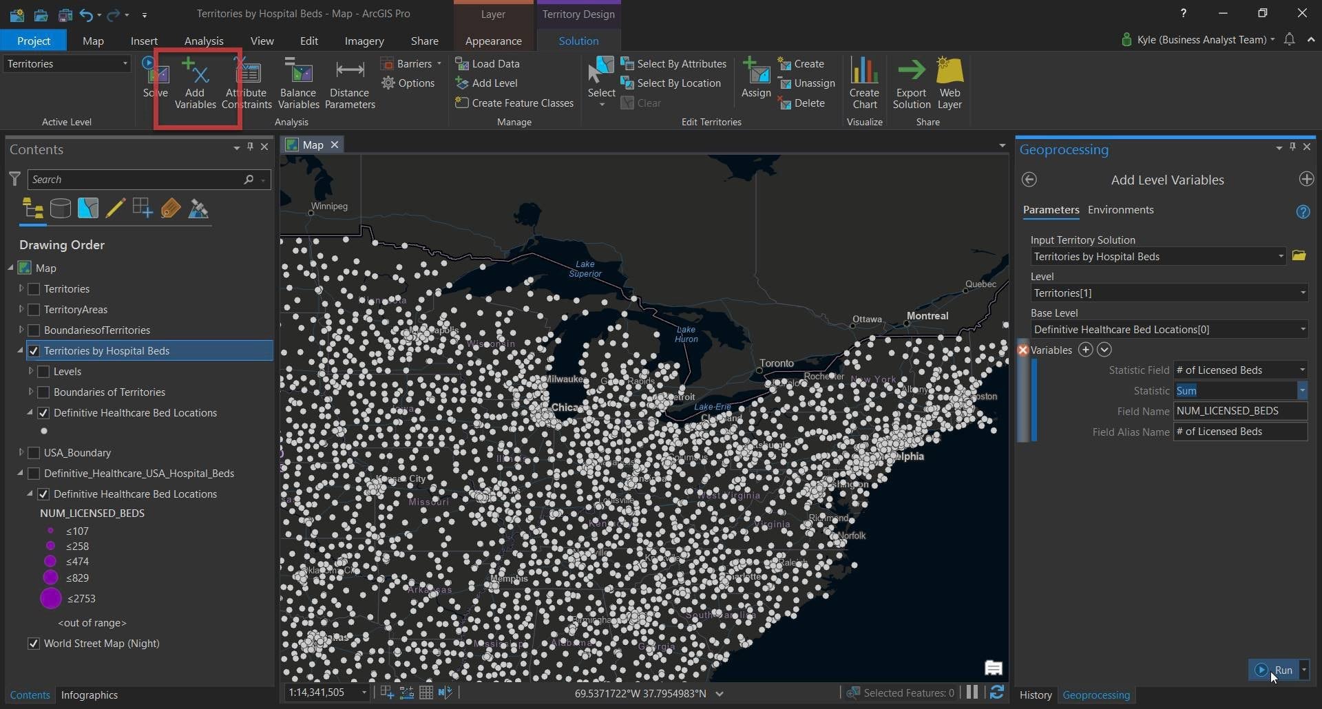
2. Adding variables lets you tell the system what rules you want to apply to the territory creation. In this case we will keep it very simple and generate territories based on a balanced number of beds, so we’ll need to add those up.
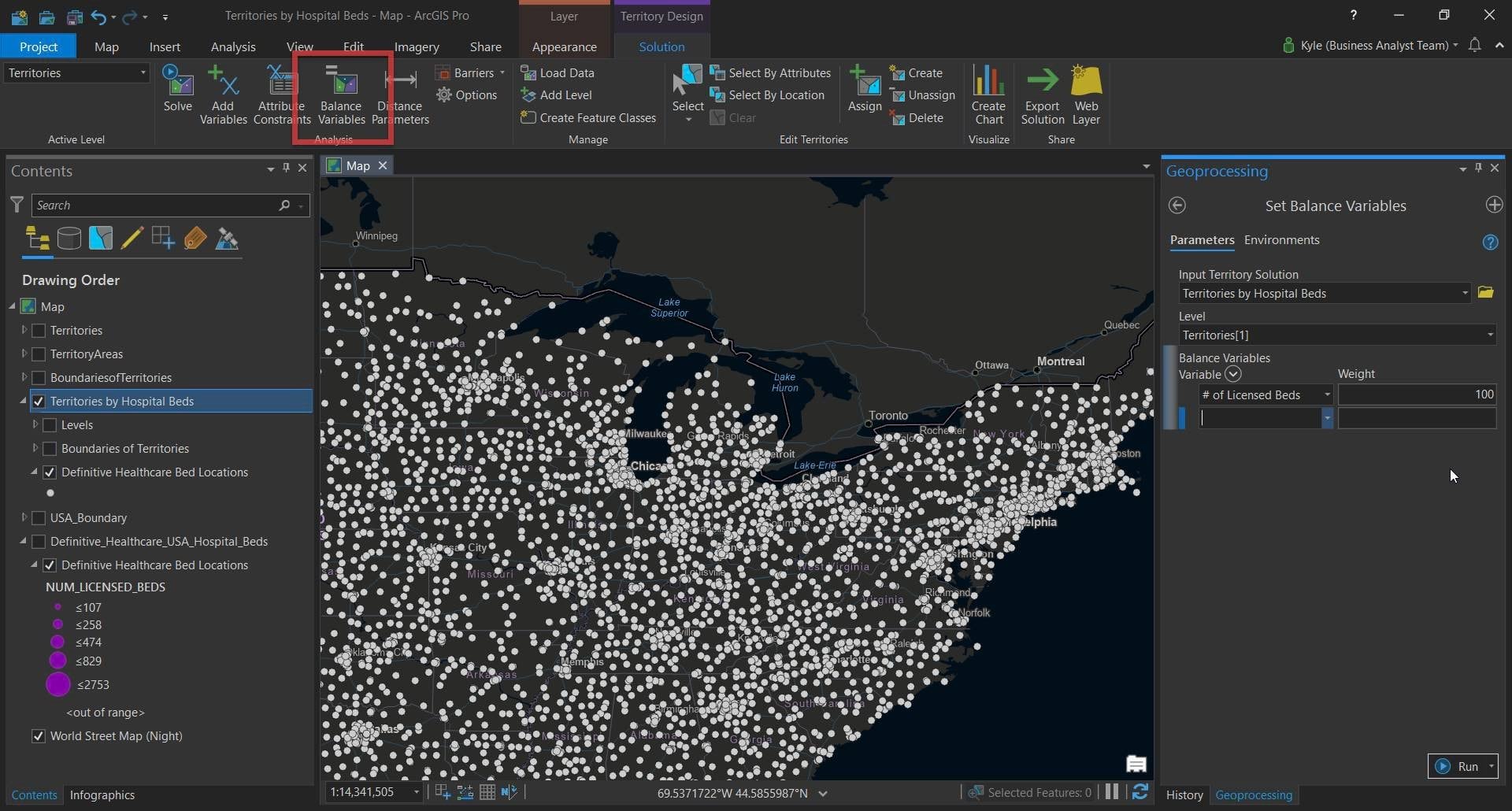
3. Next we tell Territory Design how to equally distribute territories. In this example we apply a simple balancing based 100% on the number of beds. This could be enhanced to also consider ICU beds, staffing, protective equipment, number of facilities, the proportion of elderly or vulnerable population, etc. Whatever data you have.
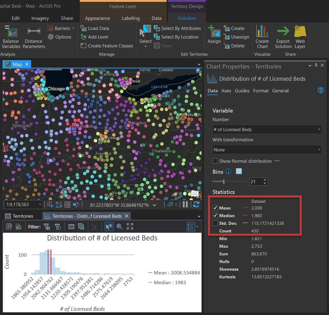
4. Then we apply our settings—we “Solve” it. And we’ll tell the software how many territories to create. Looking at the hospital bed count we know we have approximately 863,000 beds. If we carve out areas of roughly 2,000 beds we’ll need 430 territories. 2,000 seems like a reasonable size to manage, but of course this is flexible based on your needs. The Solve operation generated 430 territories based on these very limited inputs. This geoprocessing took around 5 minutes.
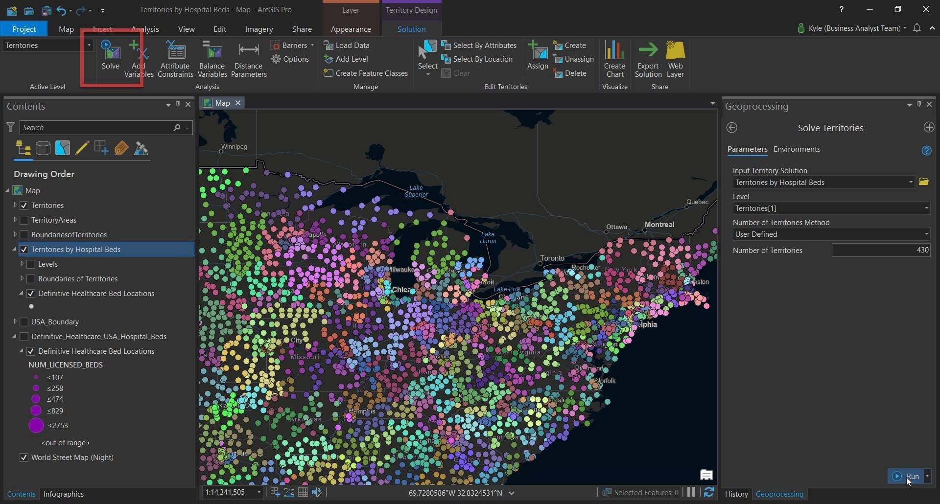
That’s it. All input hospital locations (and their constituent beds) have been assigned to a new territory, with each territory representing roughly 2,000 beds.
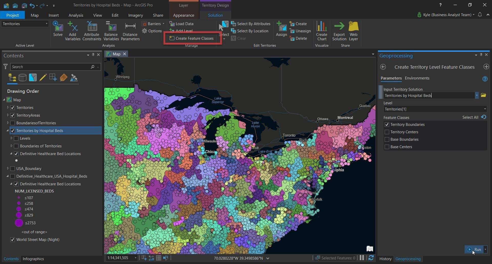
Lastly, and optionally, we can create polygons to encompass these areas so that we can enrich these nascent hospital bed territories with critical underlying demographic, economic, or industrial data. This aids in benchmarking, impact planning, and supply-chain consideration.
These territories represent a few minutes of work, and can of course be improved with additional constraints as-needed, like distance thresholds, state boundaries, and refining coastal orphans. But the most practical application will likely be the fast adaptive re-balancing/re-drawing of these territories as field hospitals are constructed in areas of punctuated need.
In a follow-up post we’ll walk through the process of isolating an area and re-balancing the territories as new beds come online in the form of field hospitals.
For additional GIS resources around the response to COVID-19, please visit this hub.
Be safe and plan well, Kyle and John


Article Discussion: