The March ArcGIS Online release includes demographic data updates for several countries. These updates are available through any apps that access Living Atlas maps or enable data enrichment, reports, and infographics. Read on to learn more about what’s new or jump ahead to learn how these updates affect you.
United States
- Updated Traffic Counts from Kalibrate (18.3, Q4 2018)
- Updated Business Locations from Infogroup (January 2019)
- Updated Major Shopping Centers from Directory of Major Malls (January 2019)
- Updated Crime Indexes from Applied Geographic Solutions (2018B)
Also new in this release is the availability of Crime data for data enrichment, reports, and infographics. Now you can obtain Crime Index data for custom areas and display it in reports and infographics. A standard Crime Summary report provides quick access to this data for custom, and standard, geographic areas.
Advanced Data for the Netherlands from 4orange
Working with Esri Netherlands, we are happy to announce the release of a new advanced dataset from 4orange in ArcGIS Online. 4orange has been collecting data from Dutch consumers since 1991 and specializes in marketing efficiency and marketing infrastructure. The information 4orange collects goes beyond just socio demographic characteristics. It includes information about consumers on life stage, their family composition, and their personal interests. The data cover many different topics to characterize and understand markets and are available at low levels of geography.
Annual updates to approximately 1,000 attributes cover:
-
- Demographic & Socioeconomic topics: Households, Population, Age, Education, Household Size, Stage of Life, Habitation, Heating Fuel, Home Value, Housing Type, Year Built, Income, Industry, Profession, Marital Status
- Behavioral topics: Alcohol Consumption, Automotive, Charity, Cultural Engagements, Sports, Internet, Social Media, TV, Pets, Travel, Personal Viewpoints, Buying Behavior, Internet Shopping, Finances, Insurances, Retirement, Mobile Phones
- Segmentation: Personicx Lifestyle Segments
Data are available down to the 5-digit postal code level. With over 33,000 5-digit postal codes in the Netherlands, this means an average of 568 people, or 254 households, per 5-digit postal code.
International Data from Michael Bauer Research
Demographic Updates (from 2016 to 2018)
The following countries were updated with new demographic data from Michael Bauer Research GmbH, and an improved Settlement Points methodology was implemented:
- Middle East: Bahrain, Jordan, Kuwait, Lebanon, Oman, Qatar, United Arab Emirates
- South America: Bolivia, Chile, Ecuador, Paraguay, Peru, Uruguay, Venezuela
- North/Central America: Costa Rica, El Salvador, Panama
- Oceania: New Zealand
Other Improvements
Data for the country of Switzerland are receiving an improved Settlement Points methodology which can impact how data is apportioned. While there are no updates to the demographic data, the improvements may result in differences to demographic analysis.
Improved Settlement Points
Settlement Points are an estimate of likelihood of settlement at low geographic levels (approximately 75m grids). They are used in the aggregation engine (in the GeoEnrichment Service) to apportion and summarize data for both standard and custom areas. For the 2018 release of international demographic data, Esri began releasing improved Settlement Points based on:
- Updated selection of Landsat8 images used to detect rural settlement from 2016 to 2017.
- Updated road intersection data to include all available data in March 2018.
- Updated Urban footprint data from 2013 to 2015. The urban footprint is a selection from MDAUS’s BaseVue classified land cover dataset.
- Removed zero population areas using features from ArcGIS Online basemaps. While these data are not considered complete inventories of these features, each feature used represents an improvement in quality. The purpose is to provide a better estimate of nighttime population, which is the best fit for Esri’s model for apportioning demographic and household spending data: Airports, Cemeteries, Commercial Retail, Education, Emergency Response / Law Enforcement, Golf Course, Government, Medical / Healthcare, Industrial, Local Parks, Transportation.
How will these updates affect me?
For the Ready-to-Use Living Atlas Maps User within ArcGIS Online
Demographic layers and maps have been updated with the latest release of demographic data.
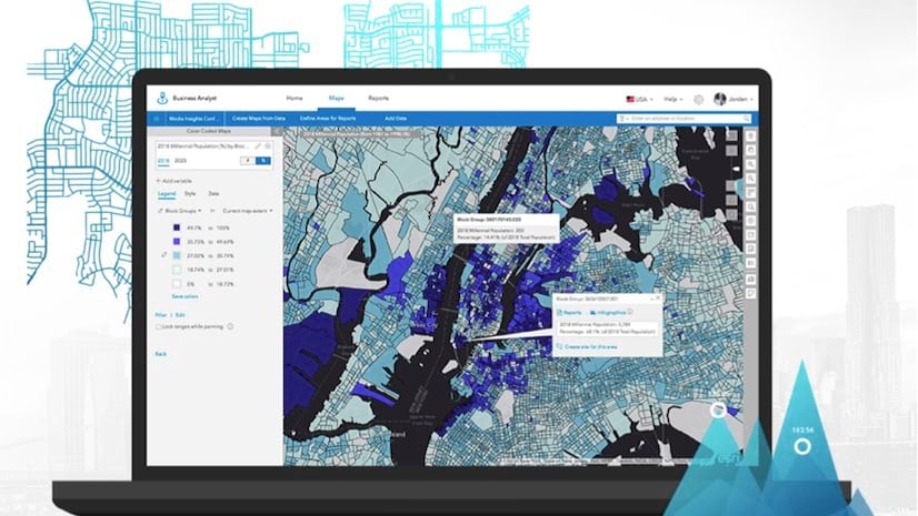
For the Business Analyst and Community Analyst Web App Users
Business Analyst and Community Analyst web app users can access the updated data through reports, infographics, and maps. The complete attribute list for each country is accessible through the data browser contained in the application.
For the Data Enrichment User in ArcGIS Online and Other ArcGIS Apps
The March 2019 update provides access to the datasets shown above. For a detailed explanation of new or deleted attributes in datasets, see the relevant release notes in the documentation.
For the Developer using the REST endpoints of the GeoEnrichment Service
The underlying datasets of the REST endpoints of the GeoEnrichment Service were updated in March 2019. Some of the changes to the REST endpoints included in this release are:
- Changes to the layer IDs of the administrative/statistical boundaries.
- Changes to the layer names of the administrative/statistical boundaries.
- Changes to attributes/analysis variables including additions and deletions.
Because of updates to the underlying data, users of the GeoEnrichment Service may need to update these items in the query parameters of REST requests to the service from their apps. To view the updated REST endpoints, you will need to access the GeoEnrichment Service with a developer or organizational account, using a token request.


Commenting is not enabled for this article.