The ArcGIS Excalibur Team is excited to meet you in San Antonio, Texas at the Esri Booth #439 during the GEOINT Symposium 2019 hosted by United States Geospatial Intelligence Forum (USGIF). Come visit the Esri area from June 3-5 to see a demonstration of ArcGIS Excalibur, ask questions about the application, and to meet the team.
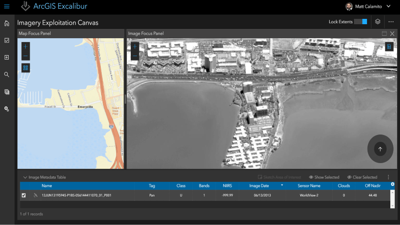
Just released in April 2019, ArcGIS Excalibur v1.0 is a next generation front-end web experience to search, discover, and work with imagery. ArcGIS Excalibur leverages ArcGIS Enterprise to extend its support for working with imagery to include national and commercial sensors and extends the power of the ArcGIS Image Server technology to work with collections of imagery and rasters when performing on-the-fly processing and visualization.

Have a workflow need to combine geospatial content and imagery? Come learn about an Imagery Project, a new and dynamic way to organize resources that are required to complete an image-based task. Projects can include geospatial reference layers to provide users with context in addition to a set of tools to streamline image-based workflows in a focused manner, such as collecting observations from the latest imagery.

Come check out ArcGIS Excalibur at the Esri Booth #439 to see how you can enhance your imagery workflows while utilizing the power of the Esri Geospatial Cloud!
Can’t make it to GEOINT 2019? Visit our ArcGIS Excalibur Website to learn more about the powerful capabilities of ArcGIS Excalibur or contact the team directly at arcgis-excalibur@esri.com.


Commenting is not enabled for this article.