ArcGIS Excalibur is a web-based image analysis app that allows analysts to access, analyze, and share imagery for informed decision-making. In this April release, we’ve made updates to Excalibur to help analysts quickly navigate and identify locations from images. Additionally, there are enhancements to comparison tools that provide better orientation when viewing imagery side-by-side – making it easier to pull precise insights.

Updates to navigating to and identifying locations:
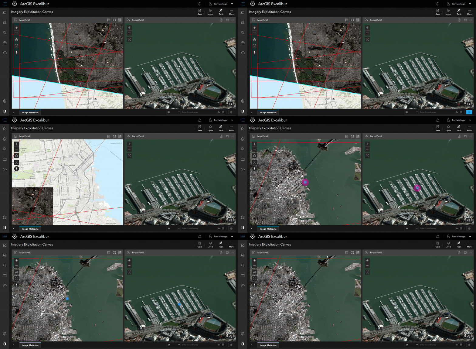
The new Flash Tool allows you to identify a location between the map or image when viewing imagery side-by-side. Using the Flash tool will quickly center on the location in the view that is clicked and in the opposite view at the corresponding location.
We’ve made enhancements to the Layers List to quickly zoom to the extent of any layer. This allows users to zoom to the extent of layers within their Excalibur projects and provides a quicker way to navigate to areas of interest.

Enhancements to comparison and analysis tools:
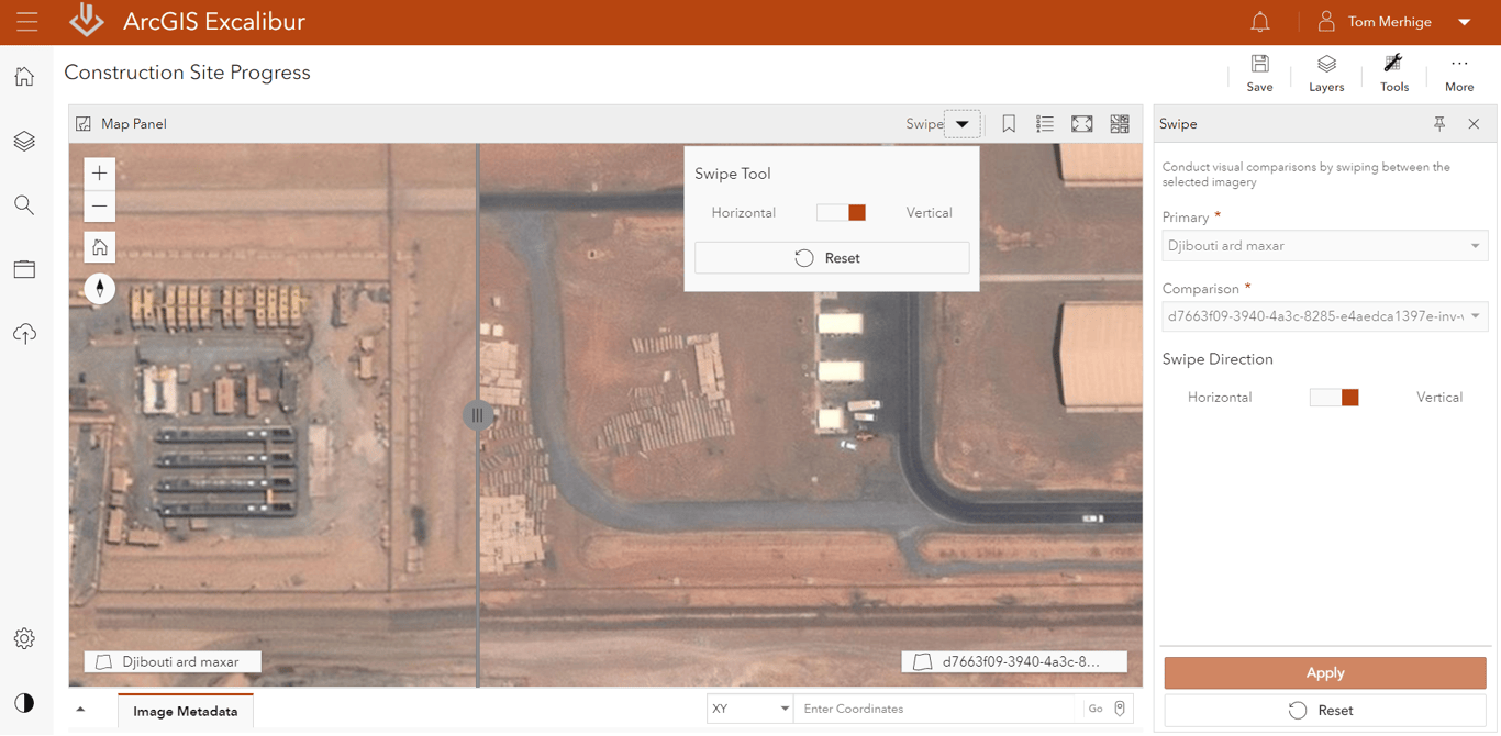
To better see change between two or more images, we’ve updated the Swipe Tool and Flicker Tools to include the display of labels that will further distinguish the primary image from the comparison images. With the Flicker tool, you can now flip between multiple images to see even more change at the same location.
The new Sync Extents feature will sync the extent of the opposite panel to the active panel for sharper orientation when viewing images side-by-side.

ArcGIS Video Server is Coming Soon
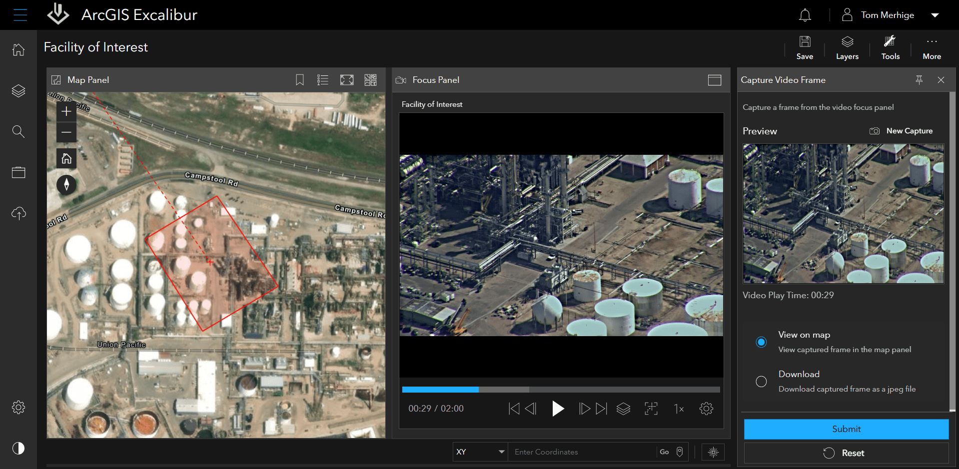
In the coming months, we will introduce a new way to consume, view, and analyze video within ArcGIS Excalibur and other ArcGIS apps. With the new ArcGIS Video Server, users will be able to search for, access, share, and stream video. We will have some new exciting tools that will capture a single frame from the video as a still image to perform further analysis on or to download as a jpeg file and share.
Sign up to be notified when ArcGIS Video Server is available
Get Started Today
Administrators can go to My Esri to download, install, and assign the latest version of the ArcGIS Excalibur app to users in their organization. Users can access ArcGIS Excalibur via the portal app launcher once logged in.
We’re here to support you. To learn more about how ArcGIS Excalibur can add value to your imagery workflows, get in touch with an Esri representative at go.esri.com/excalibur, visit the Esri Community page, and explore the new Resources Page.


Article Discussion: