The June 2026 release of ArcGIS Experience Builder in ArcGIS Online brings new capabilities for multilingual apps, data collection, imagery analysis, and accessibility. Highlights include a new translation system and Language Switcher widget, the QuickCapture and Image Change Detection widgets, dynamic attributes created with Arcade expressions, and data source-level message actions. The release also delivers numerous enhancements across widgets, data sources, themes, and accessibility. Let’s explore what’s new.
Quick links:
- Multilingual apps
- QuickCapture widget
- Image Change Detection widget
- Dynamic attributes
- Enhancements
- Accessibility updates
- More info

Multilingual apps
Translation system
Making apps available in multiple languages is now easier with the new translation system in Experience Builder. In the General settings, you can open the Manage translations panel to add and manage translations for app authored text, including widget names, button labels, Text widget content, messaging, etc.
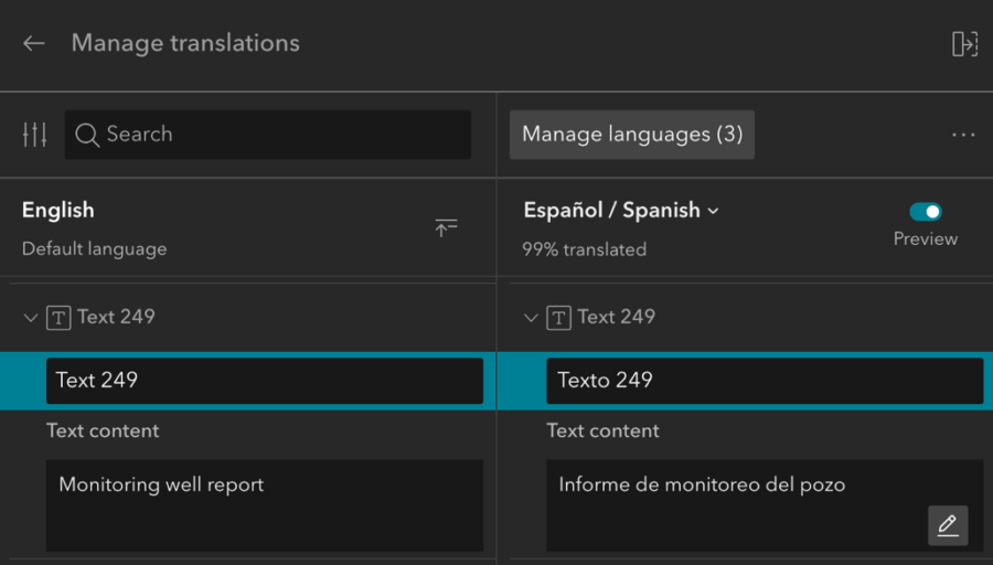
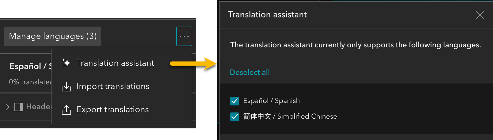
You can enter translations manually, import and export translation files, or use the translation assistant to generate translations.
Navigate text
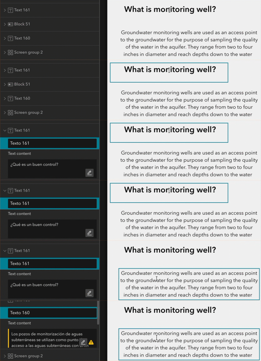
Text in the translation panel is organized by pages and windows. There are two ways to find text in the translation panel. One is to use the Search box. The other is to click the widget on the canvas, then the corresponding widget and text will be highlighted as shown below.
Edit text
When needed, click the pencil icon to open the rich text editor to edit text and adjust properties like font size, color, etc. You can also click the Expand icon to review translations in all selected languages.
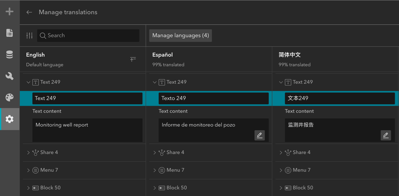
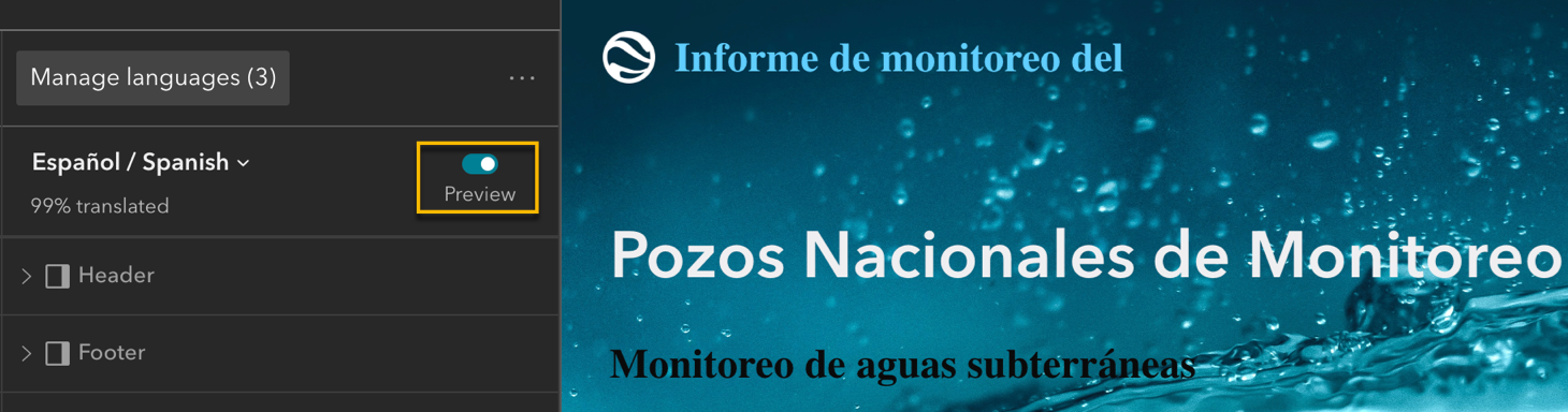
Additionally, you can preview the translations for a chosen language in the app within the builder.
Language Switcher widget
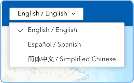
With the new Language Switcher widget, app users can easily switch the language using a drop-down menu. You can also use URL parameters to open an app in a specific language.
QuickCapture widget
The new QuickCapture widget integrates with ArcGIS QuickCapture, allowing you to add fast field data collection workflows directly to your apps. With its large-button interface, the widget helps streamline coordination between command centers and field teams and enables rapid data capture.
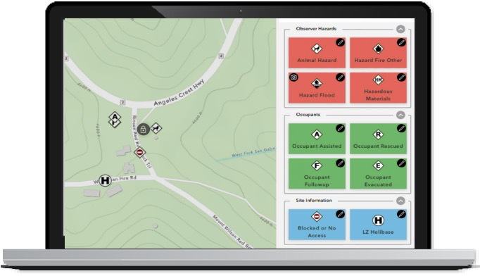
Image Change Detection widget
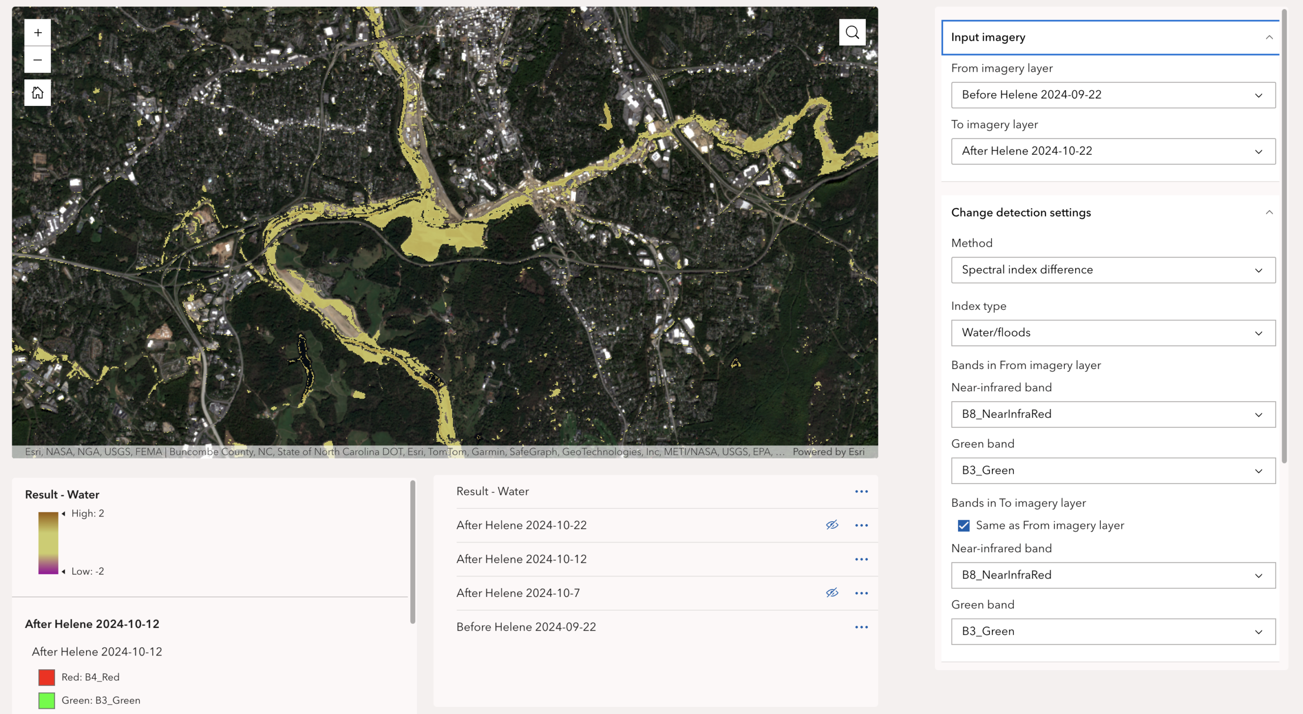
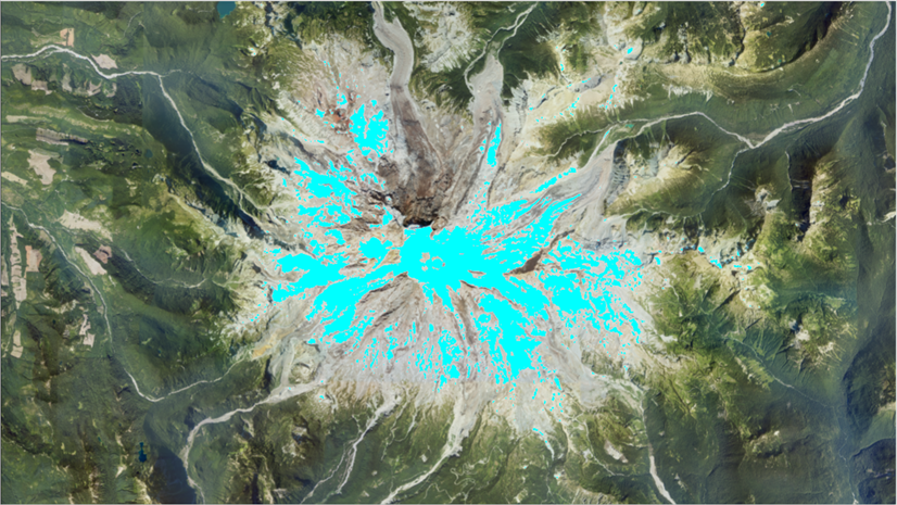
With the new Image Change Detection widget, you can compare imagery layers and identify where change has occurred. For example, you can use the widget to assess changes in vegetation health, surface water, burn severity, built-up areas, and other landscape conditions using spectral change, image index change, and pixel value change methods. For more information, see the What’s new in imagery in ArcGIS Online (June 2026) blog.
Dynamic attributes
Create dynamic attributes from existing attributes in layers using Arcade expressions and use them in widgets such as Table, Text, Search, Button, Embed, and Image.
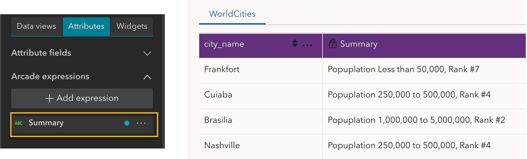
In the above example, a dynamic attribute named Summary is created using the following Arcade expression:
return "Population " + $feature.POP_CLASS + ", Rank #" + $feature.POP_RANK
In the Table widget, select Customize under Configure fields , and you will find dynamic attributes listed at the end of the attribute field list.
You can also reuse Arcade expressions already configured in web map pop-ups, eliminating the need to recreate the same scripts and helping maintain consistency across your app. When available, a suggestion panel automatically appears in the editor, allowing you to select an existing expression and create a new dynamic attribute directly from it.
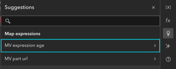
Note: Dynamic attributes are available for display purposes only and cannot be used in queries or filters.
Enhancements
Chart widget
You can create combo charts that combine bar and line series in a single chart.
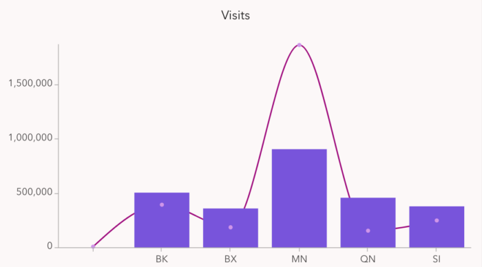
Table widget
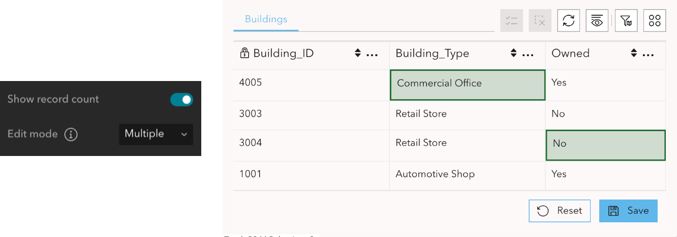
You can save edits to multiple records at one time. When the Edit mode is set to Multiple, Save and Reset buttons appear after making edits, and highlighted cells indicate unsaved changes.
Print widget
You can use the Custom Layout Printing service in ArcGIS Online to generate branded and large-format map prints. You can also save the print to your content.
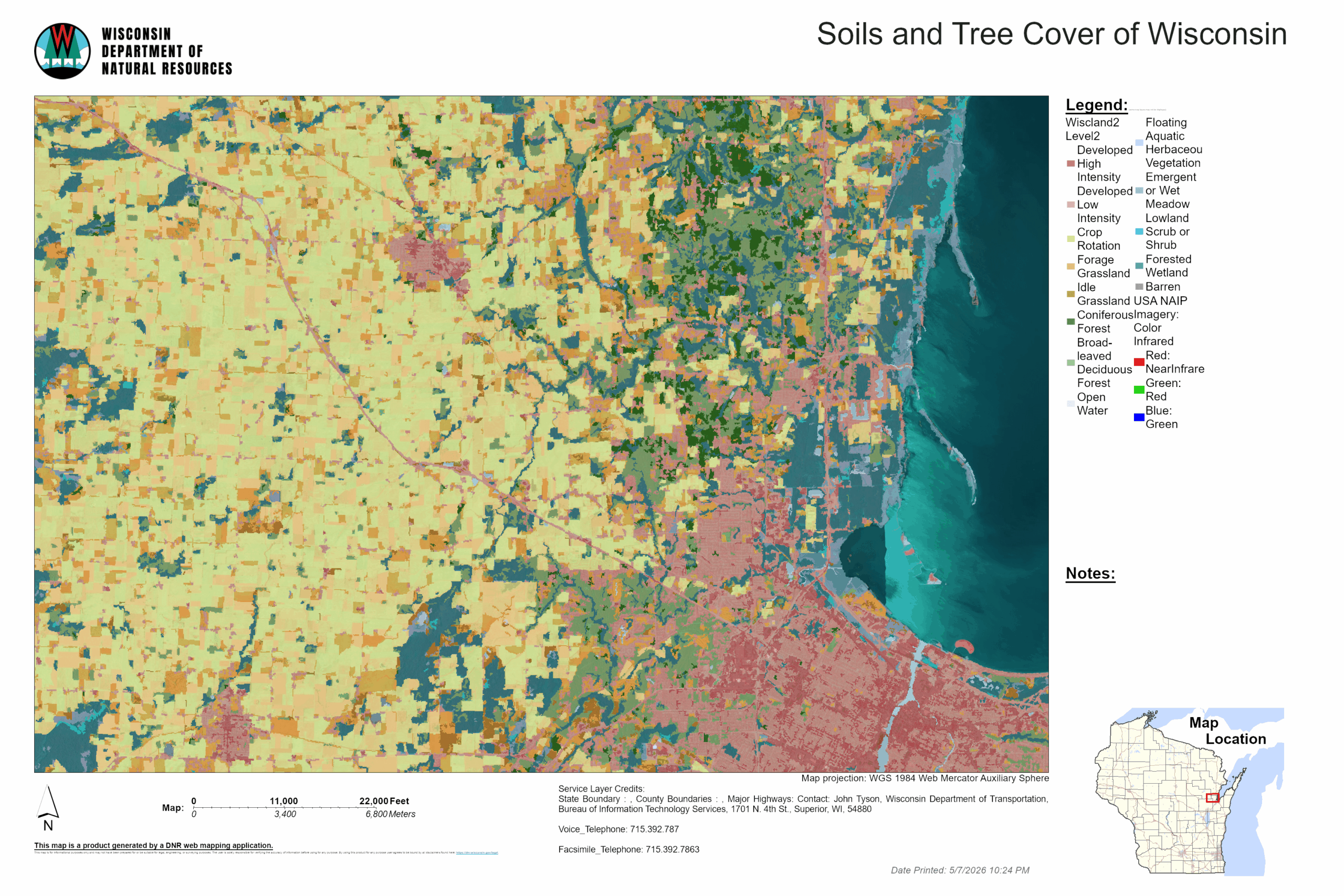
Note: Currently it requires ArcGIS account users and consume 5 credits per print.
Map widget
A loading indicator appears at the top of the map to communicate if map data is updating or the extent is changing.
Near Me widget
Like what we could in Web AppBuilder, the Near Me widget in Express mode now supports batch configuration with just a few clicks. See the June 2026 ArcGIS Online update: Near Me express mode blog for more information.
Business Analyst widget
The Business Analyst widget introduces several improvements that provide greater flexibility and help optimize credit usage. See the What’s new in Business Analyst widget for ArcGIS Experience Builder | June 2026 blog for more information
List widget
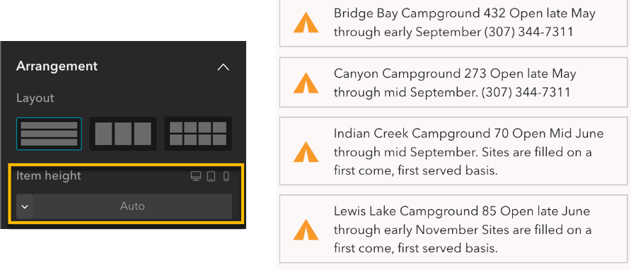
List items can now automatically resize to fit their content when using a Flow template with Auto height settings. This is especially useful for displaying fields with varying content lengths.
Message actions
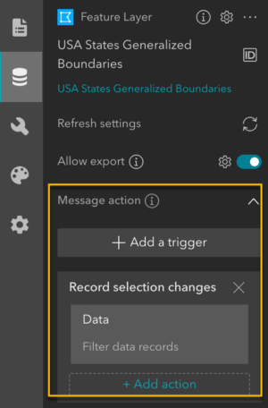
Message actions can now be configured directly at the data source level. This simplifies app configuration and ensures consistent interactions across widgets that share the same data source. Data sources support data filtering and record selection changes message actions.
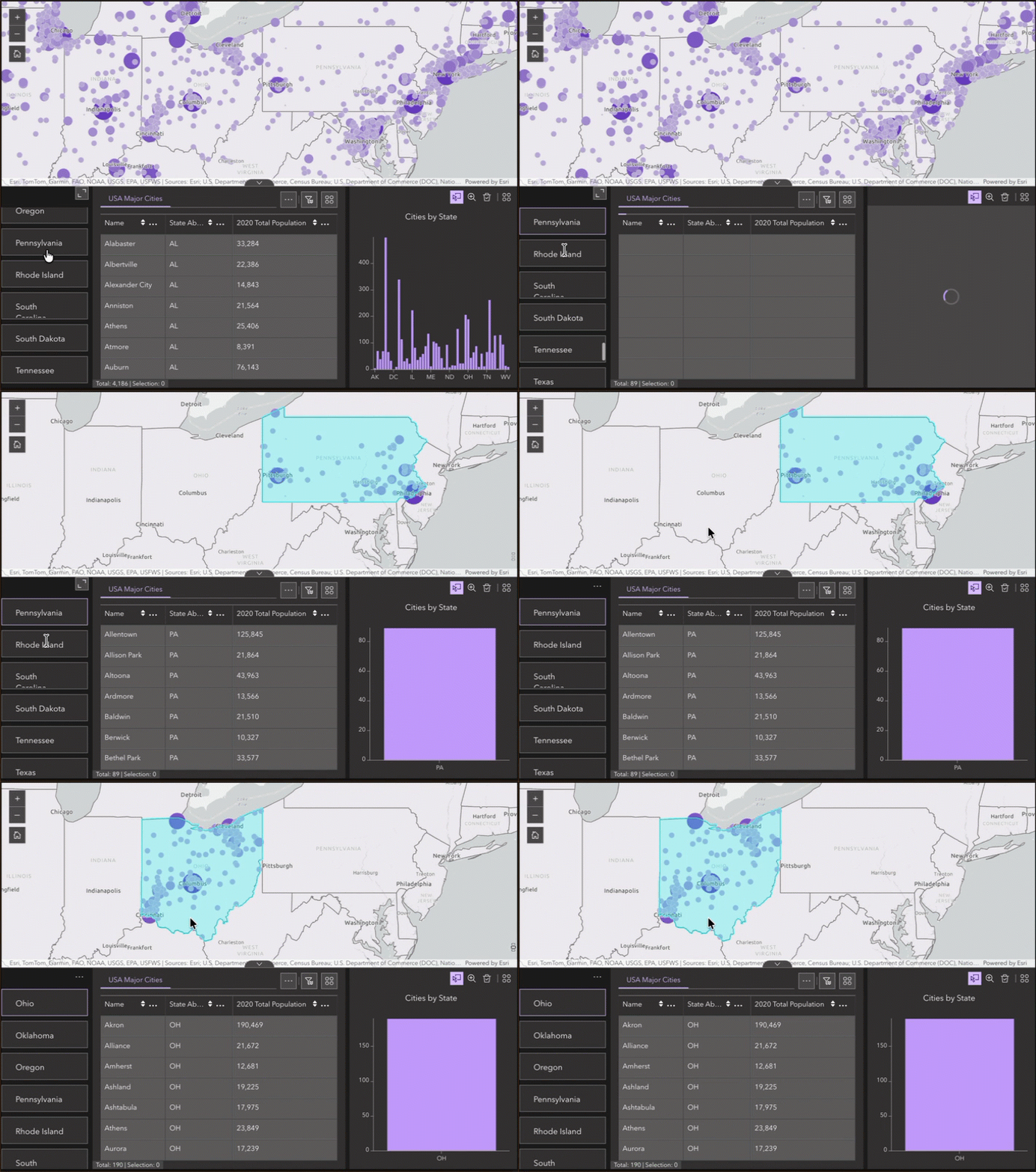
For example, when a user selects a USA state in a List widget, the cities in the Map, Table, and Chart can all be filtered automatically. Likewise, selecting a state on the map can filter the corresponding cities in the table and chart.
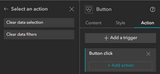
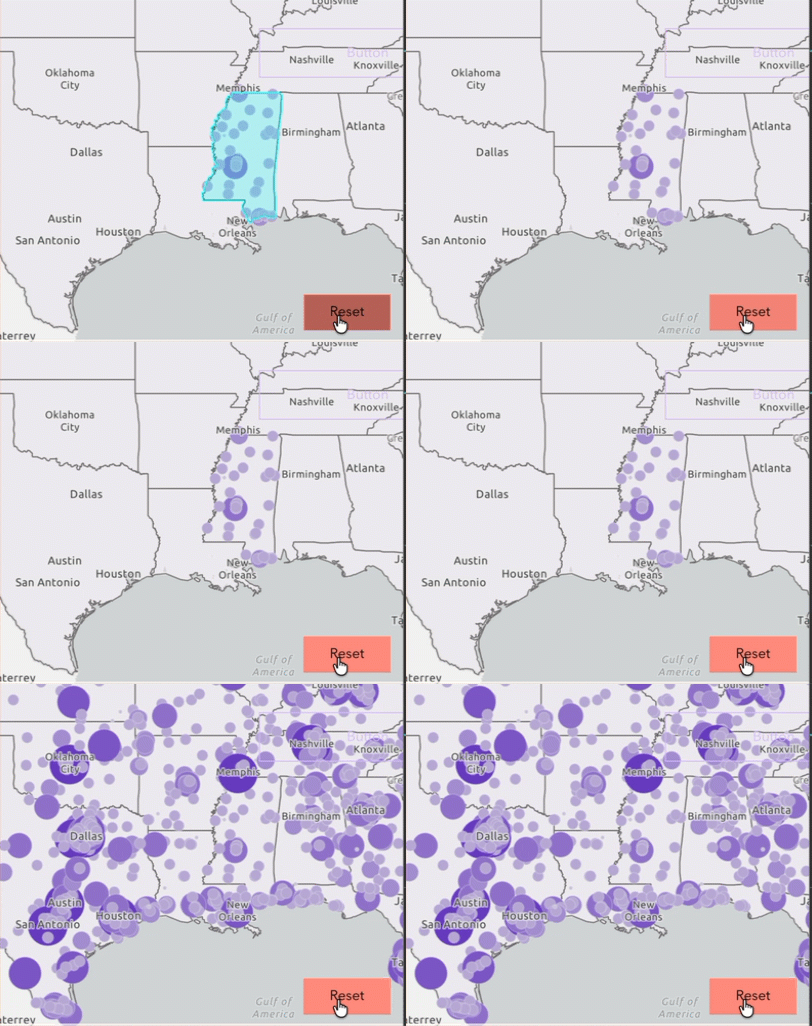
Two new message actions—Clear data filters and Clear data selection—make it easy for users to reset filters and selections for all data with a single click.
Knowledge Graph Layers as Data Sources
Experience Builder now supports knowledge graph layers as data sources for most widgets. You can connect, visualize, filter, and interact with complex networked data directly in your apps.
Theme
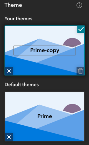
Custom theme changes, such as uploaded Google Fonts, are now automatically saved as Your themes. Custom themes can be renamed, reused, and included in app templates, making it easier to experiment with different designs and maintain consistent branding across apps.
Accessibility updates
This release includes several accessibility improvements:
- Assign ARIA landmark roles to pages, layouts, and supported widgets.
- Add accessible names to Sidebar widget buttons using tooltips.
- Announce page changes when navigating with the Menu widget.
- Accessibility support in the Language Switcher widget.
- Accessibility optimizations for the Timeline widget and Comparatist template.
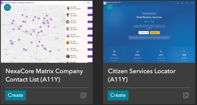
New accessible templates demonstrate best practices for maps and spreadsheets
From multilingual experiences and new widgets to enhanced data interactions, accessibility, and app customization, the June 2026 release continues to make Experience Builder more powerful and flexible for app creators of all skill levels. Explore the resources below to learn more about these updates and discover best practices for building modern web apps.
More Information
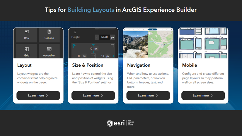
Tips for Building Layouts
Explore the Tips for Building Layouts in ArcGIS Experience Builder blog for guidance and best practices on creating and customizing app layouts.
Add Threat Analysis to Your Maps and Apps
The new Threat Analysis web tool enables rapid visualization of standoff distances and shelter-in-place zones for a variety of explosive threats at one or multiple locations. It supports public safety planning, training exercises, and emergency response scenarios. Learn more in the Add Threat Analysis to your maps and apps blog.
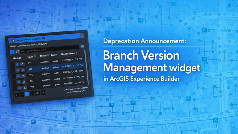
Branch Version Management Widget Deprecation
The Branch Version Management widget is being deprecated and will be retired in a future release. For details and timelines, see the Deprecation Notice blog.
2026 Esri User Conference Content
Explore Experience Builder sessions and presentations during the 2026 Esri User Conference to learn about new capabilities, best practices, and customer success stories.
For a complete list of updates, see What’s New. If you have questions, please contact experiencebuilder@esri.com.
Thank you,
The ArcGIS Experience Builder Team


Article Discussion: