ArcGIS Field Maps is a powerful mobile app solution that streamlines field workflows for exploring maps, collecting and updating authoritative data, and sharing where mobile workers have gone, all within a single location-aware mobile app. Released in November 2020, Field Maps is Esri’s premier, map-centric mobile solution for smartphone and tablet devices.
We have many exciting new development initiatives underway for the November release of ArcGIS Field Maps. We’ve updated the iOS/Android mobile apps and web app to expose some of the new capabilities coming late this fall.
Sign into the Early Access Program and start using our beta apps today! Here is a preview of what’s available now.
Geofencing
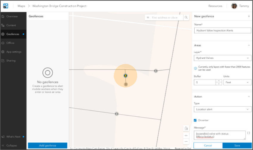
Field Maps now supports adding geofences to your maps so that mobile users can be warned when entering dangerous or restricted areas, provided critical information when approaching a building, tracked only when on company property, and more.
First released in June 2022. Field Maps now supports buffered polyline and point feature layers as a source for geofences, so you can provide local location alerts when a mobile worker crosses a barrier or gate, or is within proximity of a given point of interest or asset.

Creating Maps and Layers
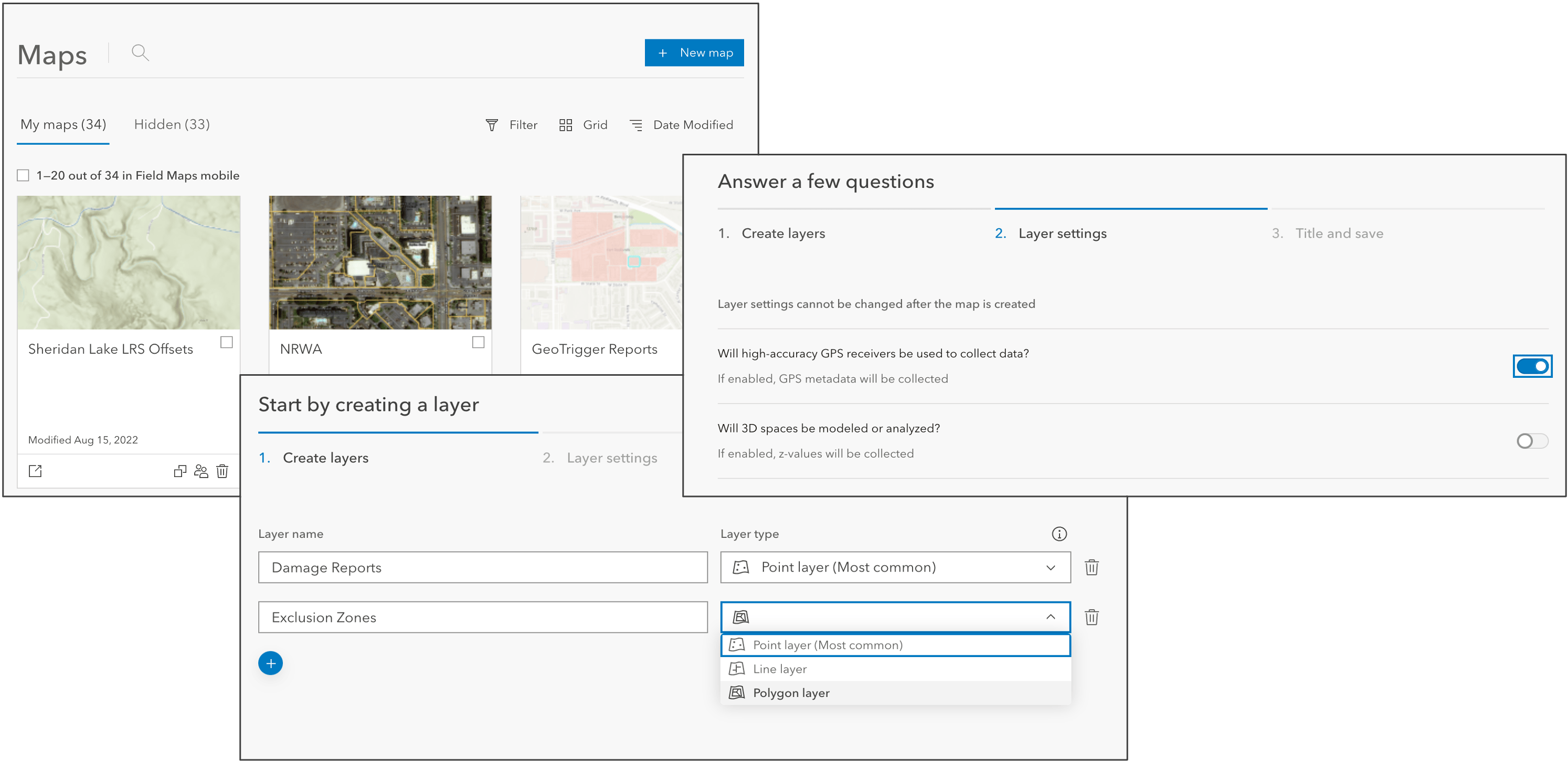
Field Maps now supports the ability to create a new map and feature layers from the Maps page. You can quickly and easily create the layers and map you need to get started authoring your forms for data collection.

Pop-up Elements
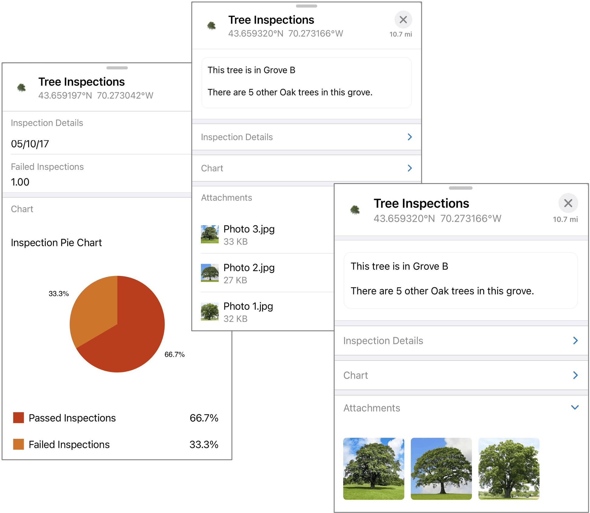
When mobile workers view information about features on the map, they are viewing the pop-up you created for that feature. When creating your map, it’s important to configure the pop-up of a layer with the information mobile workers need to discover.
With the November release of ArcGIS Field Maps, we’re adding support for pop-up elements authored in the new Map Viewer. Now you can provide a curated, informative, dynamic, and compelling experience for both web and mobile users.

IPS and indoor editing
ArcGIS Field Maps works great indoors as well as outdoors! Following our initial integration of a floor filter and ArcGIS IPS, we are continuing to add additional indoor capabilities.
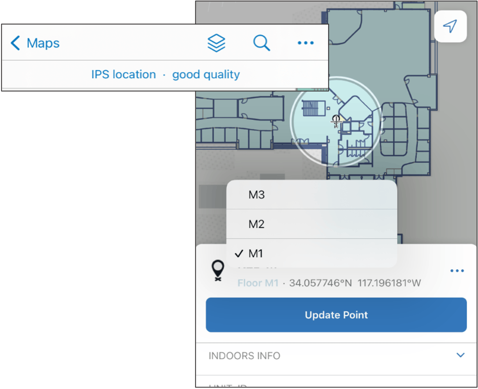
With the fall release of ArcGIS Field Maps, we are making changes to the GPS banner to better support IPS locations by presenting quality information directly in the banner and details such as the source type, floor and transmitters in the location details panel.
Field Maps will automatically set the floor information when collecting a new feature with floor-aware layers too! When mobile workers start a new collection, the floor attribute will contain information about their current floor. If necessary, mobile workers can tap on the floor to change it.

What’s Next?
We continue to introduce new capabilities to ArcGIS Field Maps with each major release. This is the first early adopter release leading to the November 2022 update of ArcGIS Field Maps.
In September, we will have another EAP update that introduces new Layer Filter capabilities – you’ll be able to dynamically filter text and numeric field types within a layer!


Article Discussion: