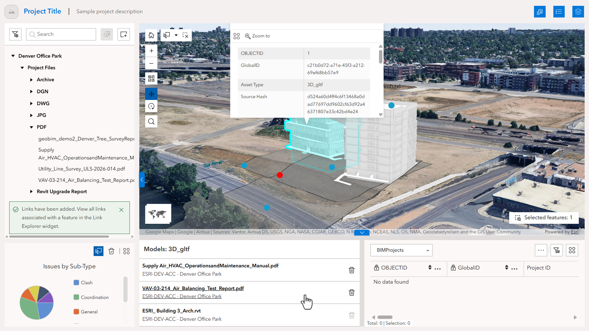
ArcGIS GeoBIM delivers a connected data environment that seamlessly links architecture, engineering, and construction (AEC) information in Autodesk Forma (formerly Autodesk Construction Cloud) with geospatial data and services in ArcGIS. By bringing these platforms together, teams can smoothly collaborate from initial design through operations to empower better decisions and project outcomes.
This update in ArcGIS Online expands how organizations connect BIM and GIS information across project teams. With enhanced ArcGIS Experience Builder integration, it is now easier than ever to create and share tailored applications that enable teams to engage with ArcGIS GeoBIM project data. Additional enhancements provide detailed 3D context through the Google Photorealistic 3D Basemap and support for Autodesk Revit 2027.
Release highlights
Visit the product documentation for more details on the latest enhancements now available in ArcGIS GeoBIM with the November 2026 update of ArcGIS Online. Visit Esri Community to ask questions, share feedback, or submit product ideas.
Connect BIM and GIS further into ArcGIS Experience Builder
These new capabilities in ArcGIS Experience Builder bring stronger BIM and GIS workflows into tailored project experiences, helping teams coordinate work more effectively.
Create connected experiences for ArcGIS Experience Builder
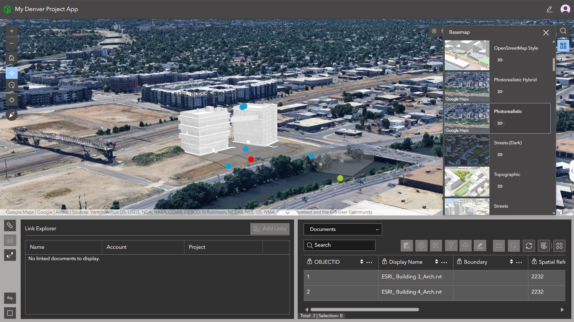
Users can now create and share native ArcGIS Experience Builder apps directly from ArcGIS GeoBIM. Project data is automatically incorporated into the app creation workflow, reducing setup time and minimizing the need to switch between applications. Teams can choose a ready-to-use template or create a custom one for apps that stay synced with ArcGIS GeoBIM for a more flexible, user-friendly experience.
New app template for BIM and GIS project apps
Build apps faster using the new Experience Builder Nexus template designed for connected BIM and GIS workflows between ArcGIS and Autodesk Forma. The template includes preconfigured Autodesk and ArcGIS widgets, helping teams get started more quickly with less setup and configuration. Available both in ArcGIS GeoBIM and the ArcGIS Experience Builder template gallery, it provides a faster path to creating project experiences for visualizing and sharing project data.
Create and manage links in ArcGIS Experience Builder
Users can now add and delete links from the Document Explorer and Link Explorer widgets in ArcGIS Experience Builder. This makes it easier to connect BIM and CAD data with GIS features directly within ArcGIS Experience Builder, reducing the need to switch between apps.
Support for the Google Photorealistic 3D Basemap
Teams can now use the Google Photorealistic 3D Basemap in ArcGIS GeoBIM to place projects within realistic, context-rich 3D environments and digital twin experiences. Support for the Google Photorealistic 3D Basemap in ArcGIS GeoBIM provides another way for users to access detailed city-scale context quickly and can be used alongside an organization’s own data or other rich 3D content from ArcGIS Living Atlas.
Support for Autodesk Revit 2027
ArcGIS GeoBIM now supports working with Autodesk Revit 2027 files in both 2D and 3D views.
Discover more
Get started with ArcGIS GeoBIM tutorial series
If you’re new to using ArcGIS GeoBIM, start learning the basics of preparing your data to create and share your first project and app. Then, advance your skills to collect, monitor, and address project issues with office to field collaboration. With four tutorial series that build on each other, you’ll also find learning content for extending ArcGIS GeoBIM as a system to build custom apps, tailor 3D scenes, and work with schedules.
Tutorial: Prepare your data for ArcGIS GeoBIM
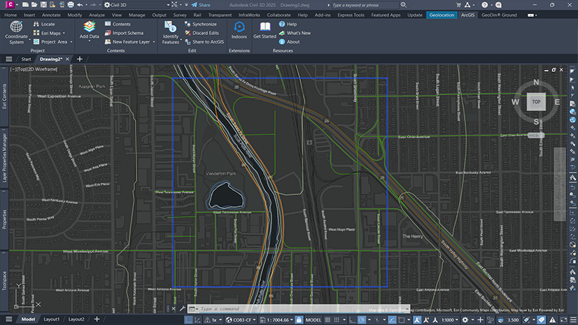
Georeferencing your design files is a critical first step for integrating BIM and ArcGIS. Doing so ensures that when these files are uploaded to Autodesk Construction Cloud and linked in ArcGIS GeoBIM, they align to the correct location on Earth. This helpful guide provides a comprehensive, step-by-step approach to georeference CAD and BIM files entirely within Autodesk AutoCAD, Civil 3D, and Revit. It also covers setup, assigning a coordinate system, and three Revit workflows for establishing shared coordinates.
Learn how to georeference your data
Get started
With a Contributor user type or above, you can view and contribute to ArcGIS GeoBIM projects that have been shared with you in ArcGIS Online and ArcGIS Enterprise 11.4 and higher. To create new ArcGIS GeoBIM projects, you’ll need a Creator, Professional, or Professional Plus user type, along with licensing for Autodesk Forma.




Article Discussion: