August 24, 2020 | Diana Lavery | Constituent Engagement How web map bookmarks benefit ArcGIS StoryMaps
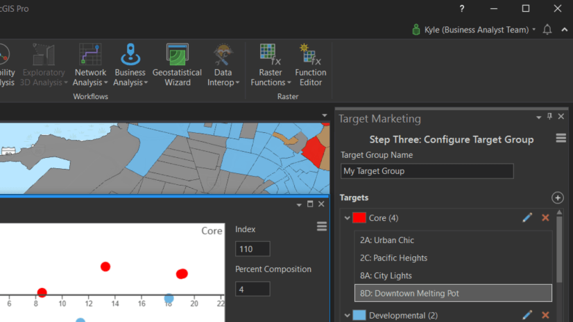
August 24, 2020 | Kyle Watson | Business Target Marketing Enhancements in ArcGIS Business Analyst Pro
August 24, 2020 | Tripp Corbett | Announcements Esri Maintenance Program Summer 2020 Report – Software Updates & Security
August 21, 2020 | Daniel Thibault | Developers Extending Utility Network Services with the ArcGIS Enterprise SDK 10.8.1
August 20, 2020 | Hussein Nasser | Electric & Gas Utilities The Life Cycle of Subnetwork in Utility Network
August 16, 2020 | Multiple Authors | Announcements So Long Internet Explorer 11, and Thanks for All the Views
August 14, 2020 | Madeline Ericson | Announcements Complimentary Software and Training Program for Professionals Extended Through December 31
August 14, 2020 | Katie Decker | Announcements Startups Grow Up: Success Stories from the Esri Startup Program
August 14, 2020 | William Hackney | Constituent Engagement Take your stories and collections anywhere by embedding them
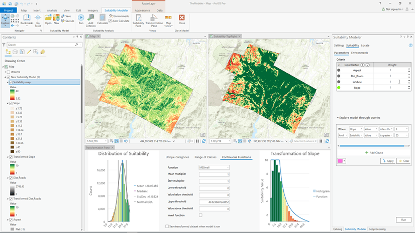
August 12, 2020 | Kevin Johnston | Analytics The new Suitability Modeler: Changing the way suitability models are created
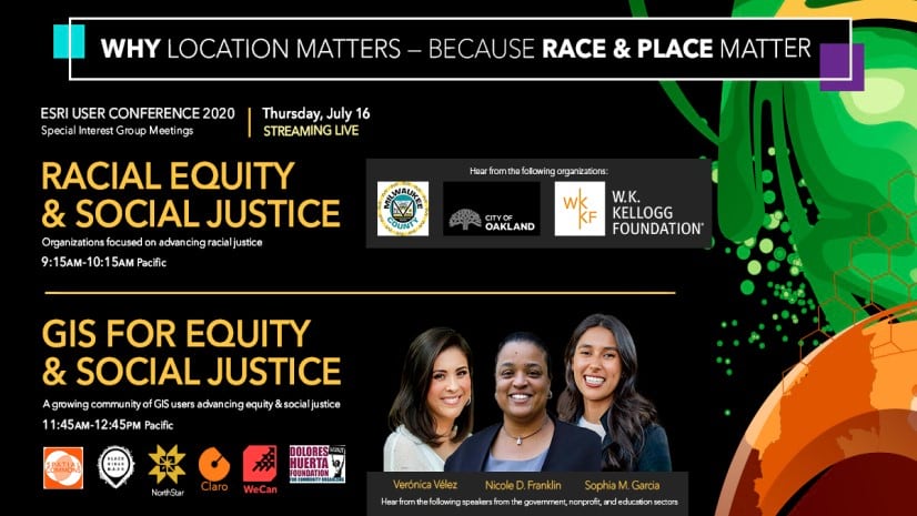
August 12, 2020 | Multiple Authors | Announcements Recap: Diversity, Equity, Inclusion & Racial Justice at the Esri User Conference 2020
August 7, 2020 | Story Maps Community | Constituent Engagement Jeffrey Sachs discusses the critical roles of GIS and storytelling in solving global challenges
August 6, 2020 | Kyle R. Cassal | Local Government How will Census 2020 Differential Privacy Impact You?
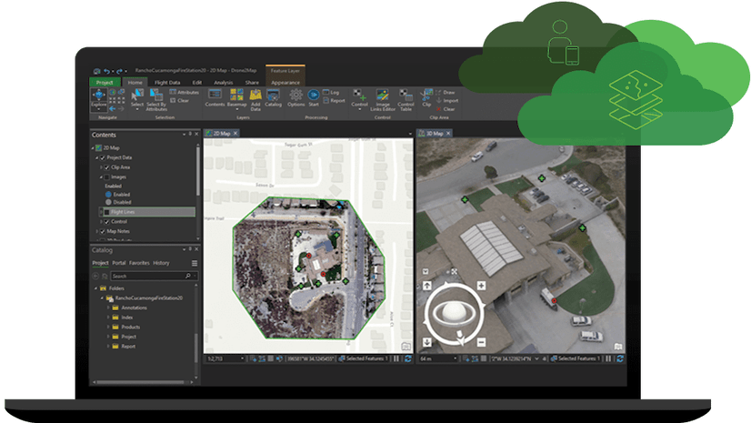
August 3, 2020 | Reanne Barrette | Imagery & Remote Sensing What’s new in ArcGIS Drone2Map (July 2020)
August 3, 2020 | Multiple Authors | Data Management Introducing Nonspatial Objects in ArcGIS Utility Network
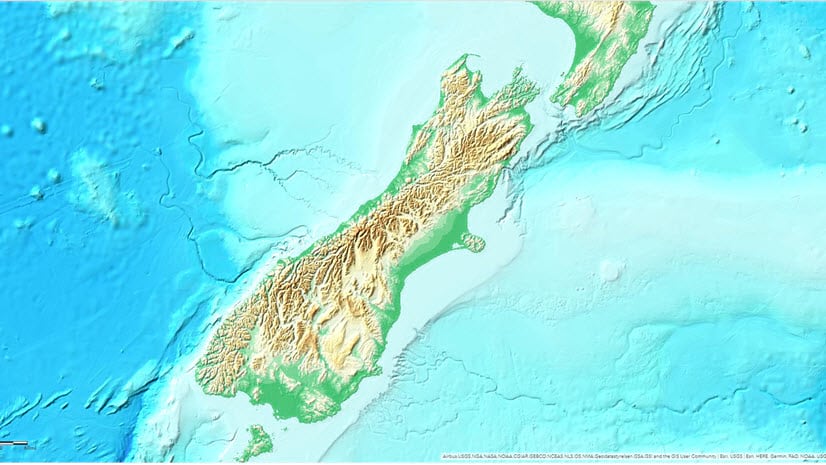
August 3, 2020 | Rajinder Nagi | Imagery & Remote Sensing High resolution data updates to Living Atlas World Elevation Layers (July 2020)
July 29, 2020 | Heather Moe | Transportation Fleet Routing with the VRP Solver: VRP Layer and Ribbon in ArcGIS Pro
July 29, 2020 | Michael Dangermond | Natural Resources Is Georgia still the Peach State? Getting crop statistics for the USA using ArcGIS Living Atlas.
July 22, 2020 | Allen Carroll | Mapping Out of Eden: walking, mapping, and learning with Paul Salopek