We have learned to think globally. By understanding our common history, and our common vulnerability, we can also grasp our common interests and values. In that way, we can also find a path to shared prosperity and peace.

Jeffrey Sachs is a world-renowned economist, bestselling author, innovative educator, and global leader in sustainable development.
He is the President of the United Nations Sustainable Development Solutions Network (SDSN) and Director of the Center for Sustainable Development at Columbia University. He currently serves as an SDG Advocate under UN Secretary-General António Guterres.
Sachs’ most recent book—The Ages of Globalization: Geography, Technology, and Institutions—published June 2020, sheds light on how geography, technology, and institutions have shaped human history over the last 70,000 years, and how understanding these forces throughout history can help inform how we handle them in the present and future.

What are the Sustainable Development Goals?
In 2015, 193 world leaders agreed to an ambitious set of 17 Sustainable Development Goals, SDGs, to be achieved by 2030. These goals function as a blueprint to achieve a better and more sustainable future for all, addressing issues such as poverty, hunger, gender equality, and climate change.
The SDGs, part of the 2030 Agenda for Sustainable Development, rely on concerted effort and collaboration across all sectors and industries, governments, and civil society members; whether you’re a government leader, businessperson, policy maker, educator, or student—everyone has a role to play in helping to achieve these Global Goals.
The Covid-19 pandemic has made them more urgent than ever, first, as guideposts for “leaving no one behind” as we fight the epidemic, and second, as a trajectory for building back better through the goals and precepts of sustainable development.
Why is geospatial data important for the SDGs?
When I was training in economics, we did not have modern GIS tools at hand. We may have looked at maps, but the data for our statistical models came mostly from national income accounts, or state and local data. Much public policy was therefore blind to geography. Policy decisions on poverty, schooling, healthcare, even infrastructure, was taken with far too little regard for the spatial distribution of real needs and opportunities.
Now we can do vastly better because of the powerful GIS tools and massive digital data now available.
Indeed, to meet the SDGs, we absolutely need reliable, quality, and timely geo-spatial data, for example to monitor environmental changes in real time (climate change, deforestation, pollution) and to assess by region the most urgent economic needs (poverty, hunger, access to healthcare and education, access to safe water and sanitation, and so forth). Real-time geo-spatial data is crucial for implementing urgent policies such as controlling the Covid-19 epidemic, and for holding governments accountable for their commitments.

Most of the traditional national-level poverty data and even deforestation data from developing countries are many years out of date. Yet satellites take detailed images of the entire Earth twice a day, and online information allows in principle to collect vast information on daily living conditions in all parts of the world. We just haven’t mobilized the SDG community yet to harness this vast flow of relevant information. When we do, we will confirm the huge benefits of having geographically specific information on critical challenges including hunger, poverty, epidemics, forest fires, droughts, migration, and the like, are of which all geographically clustered and follow distinctive spatial pathways and dynamics.

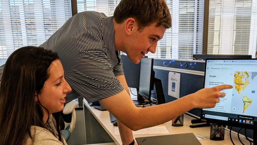
To help harness the vast treasure-trove of geographically referenced SDG-relevant daily data, SDSN, in partnership with Esri, launched SDGs Today: The Global Hub for Real-Time SDG Data. SDGs Today not only features real-time and timely geospatial data for the SDGs, but also houses educational and training resources to empower this generation and the next with the GIS skills and resources to be leaders in sustainable development.
What’s the role of storytelling?
Today’s leaders in sustainable development require skills both in the rapidly expanding range of geospatial data and GIS tools, and in the ability to convey geographic information through maps and storytelling that advance public understanding. Esri’s ArcGIS StoryMaps are an excellent tool for combining maps with narrative text, images, and multimedia content to tell compelling stories.

As part of our broader partnership and goal to continuously raise awareness on the SDGs and encourage the use of GIS to propel actionable solutions, the SDSN and Esri have launched the 2020 ArcGIS StoryMaps Competition for the Sustainable Development Goals.
We’re challenging students and professionals around the world to use GIS and storytelling to tell their own data driven, solutions-oriented story on the SDGs.
Thousands of sustainable development leaders and SDG activists around the world look forward to seeing, learning from, and disseminating the great SDG stories that will be generated in the months ahead!


Article Discussion: