Join the Esri Health Community
Resource Hub
Connecting inspiring presentations to educational resources
Resources
GIS Best Practices in Health
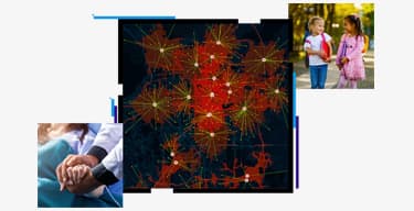
The Vision for GIS in Health—Dr. Este Geraghty, Esri
-
Bookmark this page to access GIS success stories from your peers, get the latest resources, and sign up for the Health newsletter.
Join the community -
GIS for Health & Human Services
Understand the latest trends in health the emerging GIS capabilities and advancements you should leverage to create healthier communities.Learn more -
Esri COVID-19 Resources
Explore the maps, solutions, and resources for our users for the Coronavirus Disease 2019 (COVID-19 response and reopening of our communities.Learn more
Modernizing a Public Health Department—Dr. Scott Harris, State of Alabama
-
ArcGIS Solutions for Vector Control
Download the ready-to-use solutions to manage and combat the spread of vector-borne diseases.Explore the solutions -
Responding to the Opioid Crisis with GIS
Integrate health data with geographic information to understand where, when and why the epidemic is occurring and who it is impacting.Get the industry perspective -
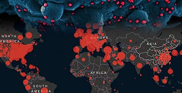
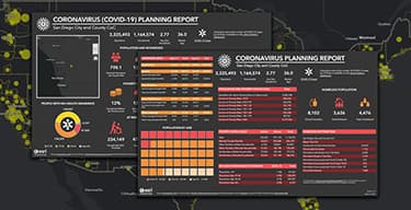
ArcGIS Solutions for Coronavirus Response
Download the ready-to-use solutions to visualize COVID-19 spread, better allocate resources, determine testing sites, and distribute vaccines.Explore the solutions
Public Health Preparedness
A Closer Look at GIS for Contact Tracing—Maria Sevier, Tacoma-Pierce County
-
Introducing Community Contact Tracing
With today's level of mobility, community contact tracing offers a technology-driven update to traditional methods.Learn more -
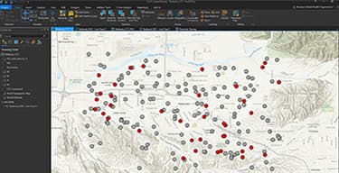
Modernize & Enhance Contact Tracing with GIS
Learn how ArcGIS Platform can support the contact tracing workflow, from data collection and management to analytics and outcome evaluation.
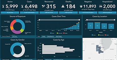
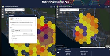
Leading a Large-Scale Pandemic Response
-
Strengthening Public Health Preparedness
Review the lessons learned and best practices from the COVID-19 response that will carry health preparedness professionals into the future.Get prepared -
Three Must-Use GIS Tools for Pandemic Response
Discover the benefits of data collection tools, dashboards, and information hubs, which have become a winning strategy for pandemic response. -
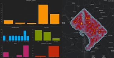
Visualize COVID-19 Impact on Your Community
Follow this training plan to use ArcGIS Business Analyst Web App to create and share customized infographics that present COVID-19 impact.Get the plan -
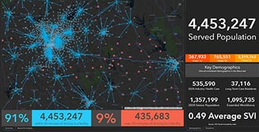
Equitable & Speedy Vaccine Distribution
To distribute vaccines on a massive scale, organizations must use GIS to prioritize the at-risk, communicate with the public, and ensure equity.
Your Road Map to Success
Building Health GIS Capacity in the Workforce—Charlie Jones, Esri
-
Explore the Esri Academy
ArcGIS training for GIS practitioners and non-GIS professionals ensures success in integrating geospatial thinking in your work.Explore the training -
Esri Change Management Consulting
Esri change management consultants use a comprehensive framework to help organizations prepare their workforce to embrace technology.Get started
Focused Maps and Apps for Quick Success—Scott Oppmann, Esri
-
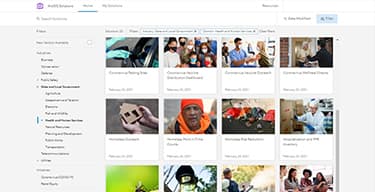
Explore ArcGIS Solutions
Explore the collection of focused maps and apps designed to improve operations, provide new insight, and enhance services in your organization.Discover the solutions -
Tips & Tricks to Deploy the ArcGIS Solutions
Use these meetups to access comprehensive tutorials and tech tips. Sign up for future meetups to build your professional network.Watch the playlist
How to Be Successful with Your GIS Implementation—Ed Carubis, Esri
-
Six Essentials for Your Next GIS Implementation
Discover the six top tips for successfully implementing a GIS.Get the tips -
Building a GIS: Strategies & Best Practices
Building a GIS without a well-planned system architecture design can lead to failure. Learn how to avoid the pitfalls.Explore the strategies -
What Makes an Enterprise GIS Successful?
Successful GIS implementation is more of a people problem than a technology problem. Finding motivated leaders will drive the desired outcomes.Find the answers
Privacy and Security
Managing Privacy and Security Needs with GIS
-
ArcGIS Trust Center
This is your go-to resource for security, privacy, and compliance information as it relates to ArcGIS.Explore the Trust Center -
Geospatial Security, HIPAA & Privacy Guidance
Explore the resources available to effectively support health operations with Esri products, in a manner that meets security and privacy demands.Go to the resources
Network Adequacy
Improving Accessibility through Network Adequacy Review
-
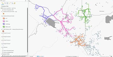
Achieve Network Adequacy with ArcGIS
Use GIS to site facilities, provide mobile and e-health options, and ensure availability of in-network providers.Get more information -
Network Adequacy with GIS in under Two Minutes
Explore the new tool that will help you with your network adequacy process in, you guessed it, under two minutes.
Health Equity
Operationalizing Health Equity—Jing Wu, Esri
-
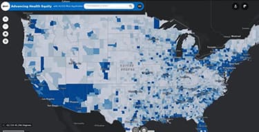
Addressing Racial Injustice on Health Equity
Racial justice and health subject matter experts discuss how the use of GIS can provide a framework to help achieve equity in health. -
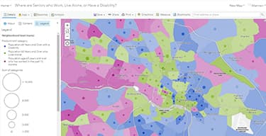
Moving toward Health Equity with GIS
Esri industry perspective provides six steps to improve health equity through location-centric data, analysis, and communication.Discover the six steps -
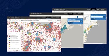
Esri Maps for Public Policy
Explore freely available data on health, communities, demographics, and other factors that impact health to provide a basis for your equity work.Explore the data -
Racial Equity in Health Online Resources
These online tools and approaches using GIS can help in addressing structural racism and health inequities impacting communities of color.Get these resources
Strategic Planning
Bringing GIS Indoors—Mark Zirkelback and Dr. Vikram Kumar
-
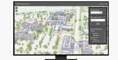
Five Ways Indoor Maps Make Hospitals Smarter
See how indoor mapping for hospitals and healthcare systems will improve the patient experience and make your organization run better.How it works -
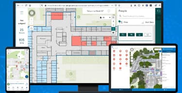
Explore ArcGIS Indoors
ArcGIS Indoors is a complete indoor mapping system for smart building management. Optimize facilities and provide quality service for patients.Discover how it works -
Smart Hospital Operations with ArcGIS Indoors
Indoor GIS allows management to make better informed decisions on resource allocation, building layout, operations, and facility management.
Implement what you learned at the event
Reach out to talk to take the next step. A conversation with an Esri expert will clarify how GIS can support your health operations.