
Give a scientist a tool, and you feed science for a day. Teach a scientist to be open, and you feed science for a lifetime.
Matthias Fromm
Open Science Radio

Interoperable, standards-compliant platforms are essential for advancing science

Watch Esri president Jack Dangermond and standards product manager/open strategist Satish Sankaran discuss standards, interoperability, open data, Python APIs, open software libraries, and Esri's participation in open science going forward.
Give a scientist a tool, and you feed science for a day. Teach a scientist to be open, and you feed science for a lifetime.
The scientific community is very interested in leveraging open-source code and solutions with Esri technology. However, many are still surprised to hear that Esri produces free, open-source products such as Esri Geoportal Server. Esri has a significant presence on GitHub with our open-source stack and examples of projects that use open source to accelerate our work.
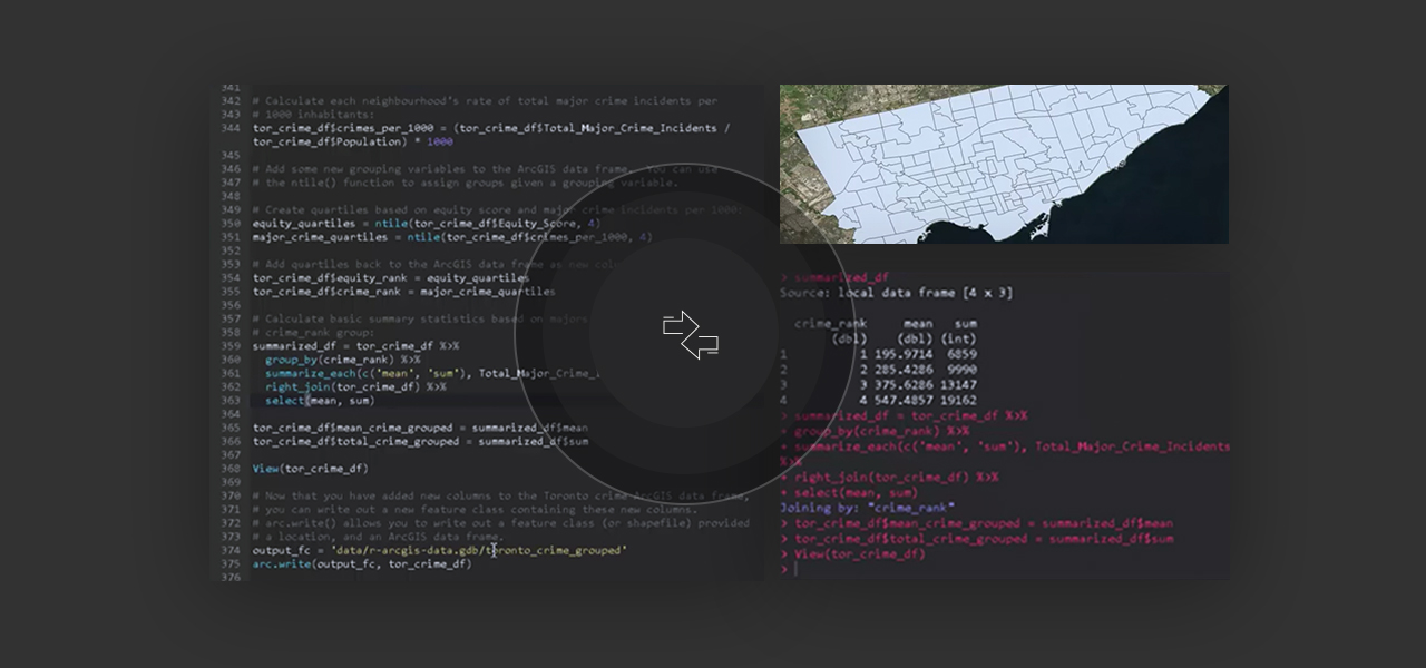
R, also known as the R Project for Statistical Computing, is the extremely popular and fastest growing environment for statistical computing, including within a range of environmental sciences. Esri's membership in the R Consortium made the list of biggest R stories for 2016, and the new R ArcGIS bridge, now compatible with Microsoft R Open, is more valuable than ever for advancing the capabilities of analyses across multiple disciplines.
Python is used for all things geospatial, from data conversion and automation to exploratory data analysis, space-time analysis, and geocomputation. Esri's ArcGIS API for Python lets you engage with data, analytics, and visualization through a clean Python API. Python raster functions, a curated set of lightweight but powerful tools, enable on-the-fly image processing and raster analysis in ArcGIS.

Notebooks have become a crucial tool in the Python and data science communities. Jupyter Notebooks are favored among Python users for their seamless integration with some of the most important Python libraries in a structure that encourages efficient prototyping and visualization. There are many types of Python notebooks, so look for more variations in the future.

Esri is proud to be a partner of 52°North. An international open-science network, 52°North unites partners from research, industry, and public administration, focusing on geoinformatics research and innovation. Recent collaborations have focused on interoperable processing of sensor data and the advancement of spatial data infrastructures.

Esri is actively developing workflows to enhance reproducibility (where results can be continually reproduced using the same data and methods) and replicability (a higher level of scientific rigor where results can be reproduced using different samples of data and different software). We are involved in several open science initiatives along these lines and are a signatory to the Coalition for Publishing Data in the Earth and Space Sciences (COPDESS) Commitment to Enabling FAIR (Findable, Accessible, Interoperable, Reusable) Data in the Earth, Space, and Environmental Sciences.

Scientists use the unique capabilities and flexible licensing of ArcGIS to incorporate location-based data and analytics in their pursuits. Migrate to ArcGIS Pro to take advantage of all available capabilities.