Deploying networks in today’s marketplace is no easy task. The complexity of the environment, need for improved transparency and collaboration, and criticality of resource management present significant challenges. Challenges that can easily overtake the capabilities of teams as their existing tools and resources are not capable of meeting organizational needs. I’m excited to share a significant move towards enhancing broadband deployment. Sitetracker, the global deployment operations management software provider, announced in September 2023 their partnership with Esri. This collaboration aims to revolutionize the industry by introducing Sitetracker GIS Link, a powerful solution designed to expedite the rollout of fiber broadband through the integration of geographic information systems (GIS) data.

The Partnership Unveiled
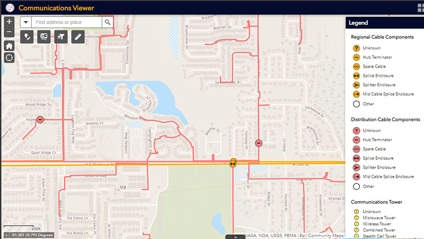
What I like most about Sitetracker’s latest innovation, GIS Link, it revolutionizes deployment operations management by seamlessly integrating geospatial data between Esri’s ArcGIS and Sitetracker’s Salesforce-based Project, Site, and Asset Management platform for Telecommunications. This transformative solution empowers network operators, engineering, and construction companies with extraordinary visibility, enhancing collaboration and efficiency in broadband deployment. GIS Link’s dynamic interface provides comprehensive metrics, including homes passed and servicing areas, helping to foster a cohesive understanding of deployment landscapes.
This integration goes beyond visibility and aims to drive efficiency by aligning planning, engineering, and construction efforts in real-time. The partnership between Esri and Sitetracker sets a new industry standard, embedding geospatial intelligence seamlessly into operational workflows. This unveiling marks not only a product launch but a significant leap towards redefining critical infrastructure deployment, reflecting Esri and Sitetracker’s commitment to advancing efficiency and collaboration within the industry.
Key Benefits and Features
- Efficient Collaboration: GIS Link allows for the efficient sharing of GIS data, fostering collaboration between internal and external parties. This collaborative approach is essential for accelerating broadband deployment, particularly in rural and underserved communities.
- Enhanced Visibility: The solution offers key metrics such as homes passed by market and servicing area, providing network operators with a comprehensive view of their deployments. This visibility is crucial for meeting the increasing demand for broadband globally.
- Multi-Industry Impact: While initially targeting fiber broadband deployment, I see GIS Link extending its benefits to various industries, including telecom tower operators, solar developers, EV companies, and other infrastructure companies. The ability to use multiple configurable map layers delivers informed decision-making processes in wireless site selection and solar developments.
- Real-time Workflow: GIS Link establishes a unified, real-time workflow between stakeholders with fully integrated geospatial data. This ensures that network plans align seamlessly with construction progress, enabling more efficient handoffs and project management.

Global Broadband Deployment
The collaborative efforts between Sitetracker and Esri have not gone unnoticed, garnering admiration from industry leaders, mentioning the strategic alignment of geospatial data with projects. This interaction positions Sitetracker as a cornerstone within their overall architectural framework. this stresses the impact of Sitetracker GIS Link in revolutionizing deployment operations, fostering seamless collaboration, and reinforcing its pivotal role in the telecom industry’s technological growth.
Globally, 2024 is poised for a surge in fiber infrastructure development, driven by BEAD funds in the United States and various public and private financing programs steering continued momentum in Europe. For Brant Carter, Sitetracker’s Director of Telecom Industry Products this translates to “significantly increased demand for contractors in network engineering, OSP construction, and splicing. For providers struggling to keep up with demand – as well as those seeking to grow – addressing inefficiencies in collaboration, construction and project management, reporting, and closeouts will be critical.” Clearly, digitizing the way you work with modern technology solutions will be a crucial element in meeting aggressive broadband build-out targets..
Efficiency gains take center stage as the cornerstone in overcoming the numerous challenges of broadband deployment. In regions grappling with deployment costs, regulatory complexities, and resource constraints, the collaboration between Esri and Sitetracker stands as a beacon of promise. I look forward to the efficiency gains for the telecom industry resulting from this partnership. I see the impact extending beyond operational streamlining – as it presents the potential to narrow the global digital divide by simplifying processes and enhancing accessibility to critical infrastructure development, the collaboration aims to foster inclusive connectivity, particularly in rural areas where broadband deployment faces unique obstacles.
Final Thoughts
The alliance between Sitetracker and Esri, coupled with the introduction of GIS Link, signifies a monumental stride towards propelling global broadband deployment. Through the seamless integration of geospatial data, this partnership promises to make a positive impact on various facets of society, including economic growth, education, business, and civic opportunities. As the industry navigates towards a fully connected and sustainable future, Sitetracker’s innovative solutions remain at the forefront of shaping the digital landscape.
Learn More:
Esri in Telecommunications: www.esri.com/telecom
See Sitetracker Solutions for Telecommunications or Request a Sitetracker Demo Top of Form