Streamline workflows
ArcGIS is an enterprise business system that enables telecoms to modernize workflows with commercial off-the-shelf solutions for the field and office.

A comprehensive geospatial system
Digitally transforming telecommunications through location intelligence
Location intelligence is fundamental to all communication services: mobile, fixed, residential, and enterprise. To learn how ArcGIS can help your organization leverage the power of location, download the ebook "Location Intelligence for Telecommunications."

Using location intelligence, utilities discover patterns and trends that simple reporting cannot detect. ArcGIS is a complete location intelligence system, providing easy-to-use analytics and solutions that support daily workflows and challenges.

Optimize network operations, facilitate near real-time updates between the field and office, and keep customers and employees safe and informed with the power of location.
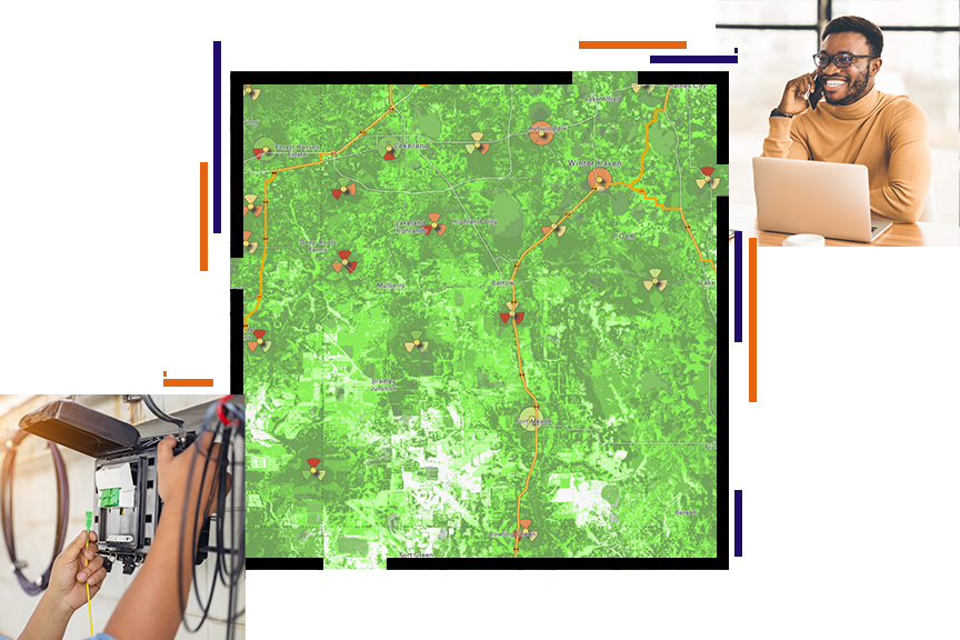
More on field operationsArcGIS Enterprise enables organizations to optimize network planning, monitor infrastructure, and improve decision-making for efficient operations and enhanced customer experiences.
More on ArcGIS EnterpriseService providers collect data about customers, the network and its usage, Wi-Fi hot spots, and more. With ArcGIS, you can visualize data and expose and analyze patterns or trends not often detected from tables alone.
More on spatial analysisArcGIS offers solutions to meet any telecom challenge, including comprehensive network management, project planning for broadband funding application, reporting, and documentation.
More on telecom managementAttend Esri’s Infrastructure Management & GIS (IMGIS) Conference to discover how ArcGIS models, connects, and enhances relationships between the built, social, and natural environments. The comprehensive geospatial platform offers advanced visualizations and analytics throughout the entire infrastructure life cycle.

Find articles and papers on best practices and innovative solutions for telecoms. Get inspired by Esri telecom GIS heroes. And discover Esri partners that can help you meet your goals.

Plan equitable broadband expansion. Design, construct, and operate broadband networks with ArcGIS.
Deliver mobile workflows, reduce paper-based processes, and communicate in real time.
Bring the field to the engineer with a digital twin of the natural and built environment.
Manage all network technologies, track designs, and deliver up-to-date as-built drawings.
Deliver operations and business support system integration with GIS.
Empower key tasks such as site suitability analysis, understanding telecom NPS, managing network capacity planning, analytics